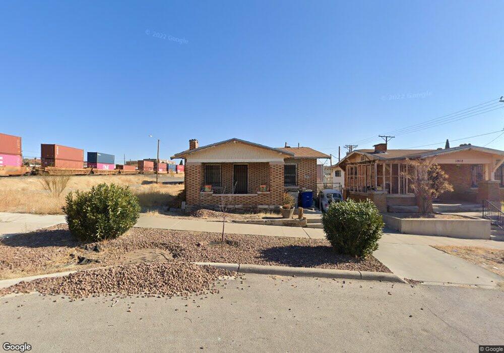
1014 Maple St El Paso, TX 79903
Five Points NeighborhoodEstimated Value: $178,072 - $213,000
3
Beds
1
Bath
952
Sq Ft
$199/Sq Ft
Est. Value
About This Home
This home is located at 1014 Maple St, El Paso, TX 79903 and is currently estimated at $189,518, approximately $199 per square foot. 1014 Maple St is a home located in El Paso County with nearby schools including Moreno Elementary School, Armendariz Middle School, and Middle School-5 NW Middle.
Ownership History
Date
Name
Owned For
Owner Type
Purchase Details
Closed on
Jun 5, 1995
Sold by
Rodriguez Valentin
Bought by
Martinez Maria Ramona
Current Estimated Value
Purchase Details
Closed on
May 30, 1995
Sold by
Rodriguez Juan Carlos
Bought by
Martinez Maria Ramona
Purchase Details
Closed on
May 26, 1995
Sold by
Rodriguez Juan
Bought by
Martinez Maria Ramona
Purchase Details
Closed on
May 25, 1995
Sold by
Czajkowski Sofia
Bought by
Martinez Maria Ramona
Create a Home Valuation Report for This Property
The Home Valuation Report is an in-depth analysis detailing your home's value as well as a comparison with similar homes in the area
Home Values in the Area
Average Home Value in this Area
Purchase History
| Date | Buyer | Sale Price | Title Company |
|---|---|---|---|
| Martinez Maria Ramona | -- | -- | |
| Martinez Maria Ramona | -- | -- | |
| Martinez Maria Ramona | -- | -- | |
| Martinez Maria Ramona | -- | -- | |
| Martinez Maria Ramona | -- | -- | |
| Martinez Maria Ramona | -- | -- |
Source: Public Records
Tax History Compared to Growth
Tax History
| Year | Tax Paid | Tax Assessment Tax Assessment Total Assessment is a certain percentage of the fair market value that is determined by local assessors to be the total taxable value of land and additions on the property. | Land | Improvement |
|---|---|---|---|---|
| 2025 | -- | $150,020 | -- | -- |
| 2024 | -- | $136,382 | -- | -- |
| 2023 | $3,430 | $123,984 | $0 | $0 |
| 2022 | $5,543 | $187,267 | $13,000 | $174,267 |
| 2021 | $2,722 | $87,178 | $9,100 | $78,078 |
| 2020 | $2,002 | $65,120 | $9,100 | $56,020 |
| 2018 | $1,896 | $64,048 | $9,100 | $54,948 |
| 2017 | $1,699 | $60,303 | $9,100 | $51,203 |
| 2016 | $1,699 | $60,303 | $9,100 | $51,203 |
| 2015 | $1,726 | $60,303 | $9,100 | $51,203 |
| 2014 | $1,726 | $63,085 | $9,100 | $53,985 |
Source: Public Records
Map
Nearby Homes
- 2805 Grant Ave
- 2415 Pittsburg Ave
- 2520 San Jose Ave Unit 4C
- 2520 San Jose Ave Unit 4D
- 2612 San Jose Ave
- 2407 Grant Ave
- 2230 Arizona Ave
- 1229 Ohio St
- 2309 San Diego Ave
- 2208 Montana Ave
- 3132 Pershing Dr
- 1605 Dakota St
- 1701 Elm St
- 2212 Silver Ave
- 2413 Copper Ave
- 2510 Federal Ave
- 615 N Cebada St
- 1712 Elm St
- 3222 E Missouri Ave
- 2012 San Jose Ave
- 1014 Maple St
- 1012 Maple St
- 2716 Chico Ct
- 2703 Pershing Dr
- 2705 Pershing Dr
- 2701 Pershing Dr
- 2713 Pershing Dr
- 1017 Maple St
- 1017 Maple St Unit C
- 1017 Maple St Unit B
- 1017 Maple St Unit A
- 2715 Pershing Dr
- 1015 Maple St
- 2631 Pershing Dr
- 2719 Pershing Dr
- 2627 Pershing Dr
- 2702 Grant Ave
- 2721 Pershing Dr
- 2704 Grant Ave
- 2630 Grant Ave