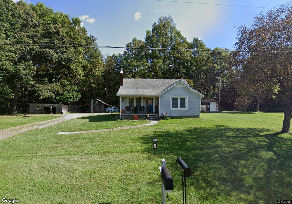
1014 Mcbride Rd Mount Airy, NC 27030
Estimated Value: $155,735 - $189,000
2
Beds
1
Bath
1,088
Sq Ft
$162/Sq Ft
Est. Value
About This Home
This home is located at 1014 Mcbride Rd, Mount Airy, NC 27030 and is currently estimated at $175,934, approximately $161 per square foot. 1014 Mcbride Rd is a home with nearby schools including Flat Rock Elementary School, Meadowview Magnet Middle School, and North Surry High School.
Ownership History
Date
Name
Owned For
Owner Type
Purchase Details
Closed on
Aug 21, 2019
Sold by
Goins-Harrell Wennia
Bought by
Dellenback-Doss Nicole and Dellenback Dennis J
Current Estimated Value
Home Financials for this Owner
Home Financials are based on the most recent Mortgage that was taken out on this home.
Original Mortgage
$62,800
Interest Rate
3.7%
Mortgage Type
New Conventional
Purchase Details
Closed on
Jun 27, 2006
Sold by
Goins A L and Goins Carl
Bought by
Harrell Wennia Goins
Create a Home Valuation Report for This Property
The Home Valuation Report is an in-depth analysis detailing your home's value as well as a comparison with similar homes in the area
Purchase History
| Date | Buyer | Sale Price | Title Company |
|---|---|---|---|
| Dellenback-Doss Nicole | -- | -- | |
| Harrell Wennia Goins | -- | None Available |
Source: Public Records
Mortgage History
| Date | Status | Borrower | Loan Amount |
|---|---|---|---|
| Closed | Dellenback-Doss Nicole | $62,800 |
Source: Public Records
Tax History
| Year | Tax Paid | Tax Assessment Tax Assessment Total Assessment is a certain percentage of the fair market value that is determined by local assessors to be the total taxable value of land and additions on the property. | Land | Improvement |
|---|---|---|---|---|
| 2025 | $617 | $89,690 | $17,000 | $72,690 |
| 2024 | $554 | $76,010 | $17,000 | $59,010 |
| 2023 | $420 | $76,010 | $17,000 | $59,010 |
| 2022 | $546 | $76,010 | $17,000 | $59,010 |
| 2021 | $554 | $76,010 | $17,000 | $59,010 |
| 2020 | $544 | $71,660 | $17,000 | $54,660 |
| 2019 | $533 | $70,460 | $0 | $0 |
| 2018 | $525 | $70,460 | $0 | $0 |
| 2017 | $521 | $70,460 | $0 | $0 |
| 2016 | $516 | $70,460 | $0 | $0 |
| 2013 | -- | $77,060 | $0 | $0 |
Source: Public Records
Map
Nearby Homes
- xx 44.93 Acres Stardust Trail
- 106 Lynnewood Dr
- 263 Badgett Ave
- 335 Badgett Ave
- TBD Glen Terrace
- 2638 Riverside Dr
- 00 Paynetown Rd
- 0 NE Pine St
- 111 Dozier Ln
- 279 Stanley Rd
- 187 Eaton St
- 124 Rocky Ln
- 240 Deatherage Rd
- 2142 Elizabeth Dr
- 417 Fulton Ave
- 1970 Mcbride Rd
- 0000 Ararat
- 00 Jackson Rd Unit 8.64 Ac
- 2828 E Pine St
- 0 Jackson Rd
- 1038 Mcbride Rd
- TBD Mcbride Rd
- 959 Mcbride Rd
- 389 Lynnewood Dr
- 0000 Mcbride Rd
- 378 Lynnewood Dr
- 385 Lynnewood Dr
- 368 Lynnewood Dr
- 1087 Mcbride Rd
- 1086 Mcbride Rd
- 958 Oak Cir
- 369 Lynnewood Dr
- 356 Lynnewood Dr
- 1094 Mcbride Rd
- 1098 Mcbride Rd
- 359 Lynnewood Dr
- 1110 Mcbride Rd
- 345 Lynnewood Dr
- 109 Oak Cir
- 109 Oak Cir
Your Personal Tour Guide
Ask me questions while you tour the home.