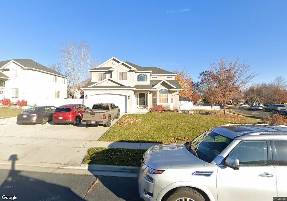
1014 N 390 W American Fork, UT 84003
Estimated Value: $664,000 - $760,000
5
Beds
4
Baths
3,118
Sq Ft
$225/Sq Ft
Est. Value
About This Home
This home is located at 1014 N 390 W, American Fork, UT 84003 and is currently estimated at $702,314, approximately $225 per square foot. 1014 N 390 W is a home located in Utah County with nearby schools including Shelley Elementary School, American Fork Junior High School, and American Fork High School.
Ownership History
Date
Name
Owned For
Owner Type
Purchase Details
Closed on
Jun 9, 2023
Sold by
Jensen Michael C
Bought by
Nhem Jacob and Nhem Shantel
Current Estimated Value
Purchase Details
Closed on
May 27, 2015
Sold by
Callaway Conor F
Bought by
Jensen Michael C and Jensen Haylie A
Home Financials for this Owner
Home Financials are based on the most recent Mortgage that was taken out on this home.
Original Mortgage
$222,000
Interest Rate
3.64%
Mortgage Type
New Conventional
Purchase Details
Closed on
Jul 6, 2006
Sold by
Gear Kevin and Gear Machelle
Bought by
Callaway Conor F
Home Financials for this Owner
Home Financials are based on the most recent Mortgage that was taken out on this home.
Original Mortgage
$331,550
Interest Rate
9.05%
Mortgage Type
Purchase Money Mortgage
Purchase Details
Closed on
Aug 21, 2003
Sold by
Salisbury Development Lc
Bought by
Gear Kevin and Gear Machelle
Home Financials for this Owner
Home Financials are based on the most recent Mortgage that was taken out on this home.
Original Mortgage
$169,700
Interest Rate
5.46%
Mortgage Type
Purchase Money Mortgage
Purchase Details
Closed on
Dec 20, 2001
Sold by
Virginia Ridge Lc
Bought by
Salisbury Development Lc
Home Financials for this Owner
Home Financials are based on the most recent Mortgage that was taken out on this home.
Original Mortgage
$412,177
Interest Rate
6.39%
Mortgage Type
Seller Take Back
Create a Home Valuation Report for This Property
The Home Valuation Report is an in-depth analysis detailing your home's value as well as a comparison with similar homes in the area
Home Values in the Area
Average Home Value in this Area
Purchase History
| Date | Buyer | Sale Price | Title Company |
|---|---|---|---|
| Nhem Jacob | -- | Cottonwood Title Insurance Age | |
| Jensen Michael C | -- | Provo Land Title Co | |
| Callaway Conor F | -- | Inwest Title Services Inc | |
| Gear Kevin | -- | Provo Land Title Company | |
| Salisbury Development Lc | -- | Provo Land Title Company |
Source: Public Records
Mortgage History
| Date | Status | Borrower | Loan Amount |
|---|---|---|---|
| Previous Owner | Jensen Michael C | $222,000 | |
| Previous Owner | Callaway Conor F | $331,550 | |
| Previous Owner | Gear Kevin | $169,700 | |
| Previous Owner | Salisbury Development Lc | $412,177 |
Source: Public Records
Tax History Compared to Growth
Tax History
| Year | Tax Paid | Tax Assessment Tax Assessment Total Assessment is a certain percentage of the fair market value that is determined by local assessors to be the total taxable value of land and additions on the property. | Land | Improvement |
|---|---|---|---|---|
| 2025 | $2,973 | $355,190 | $224,000 | $421,800 |
| 2024 | $2,973 | $330,330 | $0 | $0 |
| 2023 | $2,656 | $312,840 | $0 | $0 |
| 2022 | $2,626 | $305,305 | $0 | $0 |
| 2021 | $2,252 | $408,900 | $160,700 | $248,200 |
| 2020 | $2,108 | $371,200 | $143,500 | $227,700 |
| 2019 | $1,955 | $356,100 | $132,700 | $223,400 |
| 2018 | $1,836 | $319,800 | $125,500 | $194,300 |
| 2017 | $1,767 | $166,045 | $0 | $0 |
| 2016 | $1,825 | $159,390 | $0 | $0 |
| 2015 | $1,923 | $159,390 | $0 | $0 |
| 2014 | $1,859 | $151,965 | $0 | $0 |
Source: Public Records
Map
Nearby Homes
- 987 N 410 W
- 471 W 1040 N
- 344 W 1080 N
- 3889 W 950 Cir N Unit 366
- 425 W 1120 N
- 984 N 300 W
- 914 N 400 W Unit A
- 602 W 860 N
- 356 W 1300 N
- 796 N 200 W
- 782 N 200 W
- 179 W 1290 N
- 287 W 1360 N
- 1071 Timpview Dr
- 641 N 420 W
- 10238 N 6530 W Unit 15
- 1051 N 390 E Unit 103
- 6079 W Whisper Ln Unit 404
- 1220 E 700 N
- 1039 N 390 E Unit 102