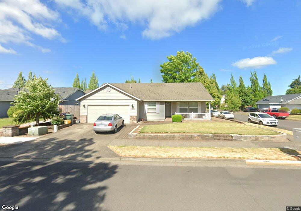
1014 S 6th St Independence, OR 97351
Estimated Value: $396,000 - $432,000
3
Beds
2
Baths
1,341
Sq Ft
$311/Sq Ft
Est. Value
About This Home
This home is located at 1014 S 6th St, Independence, OR 97351 and is currently estimated at $417,236, approximately $311 per square foot. 1014 S 6th St is a home located in Polk County with nearby schools including Independence Elementary School, Talmadge Middle School, and Central High School.
Ownership History
Date
Name
Owned For
Owner Type
Purchase Details
Closed on
Nov 29, 2017
Sold by
Andrian Corona P
Bought by
Corrales Yunit P
Current Estimated Value
Purchase Details
Closed on
Nov 15, 2017
Sold by
Adrian Corona P
Bought by
Corrales Yunit P
Purchase Details
Closed on
Jun 19, 2008
Sold by
Pena Yunit Perla Corrales and Jesus Sanchez Marciel J
Bought by
Corona Pinto Adrian
Purchase Details
Closed on
Jan 30, 2004
Sold by
Gebb Kirk W
Bought by
Corona Adrian P and Corrales Yunit P
Home Financials for this Owner
Home Financials are based on the most recent Mortgage that was taken out on this home.
Original Mortgage
$141,282
Interest Rate
5.79%
Mortgage Type
FHA
Create a Home Valuation Report for This Property
The Home Valuation Report is an in-depth analysis detailing your home's value as well as a comparison with similar homes in the area
Home Values in the Area
Average Home Value in this Area
Purchase History
| Date | Buyer | Sale Price | Title Company |
|---|---|---|---|
| Corrales Yunit P | -- | None Listed On Document | |
| Corrales Yunit P | -- | None Available | |
| Corona Pinto Adrian | -- | None Available | |
| Corona Adrian P | $143,500 | Amerititle |
Source: Public Records
Mortgage History
| Date | Status | Borrower | Loan Amount |
|---|---|---|---|
| Previous Owner | Corona Adrian P | $141,282 |
Source: Public Records
Tax History
| Year | Tax Paid | Tax Assessment Tax Assessment Total Assessment is a certain percentage of the fair market value that is determined by local assessors to be the total taxable value of land and additions on the property. | Land | Improvement |
|---|---|---|---|---|
| 2025 | $3,544 | $202,730 | $51,190 | $151,540 |
| 2024 | $3,544 | $196,830 | $49,700 | $147,130 |
| 2023 | $3,636 | $191,100 | $48,250 | $142,850 |
| 2022 | $3,337 | $185,540 | $46,840 | $138,700 |
| 2021 | $3,300 | $180,140 | $45,480 | $134,660 |
| 2020 | $3,214 | $174,900 | $44,160 | $130,740 |
| 2019 | $3,131 | $169,810 | $42,870 | $126,940 |
| 2018 | $3,031 | $164,870 | $41,630 | $123,240 |
| 2017 | $3,015 | $160,070 | $40,420 | $119,650 |
| 2016 | $3,071 | $155,410 | $39,240 | $116,170 |
| 2015 | $2,951 | $150,890 | $38,090 | $112,800 |
| 2014 | $2,834 | $146,500 | $36,980 | $109,520 |
Source: Public Records
Map
Nearby Homes
Your Personal Tour Guide
Ask me questions while you tour the home.