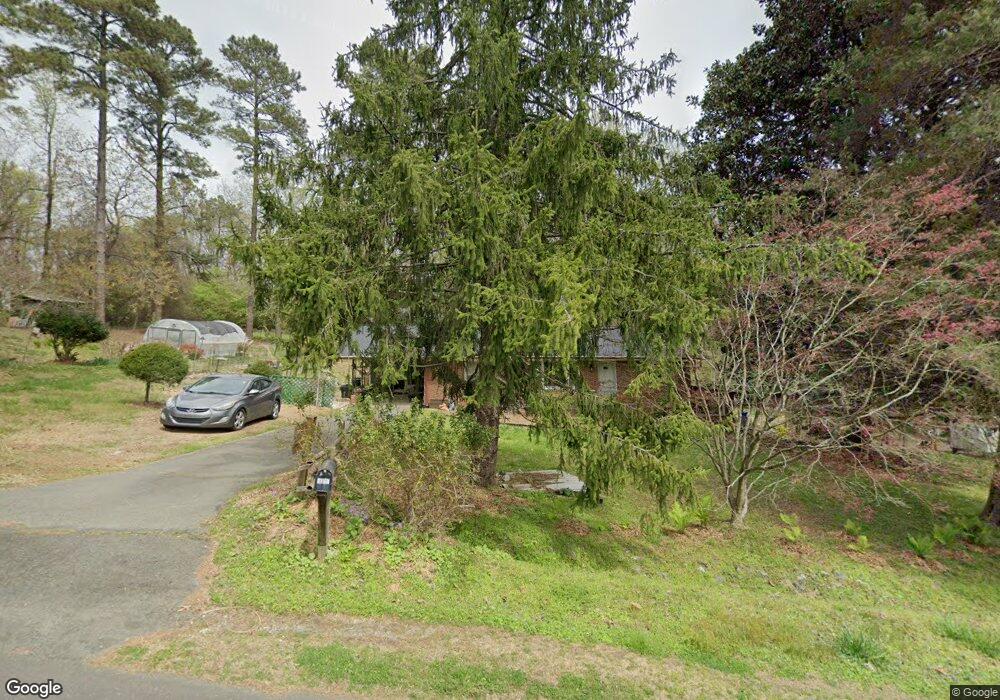
1014 Wave Rd Chapel Hill, NC 27517
Estimated Value: $277,000
4
Beds
2
Baths
1,482
Sq Ft
$187/Sq Ft
Est. Value
About This Home
This home is located at 1014 Wave Rd, Chapel Hill, NC 27517 and is currently priced at $277,000, approximately $186 per square foot. 1014 Wave Rd is a home located in Orange County with nearby schools including Scroggs Elementary School, Culbreth Middle School, and Carrboro High School.
Ownership History
Date
Name
Owned For
Owner Type
Purchase Details
Closed on
Mar 11, 2014
Sold by
Stone Naomi H and Stone Gary Harold
Bought by
Ah Kuoi Barbara J and Ah Kuoi Isidore
Current Estimated Value
Purchase Details
Closed on
Dec 7, 2004
Sold by
Harold John Gary and Harold Raymond L
Bought by
Stone Naomi Harold and Stone Harold John
Create a Home Valuation Report for This Property
The Home Valuation Report is an in-depth analysis detailing your home's value as well as a comparison with similar homes in the area
Home Values in the Area
Average Home Value in this Area
Purchase History
| Date | Buyer | Sale Price | Title Company |
|---|---|---|---|
| Ah Kuoi Barbara J | -- | None Available | |
| Stone Naomi Harold | -- | -- |
Source: Public Records
Tax History Compared to Growth
Tax History
| Year | Tax Paid | Tax Assessment Tax Assessment Total Assessment is a certain percentage of the fair market value that is determined by local assessors to be the total taxable value of land and additions on the property. | Land | Improvement |
|---|---|---|---|---|
| 2025 | $1,918 | $338,600 | $157,500 | $181,100 |
| 2024 | $1,352 | $204,300 | $85,000 | $119,300 |
| 2023 | $1,028 | $204,300 | $85,000 | $119,300 |
| 2022 | $557 | $204,300 | $85,000 | $119,300 |
| 2021 | $1,418 | $204,300 | $85,000 | $119,300 |
| 2020 | $1,375 | $185,300 | $75,000 | $110,300 |
| 2018 | $1,070 | $185,300 | $75,000 | $110,300 |
| 2017 | $2,397 | $185,300 | $75,000 | $110,300 |
| 2016 | $2,397 | $183,516 | $75,834 | $107,682 |
| 2015 | $2,397 | $183,516 | $75,834 | $107,682 |
| 2014 | -- | $183,516 | $75,834 | $107,682 |
Source: Public Records
Map
Nearby Homes
- 5 Alston Dr
- 1807 Old Lystra Rd
- K Model - Building 5 Plan at South Creek
- J Model - Building 5 Plan at South Creek
- H Model - Building 5 Plan at South Creek
- G Model - Building 5 Plan at South Creek
- F Model - Building 5 Plan at South Creek
- E Model - Building 5 Plan at South Creek
- D Model - Building 5 Plan at South Creek
- C Model - Building 5 Plan at South Creek
- B Model - Building 5 Plan at South Creek
- A Model - Building 5 Plan at South Creek
- 600 Copperline Dr Unit 103
- 52 Dogwood Acres Dr
- 403 Brookgreen Dr
- 1705 Smith Level Rd Unit A
- 108 Meeting St
- 409 Northside Dr
- 313 Yorktown Dr
- 391 Northside Dr
- 980 Wave Rd
- 1019 Wave Rd
- 1021 Wave Rd
- 1017 Wave Rd
- 1010 Wave Rd
- 1435 Us Highway 15 501 N
- 1435 Highway 15 501
- 1423 Us Highway 15 501 N
- 1435 Us 15 501 S
- 1023 Wave Rd
- 1015 Wave Rd
- 1412 Us 15 501 S
- 1412 Us 15 501 S
- 1423 Us 15 501 S
- 1412 Us Highway 15 501 N
- 1008 Wave Rd
- 111 Pinewood Dr
- 1013 Wave Rd Unit B
- 1006 Wave Rd
- 1411 Us 15 501 S