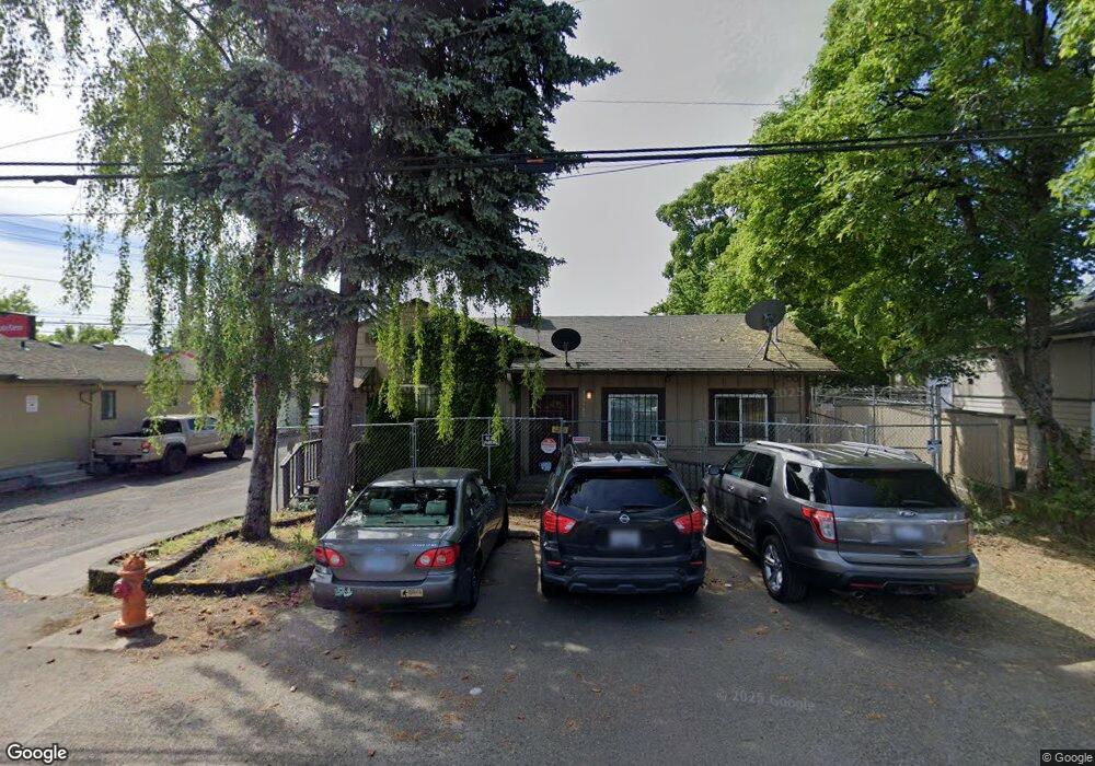
10140 SE Pine St Portland, OR 97216
Hazelwood NeighborhoodEstimated Value: $259,000 - $345,000
2
Beds
1
Bath
824
Sq Ft
$363/Sq Ft
Est. Value
About This Home
This home is located at 10140 SE Pine St, Portland, OR 97216 and is currently estimated at $298,755, approximately $362 per square foot. 10140 SE Pine St is a home located in Multnomah County with nearby schools including Cherry Park Elementary School, Floyd Light Middle School, and David Douglas High School.
Ownership History
Date
Name
Owned For
Owner Type
Purchase Details
Closed on
May 22, 2019
Sold by
Mullan Sandra A
Bought by
Johnson Gregory A
Current Estimated Value
Purchase Details
Closed on
Dec 21, 2005
Sold by
Grohs William T
Bought by
Mullan John J and Mullan Sandra A
Home Financials for this Owner
Home Financials are based on the most recent Mortgage that was taken out on this home.
Original Mortgage
$74,860
Interest Rate
6.35%
Mortgage Type
Purchase Money Mortgage
Purchase Details
Closed on
Dec 1, 1999
Sold by
Plumlee Barbara
Bought by
Muray Dail M and Troxel Jessica J
Create a Home Valuation Report for This Property
The Home Valuation Report is an in-depth analysis detailing your home's value as well as a comparison with similar homes in the area
Home Values in the Area
Average Home Value in this Area
Purchase History
| Date | Buyer | Sale Price | Title Company |
|---|---|---|---|
| Johnson Gregory A | $245,942 | Wfg Title | |
| Mullan John J | $74,602 | Transnation Title Agency Or | |
| Muray Dail M | -- | Transnation Title Insurance |
Source: Public Records
Mortgage History
| Date | Status | Borrower | Loan Amount |
|---|---|---|---|
| Previous Owner | Mullan John J | $74,860 |
Source: Public Records
Tax History Compared to Growth
Tax History
| Year | Tax Paid | Tax Assessment Tax Assessment Total Assessment is a certain percentage of the fair market value that is determined by local assessors to be the total taxable value of land and additions on the property. | Land | Improvement |
|---|---|---|---|---|
| 2025 | $2,862 | $118,370 | -- | -- |
| 2024 | $2,742 | $114,930 | -- | -- |
| 2023 | $2,623 | $111,590 | $0 | $0 |
| 2022 | $2,486 | $108,340 | $0 | $0 |
| 2021 | $2,445 | $105,190 | $0 | $0 |
| 2020 | $2,215 | $102,130 | $0 | $0 |
| 2019 | $2,145 | $99,160 | $0 | $0 |
| 2018 | $2,079 | $96,280 | $0 | $0 |
Source: Public Records
Map
Nearby Homes
- 206 NE 102nd Ave
- 126 SE 106th Ave
- 9311 SE Alder St
- 9145 SE Oak St
- 116 NE 109th Ave
- 10985 E Burnside St Unit 7
- 10985 E Burnside St Unit 26
- 10985 E Burnside St Unit 4
- 10985 E Burnside St Unit 18
- 10985 E Burnside St Unit 19
- 10985 E Burnside St Unit 27
- 10985 E Burnside St Unit 9
- 10985 E Burnside St Unit 25
- 10985 E Burnside St Unit 15
- 10985 E Burnside St Unit 17
- 10985 E Burnside St Unit 12
- 10985 E Burnside St Unit 8
- 9715 NE Glisan St
- 11018 E Burnside St Unit 11032
- 11181 SE Stark St
- 315 SE 102nd Ave Unit 1
- 315 SE 102nd Ave
- 10110 SE Pine St Unit 10116
- 231 SE 102nd Ave
- 111805 SE Pine St
- 10105 SE Pine St
- 10121 SE Pine St
- 215 SE 102nd Ave
- 0 SE Pine St
- 10175 SE Stark St
- 135 SE 102nd Ave Unit 3
- 135 SE 102nd Ave Unit 2
- 135 SE 102nd Ave
- 10104 SE Ankeny St
- 10320 SE Pine St
- 0 SE Oak St
- 11910 SE Ash St
- 12001 SE Ash St
- 10131 SE Ankeny St
- 10137 SE Ankeny St