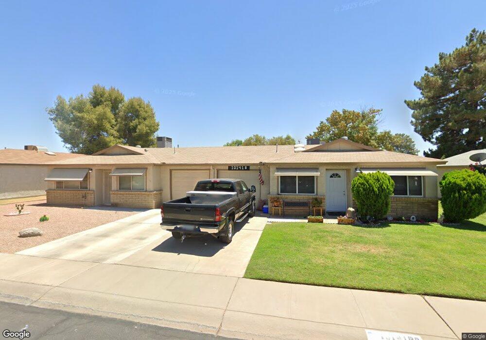
10141 N 97th Dr Unit A Peoria, AZ 85345
Estimated Value: $216,376 - $240,000
2
Beds
2
Baths
1,025
Sq Ft
$221/Sq Ft
Est. Value
About This Home
This home is located at 10141 N 97th Dr Unit A, Peoria, AZ 85345 and is currently estimated at $226,594, approximately $221 per square foot. 10141 N 97th Dr Unit A is a home located in Maricopa County with nearby schools including Sun Valley Elementary School, Raymond S. Kellis, and Ombudsman - Northwest Charter.
Ownership History
Date
Name
Owned For
Owner Type
Purchase Details
Closed on
Feb 10, 2020
Sold by
Knaack Brandon D and Knaack Danielle E
Bought by
Tignor Murdoch G and Tignor Melisa G
Current Estimated Value
Home Financials for this Owner
Home Financials are based on the most recent Mortgage that was taken out on this home.
Original Mortgage
$109,500
Outstanding Balance
$96,769
Interest Rate
3.5%
Mortgage Type
New Conventional
Estimated Equity
$129,825
Purchase Details
Closed on
Jan 18, 2013
Sold by
Knaack Brandon D
Bought by
Knaack Brandon D and Knaack Danielle E
Home Financials for this Owner
Home Financials are based on the most recent Mortgage that was taken out on this home.
Original Mortgage
$45,000
Interest Rate
3.33%
Mortgage Type
New Conventional
Purchase Details
Closed on
Nov 6, 2011
Sold by
Childers & Berg Llc
Bought by
Knaack Brandon D
Create a Home Valuation Report for This Property
The Home Valuation Report is an in-depth analysis detailing your home's value as well as a comparison with similar homes in the area
Home Values in the Area
Average Home Value in this Area
Purchase History
| Date | Buyer | Sale Price | Title Company |
|---|---|---|---|
| Tignor Murdoch G | $146,000 | American Title Svc Agcy Llc | |
| Knaack Brandon D | -- | First American Title Ins Co | |
| Knaack Brandon D | $43,000 | Lawyers Title Of Arizona Inc |
Source: Public Records
Mortgage History
| Date | Status | Borrower | Loan Amount |
|---|---|---|---|
| Open | Tignor Murdoch G | $109,500 | |
| Previous Owner | Knaack Brandon D | $45,000 |
Source: Public Records
Tax History Compared to Growth
Tax History
| Year | Tax Paid | Tax Assessment Tax Assessment Total Assessment is a certain percentage of the fair market value that is determined by local assessors to be the total taxable value of land and additions on the property. | Land | Improvement |
|---|---|---|---|---|
| 2025 | $527 | $5,644 | -- | -- |
| 2024 | $518 | $5,375 | -- | -- |
| 2023 | $518 | $16,030 | $3,200 | $12,830 |
| 2022 | $507 | $12,280 | $2,450 | $9,830 |
| 2021 | $531 | $10,670 | $2,130 | $8,540 |
| 2020 | $535 | $9,870 | $1,970 | $7,900 |
| 2019 | $518 | $8,730 | $1,740 | $6,990 |
| 2018 | $503 | $6,930 | $1,380 | $5,550 |
| 2017 | $502 | $5,730 | $1,140 | $4,590 |
| 2016 | $496 | $5,150 | $1,030 | $4,120 |
| 2015 | $461 | $5,160 | $1,030 | $4,130 |
Source: Public Records
Map
Nearby Homes
- 10134 N 97th Ave Unit B
- 10018 N 97th Dr Unit A
- 10127 N 95th Dr Unit A
- 9616 W Mountain View Rd Unit A
- 9564 W Purdue Ave
- 9721 W Mountain View Rd
- 10201 N 99th Ave Unit 32A
- 10201 N 99th Ave Unit 46
- 10201 N 99th Ave Unit 44
- 10201 N 99th Ave Unit 97
- 10201 N 99th Ave Unit 34
- 10201 N 99th Ave Unit 28A
- 10201 N 99th Ave Unit 49
- 10201 N 99th Ave Unit 129E
- 10201 N 99th Ave Unit 135F
- 10201 N 99th Ave Unit 3
- 10201 N 99th Ave Unit 160
- 10201 N 99th Ave Unit 149
- 10201 N 99th Ave Unit 2
- 10201 N 99th Ave Unit 33
- 10141 N 97th Dr Unit B
- 10133 N 97th Dr Unit B
- 10126 N 97th Ave Unit B
- 10126 N 97th Ave Unit A
- 10149 N 97th Dr Unit B
- 10149 N 97th Dr Unit A
- 10202 N 97th Dr Unit B
- 10202 N 97th Dr Unit A
- 10118 N 97th Ave Unit B
- 10118 N 97th Ave
- 10206 N 97th Dr Unit B
- 10206 N 97th Dr Unit A
- 10138 N 97th Dr
- 10138 N 97th Dr Unit B
- 10138 N 97th Dr Unit A
- 10134 N 97th Ave Unit A
- 10110 N 97th Ave Unit B
- 10110 N 97th Ave Unit A
- 10132 N 97th Dr Unit B
- 10132 N 97th Dr Unit A