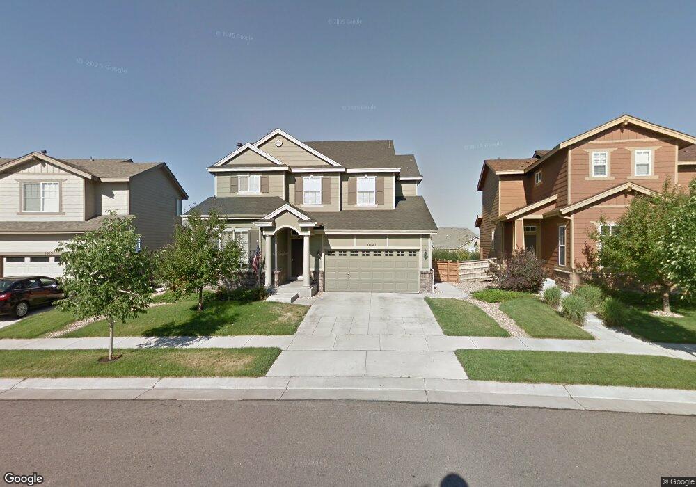
10141 Rifle St Commerce City, CO 80022
Reunion NeighborhoodEstimated Value: $543,561 - $611,000
4
Beds
3
Baths
3,636
Sq Ft
$160/Sq Ft
Est. Value
About This Home
This home is located at 10141 Rifle St, Commerce City, CO 80022 and is currently estimated at $581,640, approximately $159 per square foot. 10141 Rifle St is a home located in Adams County with nearby schools including Second Creek Elementary School, Otho E Stuart Middle School, and Prairie View High School.
Ownership History
Date
Name
Owned For
Owner Type
Purchase Details
Closed on
Sep 30, 2013
Sold by
Henderson Robert P and Henderson Jennifer L
Bought by
Dilworth Maili K and Dilworth Jeffrey E
Current Estimated Value
Home Financials for this Owner
Home Financials are based on the most recent Mortgage that was taken out on this home.
Original Mortgage
$292,500
Outstanding Balance
$219,450
Interest Rate
4.46%
Mortgage Type
VA
Estimated Equity
$362,190
Purchase Details
Closed on
Jul 20, 2007
Sold by
North Range Ii Llc
Bought by
Henderson Robert P and Henderson Jennifer L
Home Financials for this Owner
Home Financials are based on the most recent Mortgage that was taken out on this home.
Original Mortgage
$252,758
Interest Rate
6.54%
Mortgage Type
New Conventional
Create a Home Valuation Report for This Property
The Home Valuation Report is an in-depth analysis detailing your home's value as well as a comparison with similar homes in the area
Home Values in the Area
Average Home Value in this Area
Purchase History
| Date | Buyer | Sale Price | Title Company |
|---|---|---|---|
| Dilworth Maili K | $292,500 | None Available | |
| Henderson Robert P | $315,948 | Fahtco |
Source: Public Records
Mortgage History
| Date | Status | Borrower | Loan Amount |
|---|---|---|---|
| Open | Dilworth Maili K | $292,500 | |
| Previous Owner | Henderson Robert P | $252,758 |
Source: Public Records
Tax History Compared to Growth
Tax History
| Year | Tax Paid | Tax Assessment Tax Assessment Total Assessment is a certain percentage of the fair market value that is determined by local assessors to be the total taxable value of land and additions on the property. | Land | Improvement |
|---|---|---|---|---|
| 2024 | $7,097 | $37,000 | $7,500 | $29,500 |
| 2023 | $7,075 | $41,950 | $6,700 | $35,250 |
| 2022 | $6,154 | $27,900 | $6,880 | $21,020 |
| 2021 | $6,023 | $27,900 | $6,880 | $21,020 |
| 2020 | $6,046 | $28,920 | $7,080 | $21,840 |
| 2019 | $6,045 | $28,920 | $7,080 | $21,840 |
| 2018 | $5,785 | $26,720 | $6,260 | $20,460 |
| 2017 | $5,648 | $26,720 | $6,260 | $20,460 |
| 2016 | $4,554 | $22,360 | $4,300 | $18,060 |
| 2015 | $4,552 | $22,360 | $4,300 | $18,060 |
| 2014 | $3,999 | $19,780 | $3,740 | $16,040 |
Source: Public Records
Map
Nearby Homes
- 10121 Rifle St
- 10139 Richfield Way
- 10069 Richfield St
- 10029 Richfield St
- 10020 Richfield St
- 10045 Sedalia St
- 10173 Pagosa St
- 9957 Quintero St
- 10247 Telluride Way
- 9915 Pitkin St
- 9996 Sedalia St
- 9923 Salida St
- 17439 E 103rd Place
- 10022 Reunion Pkwy
- 16751 E 102nd Place
- Griffin Plan at Reunion Ridge - Porchlight
- Selma Plan at Reunion Ridge - Porchlight
- Helena Plan at Reunion Ridge - Porchlight
- Dalton Plan at Reunion Ridge - Porchlight
- Clydesdale Plan at Reunion Ridge - Coach House
- 10131 Rifle St
- 10151 Rifle St
- 10152 Richfield Way
- 10162 Richfield Way
- 10142 Richfield Way
- 10172 Richfield Way
- 10122 Richfield Way
- 10150 Rifle St
- 17394 E 102nd Place
- 17374 E 102nd Place
- 10160 Rifle St
- 17354 E 102nd Place
- 10180 Richfield Way
- 10190 Rifle St
- 17334 E 102nd Place
- 10200 Rifle St
- 17304 E 102nd Place
- 10182 Richfield Way
- 10183 Salida St
- 10169 Richfield Way