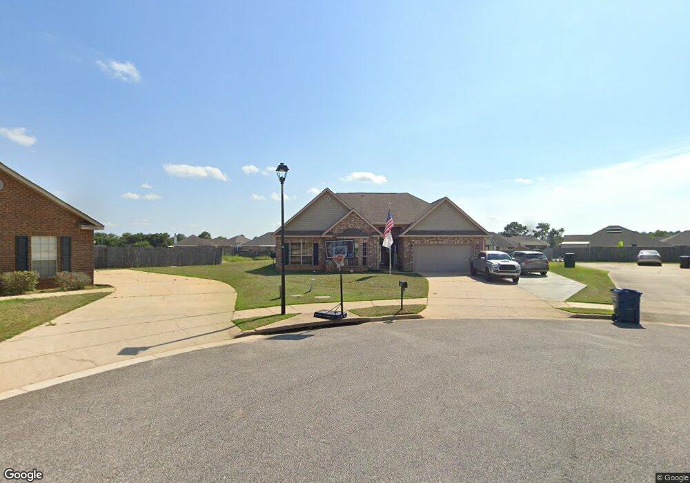
10143 Jersey Ct Mobile, AL 36695
Westlake NeighborhoodEstimated Value: $288,137 - $324,000
3
Beds
2
Baths
2,272
Sq Ft
$133/Sq Ft
Est. Value
About This Home
This home is located at 10143 Jersey Ct, Mobile, AL 36695 and is currently estimated at $301,784, approximately $132 per square foot. 10143 Jersey Ct is a home located in Mobile County with nearby schools including Hutchens Elementary School, Dawes Intermediate School, and Bernice J Causey Middle School.
Ownership History
Date
Name
Owned For
Owner Type
Purchase Details
Closed on
Apr 12, 2019
Sold by
Mccardle Mark A
Bought by
Mccardle Mccardle Mark A Mark A and Mccardle Jenkins Marianne
Current Estimated Value
Purchase Details
Closed on
May 28, 2010
Sold by
D R Horton Inc Birmingham
Bought by
Mccardle Mark A
Home Financials for this Owner
Home Financials are based on the most recent Mortgage that was taken out on this home.
Original Mortgage
$197,088
Interest Rate
4.87%
Mortgage Type
FHA
Create a Home Valuation Report for This Property
The Home Valuation Report is an in-depth analysis detailing your home's value as well as a comparison with similar homes in the area
Home Values in the Area
Average Home Value in this Area
Purchase History
| Date | Buyer | Sale Price | Title Company |
|---|---|---|---|
| Mccardle Mccardle Mark A Mark A | $93,500 | None Available | |
| Mccardle Mark A | $201,088 | None Available |
Source: Public Records
Mortgage History
| Date | Status | Borrower | Loan Amount |
|---|---|---|---|
| Previous Owner | Mccardle Mark A | $197,088 |
Source: Public Records
Tax History
| Year | Tax Paid | Tax Assessment Tax Assessment Total Assessment is a certain percentage of the fair market value that is determined by local assessors to be the total taxable value of land and additions on the property. | Land | Improvement |
|---|---|---|---|---|
| 2025 | $2,825 | $28,400 | $4,000 | $24,400 |
| 2024 | $2,825 | $27,340 | $3,700 | $23,640 |
| 2023 | $2,722 | $24,510 | $3,700 | $20,810 |
| 2022 | $2,061 | $21,250 | $3,700 | $17,550 |
| 2021 | $2,041 | $21,040 | $3,700 | $17,340 |
| 2020 | $1,988 | $40,980 | $7,400 | $33,580 |
| 2019 | $1,916 | $39,500 | $0 | $0 |
| 2018 | $1,911 | $39,400 | $0 | $0 |
| 2017 | $1,934 | $38,440 | $0 | $0 |
| 2016 | $1,881 | $38,780 | $0 | $0 |
| 2013 | $1,825 | $37,200 | $0 | $0 |
Source: Public Records
Map
Nearby Homes
- 3050 Jersey Dr W
- 3387 Deer Crest Dr
- 3105 Scott Place Ct
- 0 Jeff Hamilton Rd Unit 7613918
- 10485 Ellenton St W
- The Denton Plan at Rossfield
- The Booth Plan at Rossfield
- The Cairn Plan at Rossfield
- The Sawyer Plan at Rossfield
- 10497 Ellenton W
- 10000 Country Rd
- 10511 Ellenton St W
- 10494 Ellenton St W
- 10518 Ellenton St W
- 10521 Lowell St W
- 10595 Lowell St W
- 10508 Lowell St W
- 10530 Lowell St W
- 10520 Lowell St W
- 2751 Hamilton Creek Dr W
- 10133 Jersey Ct
- 10142 Jersey Ct
- 10123 Jersey Ct
- 10172 Jersey Ct N
- 2955 Jersey Dr W
- 2986 Dairy Ct
- 2945 Jersey Dr W
- 10132 Jersey Ct
- 10182 Jersey Ct N
- 2974 Dairy Ct
- 10122 Jersey Ct
- 2935 Jersey Dr W
- 10113 Jersey Ct
- 10112 Jersey Ct
- 2925 Jersey Dr W
- 10173 Jersey Ct N
- 2998 Dairy Ct
- 10103 Jersey Ct
- 10159 Scott Plantation Dr N
- 2985 Dairy Ct