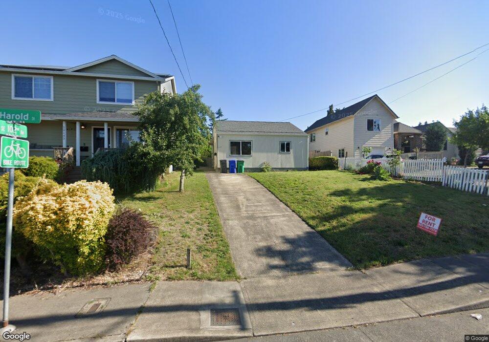
10145 SE Harold St Portland, OR 97266
Lents NeighborhoodEstimated Value: $282,171 - $366,000
2
Beds
1
Bath
822
Sq Ft
$389/Sq Ft
Est. Value
About This Home
This home is located at 10145 SE Harold St, Portland, OR 97266 and is currently estimated at $320,043, approximately $389 per square foot. 10145 SE Harold St is a home located in Multnomah County with nearby schools including Lent K-5 and Franklin High School.
Ownership History
Date
Name
Owned For
Owner Type
Purchase Details
Closed on
Jan 1, 2015
Sold by
Bradley David George
Bought by
Cm Residential Llc
Current Estimated Value
Purchase Details
Closed on
Oct 12, 2001
Sold by
Edwards John A
Bought by
Bradley David G and Fleck Martin E
Home Financials for this Owner
Home Financials are based on the most recent Mortgage that was taken out on this home.
Original Mortgage
$73,600
Interest Rate
6.91%
Mortgage Type
Purchase Money Mortgage
Create a Home Valuation Report for This Property
The Home Valuation Report is an in-depth analysis detailing your home's value as well as a comparison with similar homes in the area
Home Values in the Area
Average Home Value in this Area
Purchase History
| Date | Buyer | Sale Price | Title Company |
|---|---|---|---|
| Cm Residential Llc | -- | None Available | |
| Bradley David G | $95,000 | First American Title Co |
Source: Public Records
Mortgage History
| Date | Status | Borrower | Loan Amount |
|---|---|---|---|
| Previous Owner | Bradley David G | $73,600 |
Source: Public Records
Tax History Compared to Growth
Tax History
| Year | Tax Paid | Tax Assessment Tax Assessment Total Assessment is a certain percentage of the fair market value that is determined by local assessors to be the total taxable value of land and additions on the property. | Land | Improvement |
|---|---|---|---|---|
| 2024 | $2,669 | $99,750 | -- | -- |
| 2023 | $2,566 | $96,850 | $0 | $0 |
| 2022 | $2,511 | $94,030 | $0 | $0 |
| 2021 | $2,469 | $91,300 | $0 | $0 |
| 2020 | $2,265 | $88,650 | $0 | $0 |
| 2019 | $2,182 | $86,070 | $0 | $0 |
| 2018 | $2,118 | $83,570 | $0 | $0 |
| 2017 | $2,030 | $81,140 | $0 | $0 |
| 2016 | $1,857 | $78,780 | $0 | $0 |
| 2015 | $1,809 | $76,490 | $0 | $0 |
| 2014 | $1,779 | $74,270 | $0 | $0 |
Source: Public Records
Map
Nearby Homes
- 5215 SE 104th Ave
- 9842 SE Harold St
- 9828 SE Ellis St
- 9913 SE Steele St
- 5826 SE 103rd Ave Unit A/B/C
- 5826 SE 103rd Ave
- 9826 SE Ramona St
- 9819 SE Knight St
- 00 SE Liebe St
- 5401 SE 97th Ave
- 10304 SE Yukon St
- 9971 SE Yukon St
- 0 SE Liebe St Unit 512290337
- 6200 SE 103rd Ave
- 5104 SE 109th Ave
- 9630 SE Foster Rd Unit 9634
- 11870 SE Pardee St
- 4915 SE 111th Ave
- 6320 SE 97th Ave
- 4533 SE 99th Ave
- 10143 SE Harold St
- 10221 SE Harold St
- 10139 SE Harold St
- 10154 SE Insley St
- 10146 SE Insley St
- 10208 SE Insley St
- 10225 SE Harold St
- 10138 SE Insley St
- 10214 SE Insley St
- 10115 SE Harold St
- 10130 SE Insley St
- 5511 SE 102nd Ave
- 10233 SE Harold St
- 10214 SE Harold St
- 111th & Se Harold St
- 10228 SE Insley St
- 10136 SE Harold St
- 10112 SE Insley St
- 10222 SE Harold St
- 10120 SE Harold St