Estimated Value: $349,813 - $565,000
Studio
--
Bath
--
Sq Ft
3,398
Sq Ft
About This Home
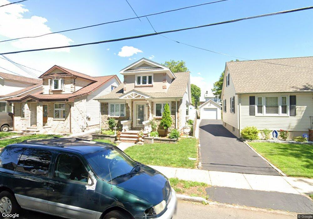
This home is located at 1015 Adams Ave, Union, NJ 07083 and is currently estimated at $444,703. 1015 Adams Ave is a home located in Union County with nearby schools including Connecticut Farms Elementary School, Union High School, and St Michael Parish School.
Ownership History
Date
Name
Owned For
Owner Type
Purchase Details
Closed on
Sep 7, 2004
Sold by
Valentine Longmore
Bought by
Giacometti Narcisa
Current Estimated Value
Home Financials for this Owner
Home Financials are based on the most recent Mortgage that was taken out on this home.
Original Mortgage
$218,400
Outstanding Balance
$109,210
Interest Rate
6.02%
Estimated Equity
$335,493
Purchase Details
Closed on
Jun 19, 1996
Sold by
Barge Mariann D and Richter Elisabeth J
Bought by
Longmore Valentine and Longmore Elaine
Create a Home Valuation Report for This Property
The Home Valuation Report is an in-depth analysis detailing your home's value as well as a comparison with similar homes in the area
Home Values in the Area
Average Home Value in this Area
Purchase History
| Date | Buyer | Sale Price | Title Company |
|---|---|---|---|
| Giacometti Narcisa | $273,000 | -- | |
| Longmore Valentine | $128,500 | -- |
Source: Public Records
Mortgage History
| Date | Status | Borrower | Loan Amount |
|---|---|---|---|
| Open | Giacometti Narcisa | $218,400 |
Source: Public Records
Tax History
| Year | Tax Paid | Tax Assessment Tax Assessment Total Assessment is a certain percentage of the fair market value that is determined by local assessors to be the total taxable value of land and additions on the property. | Land | Improvement |
|---|---|---|---|---|
| 2025 | $8,024 | $35,900 | $13,600 | $22,300 |
| 2024 | $7,779 | $35,900 | $13,600 | $22,300 |
| 2023 | $7,779 | $35,900 | $13,600 | $22,300 |
| 2022 | $7,509 | $35,900 | $13,600 | $22,300 |
| 2021 | $7,327 | $35,900 | $13,600 | $22,300 |
| 2020 | $7,181 | $35,900 | $13,600 | $22,300 |
| 2019 | $7,084 | $35,900 | $13,600 | $22,300 |
| 2018 | $6,964 | $35,900 | $13,600 | $22,300 |
| 2017 | $6,860 | $35,900 | $13,600 | $22,300 |
| 2016 | $6,693 | $35,900 | $13,600 | $22,300 |
| 2015 | $6,582 | $35,900 | $13,600 | $22,300 |
| 2014 | $6,435 | $35,900 | $13,600 | $22,300 |
Source: Public Records
Map
Nearby Homes
- 1011 Adams Ave
- 987 Floyd Terrace
- 1244 Grandview Ave
- 1239 Victor Ave
- 1263 Coolidge Ave
- 1841 Cider Mill Rd
- 937 Roosevelt Ave
- 1218 Schmidt Ave
- 2011 Kay Ave
- 210 Globe Ave
- 1801 Quaker Way
- 237 Winfield Terrace
- 404 Burroughs Terrace
- 891 Pennsylvania Ave
- 401 Burroughs Terrace
- 1010 Falls Terrace
- 1779 Oak Hill Dr
- 2144 Tyler St
- 362 Crawford Terrace
- 1395 Isabella Ave
- 1017 Adams Ave
- 1019 Adams Ave
- 1012 Harding Ave
- 1021 Adams Ave Unit 2
- 1021 Adams Ave
- 1008 Harding Ave
- 1016 Harding Ave
- 1023 Adams Ave
- 1020 Harding Ave
- 1014 Adams Ave
- 1010 Adams Ave
- 1020 Adams Ave
- 1027 Adams Ave
- 1024 Harding Ave
- 1879 Morris Ave Unit 1
- 1879 Morris Ave Unit 2
- 1879 Morris Ave
- 1029 Adams Ave
- 1910 Axton Ave
- 1026 Adams Ave
Your Personal Tour Guide
Ask me questions while you tour the home.