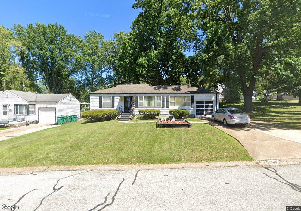
1015 Addison Dr Saint Louis, MO 63137
Estimated Value: $89,000 - $112,670
2
Beds
1
Bath
992
Sq Ft
$106/Sq Ft
Est. Value
About This Home
This home is located at 1015 Addison Dr, Saint Louis, MO 63137 and is currently estimated at $104,668, approximately $105 per square foot. 1015 Addison Dr is a home located in St. Louis County with nearby schools including Riverview Gardens Senior High School, Grace Chapel Lutheran School, and St. Louis Unified School.
Ownership History
Date
Name
Owned For
Owner Type
Purchase Details
Closed on
Jan 28, 2008
Sold by
Long John P
Bought by
Bradford Irma J
Current Estimated Value
Home Financials for this Owner
Home Financials are based on the most recent Mortgage that was taken out on this home.
Original Mortgage
$71,250
Outstanding Balance
$44,951
Interest Rate
6.15%
Mortgage Type
Purchase Money Mortgage
Estimated Equity
$59,717
Purchase Details
Closed on
Jul 29, 2004
Sold by
Tuhill Mary B
Bought by
Long John P
Home Financials for this Owner
Home Financials are based on the most recent Mortgage that was taken out on this home.
Original Mortgage
$32,750
Interest Rate
6.26%
Mortgage Type
Purchase Money Mortgage
Create a Home Valuation Report for This Property
The Home Valuation Report is an in-depth analysis detailing your home's value as well as a comparison with similar homes in the area
Home Values in the Area
Average Home Value in this Area
Purchase History
| Date | Buyer | Sale Price | Title Company |
|---|---|---|---|
| Bradford Irma J | $75,000 | None Available | |
| Long John P | $45,000 | -- |
Source: Public Records
Mortgage History
| Date | Status | Borrower | Loan Amount |
|---|---|---|---|
| Open | Bradford Irma J | $71,250 | |
| Previous Owner | Long John P | $32,750 | |
| Closed | Long John P | $10,000 |
Source: Public Records
Tax History Compared to Growth
Tax History
| Year | Tax Paid | Tax Assessment Tax Assessment Total Assessment is a certain percentage of the fair market value that is determined by local assessors to be the total taxable value of land and additions on the property. | Land | Improvement |
|---|---|---|---|---|
| 2025 | $1,958 | $19,590 | $3,080 | $16,510 |
| 2024 | $1,958 | $17,010 | $3,080 | $13,930 |
| 2023 | $1,935 | $17,010 | $3,080 | $13,930 |
| 2022 | $1,818 | $12,780 | $2,200 | $10,580 |
| 2021 | $1,801 | $12,780 | $2,200 | $10,580 |
| 2020 | $1,505 | $11,610 | $2,660 | $8,950 |
| 2019 | $1,462 | $11,610 | $2,660 | $8,950 |
| 2018 | $1,289 | $9,560 | $1,200 | $8,360 |
| 2017 | $1,246 | $9,560 | $1,200 | $8,360 |
| 2016 | $1,396 | $10,590 | $1,960 | $8,630 |
| 2015 | $1,271 | $10,590 | $1,960 | $8,630 |
| 2014 | $1,223 | $10,220 | $2,700 | $7,520 |
Source: Public Records
Map
Nearby Homes
- 10236 Tappan Dr
- 10200 Tappan Dr
- 10218 Unicorn Dr
- 10249 Coburg Lands Dr
- 10346 Ashbrook Dr
- 10233 Unicorn Dr
- 1213 Addison Dr
- 1122 Roxton Dr
- 1207 Bakewell Dr
- 10130 Newbold Dr
- 1131 Roxton Dr
- 10139 Cabot Dr
- 1132 Kilgore Dr
- 1222 Hoyt Dr
- 1127 Chambers Rd
- 1422 Akron Dr
- 10537 Repose Dr
- 936 Amaral Cir
- 10043 Hedge Dr
- 1100 La Roux Ct
- 1001 Addison Dr
- 1027 Addison Dr
- 1000 Avant Dr
- 1031 Addison Dr
- 1024 Addison Dr
- 1012 Avant Dr
- 1028 Addison Dr
- 1008 Addison Dr
- 1020 Addison Dr
- 1004 Addison Dr
- 1022 Avant Dr
- 1016 Addison Dr
- 1030 Addison Dr
- 1035 Addison Dr
- 1012 Addison Dr
- 1000 Addison Dr
- 1001 Avant Dr
- 1034 Addison Dr
- 1005 Avant Dr
- 10216 Cabot Dr