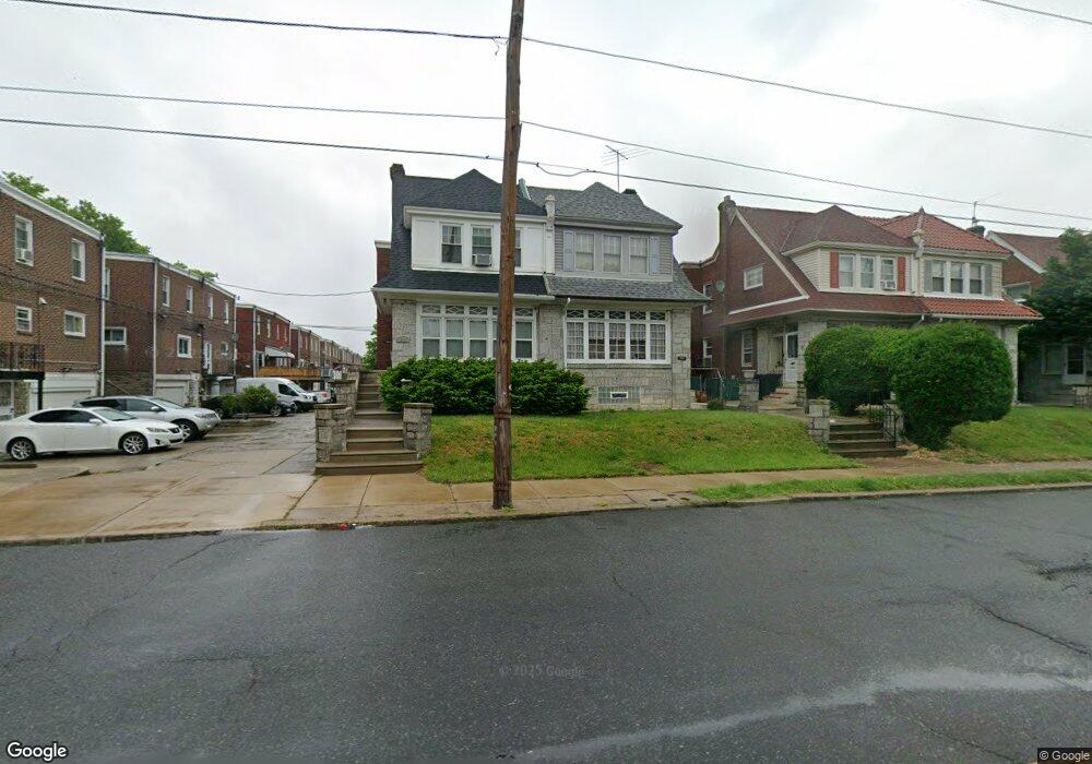
1015 Bridge St Philadelphia, PA 19124
Frankford NeighborhoodEstimated Value: $265,000 - $333,000
4
Beds
1
Bath
1,896
Sq Ft
$157/Sq Ft
Est. Value
About This Home
This home is located at 1015 Bridge St, Philadelphia, PA 19124 and is currently estimated at $298,367, approximately $157 per square foot. 1015 Bridge St is a home with nearby schools including Frankford High School, The Philadelphia Charter School for the Arts & Sciences, and Northwood Academy Charter School.
Ownership History
Date
Name
Owned For
Owner Type
Purchase Details
Closed on
May 24, 2002
Sold by
Wall Maureen and Will Of Mary B Phelan
Bought by
Pierre Micheline
Current Estimated Value
Home Financials for this Owner
Home Financials are based on the most recent Mortgage that was taken out on this home.
Original Mortgage
$69,500
Outstanding Balance
$28,790
Interest Rate
6.8%
Estimated Equity
$269,577
Create a Home Valuation Report for This Property
The Home Valuation Report is an in-depth analysis detailing your home's value as well as a comparison with similar homes in the area
Home Values in the Area
Average Home Value in this Area
Purchase History
| Date | Buyer | Sale Price | Title Company |
|---|---|---|---|
| Pierre Micheline | $81,500 | -- |
Source: Public Records
Mortgage History
| Date | Status | Borrower | Loan Amount |
|---|---|---|---|
| Open | Pierre Micheline | $69,500 |
Source: Public Records
Tax History Compared to Growth
Tax History
| Year | Tax Paid | Tax Assessment Tax Assessment Total Assessment is a certain percentage of the fair market value that is determined by local assessors to be the total taxable value of land and additions on the property. | Land | Improvement |
|---|---|---|---|---|
| 2026 | $3,225 | $275,300 | $55,060 | $220,240 |
| 2025 | $3,225 | $275,300 | $55,060 | $220,240 |
| 2024 | $3,225 | $275,300 | $55,060 | $220,240 |
| 2023 | $3,225 | $230,400 | $46,080 | $184,320 |
| 2022 | $1,863 | $185,400 | $46,080 | $139,320 |
| 2021 | $2,493 | $0 | $0 | $0 |
| 2020 | $2,493 | $0 | $0 | $0 |
| 2019 | $2,392 | $0 | $0 | $0 |
| 2018 | $1,788 | $0 | $0 | $0 |
| 2017 | $2,207 | $0 | $0 | $0 |
| 2016 | $1,788 | $0 | $0 | $0 |
| 2015 | $1,711 | $0 | $0 | $0 |
| 2014 | -- | $157,700 | $36,250 | $121,450 |
| 2012 | -- | $17,408 | $2,780 | $14,628 |
Source: Public Records
Map
Nearby Homes
- 1048 Bridge St
- 5659 Miriam Rd
- 5661 Miriam Rd
- 1137 Bridge St
- 5640 Miriam Rd
- 996 Anchor St
- 991 Carver St
- 972 Bridge St
- 1204 Pratt St
- 5505 Loretto Ave
- 1218 Pratt St
- 1431 Rosalie St
- 5347 Sylvester St
- 1220 Pratt St
- 934 Brill St
- 1244 E Sanger St
- 934 E Sanger St
- 1225 E Cheltenham Ave
- 1211 E Cheltenham Ave
- 5902 E Roosevelt Blvd
- 1017 Bridge St
- 1019 Bridge St
- 5303 Castor Ave
- 5301 Castor Ave
- 1021 Bridge St
- 5307 Castor Ave
- 5305 Castor Ave
- 5309 Castor Ave
- 1023 Bridge St
- 5311 Castor Ave
- 1025 Bridge St
- 5308 Rutland St
- 5313 Castor Ave
- 5245 Castor Ave
- 1027 Bridge St
- 5315 Castor Ave
- 1029 Bridge St
- 1030 Bridge St
- 5312 Rutland St
- 1032 Bridge St