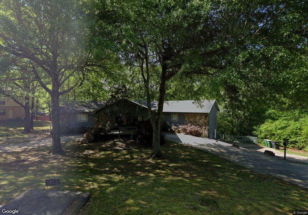
1015 Club Rd Sherwood, AR 72120
Estimated Value: $314,000 - $365,000
--
Bed
2
Baths
3,502
Sq Ft
$99/Sq Ft
Est. Value
About This Home
This home is located at 1015 Club Rd, Sherwood, AR 72120 and is currently estimated at $346,583, approximately $98 per square foot. 1015 Club Rd is a home located in Pulaski County with nearby schools including Sherwood Elementary School, Sylvan Hills Middle School, and Sylvan Hills High School.
Ownership History
Date
Name
Owned For
Owner Type
Purchase Details
Closed on
Mar 26, 1999
Sold by
Rhoads Robert Judd
Bought by
Janssen Everett Richard and Janssen Mary Janet
Current Estimated Value
Home Financials for this Owner
Home Financials are based on the most recent Mortgage that was taken out on this home.
Original Mortgage
$40,000
Interest Rate
6.52%
Mortgage Type
Purchase Money Mortgage
Purchase Details
Closed on
Jun 17, 1998
Sold by
Rhoads Cheryl Ruth
Bought by
Rhoads Robert Judd
Create a Home Valuation Report for This Property
The Home Valuation Report is an in-depth analysis detailing your home's value as well as a comparison with similar homes in the area
Home Values in the Area
Average Home Value in this Area
Purchase History
| Date | Buyer | Sale Price | Title Company |
|---|---|---|---|
| Janssen Everett Richard | $158,000 | Beach Abstract & Guaranty Co | |
| Rhoads Robert Judd | -- | -- |
Source: Public Records
Mortgage History
| Date | Status | Borrower | Loan Amount |
|---|---|---|---|
| Closed | Janssen Everett Richard | $40,000 |
Source: Public Records
Tax History Compared to Growth
Tax History
| Year | Tax Paid | Tax Assessment Tax Assessment Total Assessment is a certain percentage of the fair market value that is determined by local assessors to be the total taxable value of land and additions on the property. | Land | Improvement |
|---|---|---|---|---|
| 2025 | $2,327 | $60,810 | $6,600 | $54,210 |
| 2024 | $2,327 | $60,810 | $6,600 | $54,210 |
| 2023 | $2,327 | $60,810 | $6,600 | $54,210 |
| 2022 | $2,640 | $60,810 | $6,600 | $54,210 |
| 2021 | $2,870 | $50,470 | $6,000 | $44,470 |
| 2020 | $2,483 | $50,470 | $6,000 | $44,470 |
| 2019 | $2,483 | $50,470 | $6,000 | $44,470 |
| 2018 | $2,508 | $50,470 | $6,000 | $44,470 |
| 2017 | $2,493 | $50,470 | $6,000 | $44,470 |
| 2016 | $2,641 | $53,310 | $6,600 | $46,710 |
| 2015 | $2,708 | $53,310 | $6,600 | $46,710 |
| 2014 | $2,708 | $38,680 | $6,600 | $32,080 |
Source: Public Records
Map
Nearby Homes
- 4636 Brandywine Cove
- 11 Daniel Dr
- 701 Club Rd
- 8320 Holiday Dr
- 8000 Pinto Trail
- +/- 8.16 Acres Windchime Ave
- 1800 Palomino Dr
- 1301 Stafford Rd
- 1300 Stafford Rd
- 619 Newcastle Dr
- 609 Newcastle Dr
- 1415 Stafford Rd
- 626 Newcastle Dr
- 622 Newcastle Dr
- 8602 Patricia Lynn Ln
- 618 & 620 Newcastle Dr
- 610 Newcastle Dr
- 1419 Stafford Rd
- 1423 Stafford Rd
- 615 & 617 Brierly Dr
- 1010 Club Rd
- 1020 Club Rd
- 100 Alanbrook Ave
- 1005 Club Rd
- 1100 Club Rd
- 102 Alanbrook Ave
- 1003 Club Rd
- 101 Alanbrook Ave
- 1101 Club Rd
- 0 Alanbrook Cir Unit 18001951
- 1102 Club Rd
- 104 Alanbrook Ave
- 46 Daniel Dr
- 1105 Club Rd
- 10 Greenview Cir
- 12 Greenview Cir
- 1108 Club Rd
- 106 Alanbrook Ave
- 44 Daniel Dr
- 8 Greenview Cir