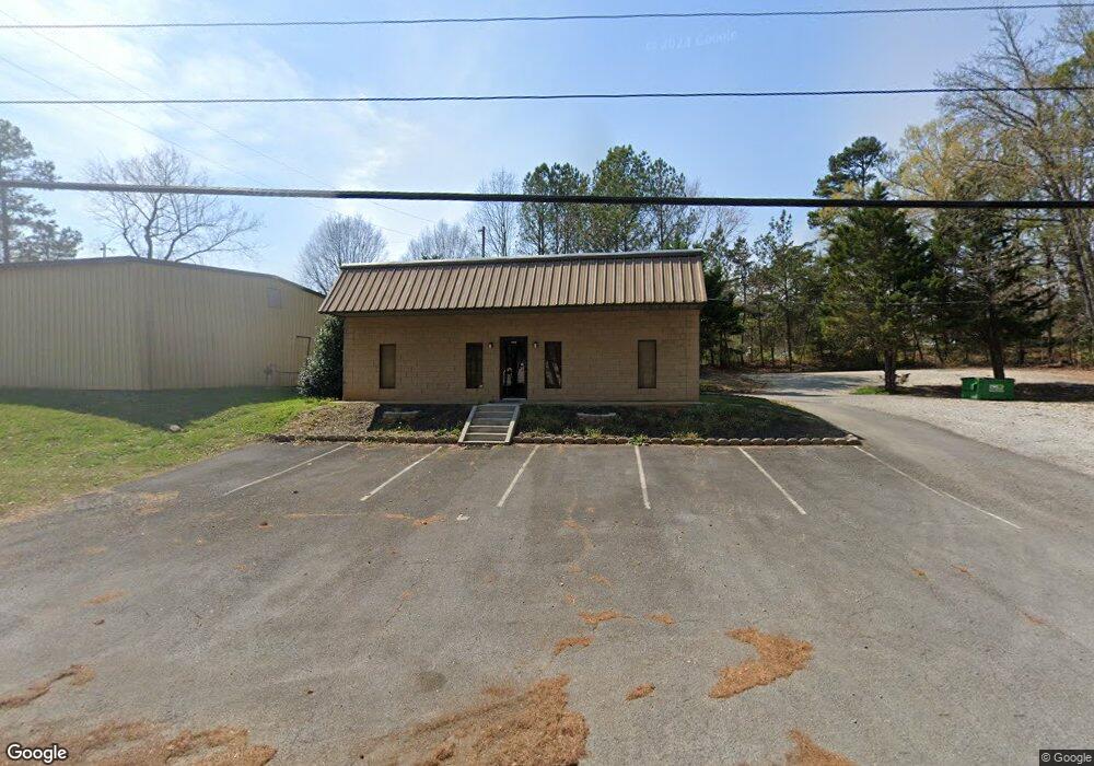
1015 Curtis Pkwy SE Calhoun, GA 30701
Estimated Value: $355,503
--
Bed
--
Bath
1,932
Sq Ft
$184/Sq Ft
Est. Value
About This Home
This home is located at 1015 Curtis Pkwy SE, Calhoun, GA 30701 and is currently estimated at $355,503, approximately $184 per square foot. 1015 Curtis Pkwy SE is a home located in Gordon County with nearby schools including Calhoun Primary School, Calhoun Elementary School, and Calhoun Middle School.
Ownership History
Date
Name
Owned For
Owner Type
Purchase Details
Closed on
Jul 15, 2022
Sold by
Russell George
Bought by
Russell Management Llc and C/O Russell George
Current Estimated Value
Purchase Details
Closed on
Nov 13, 2017
Sold by
Pulliam Janice
Bought by
Russell George
Home Financials for this Owner
Home Financials are based on the most recent Mortgage that was taken out on this home.
Original Mortgage
$144,000
Interest Rate
3.91%
Mortgage Type
Commercial
Purchase Details
Closed on
Apr 3, 2003
Sold by
Sue Patricia J and Sue Phil
Bought by
Pulliam Janice
Purchase Details
Closed on
Jul 9, 1999
Bought by
Sue Patricia J and Sue Phil
Purchase Details
Closed on
Jan 24, 1997
Bought by
Sue Phil and Sue Patricia T
Purchase Details
Closed on
Nov 8, 1996
Bought by
Walraven Bill and John Didier
Purchase Details
Closed on
Jun 30, 1992
Bought by
Moss Sam and Brumlow Jack D
Create a Home Valuation Report for This Property
The Home Valuation Report is an in-depth analysis detailing your home's value as well as a comparison with similar homes in the area
Home Values in the Area
Average Home Value in this Area
Purchase History
| Date | Buyer | Sale Price | Title Company |
|---|---|---|---|
| Russell Management Llc | -- | -- | |
| Russell George | $180,000 | -- | |
| Russell George | -- | -- | |
| Pulliam Janice | $180,000 | -- | |
| Sue Patricia J | -- | -- | |
| Sue Phil | $88,500 | -- | |
| Walraven Bill | -- | -- | |
| Calhoun North Industrial Pro | $85,000 | -- | |
| Moss Sam | $12,500 | -- |
Source: Public Records
Mortgage History
| Date | Status | Borrower | Loan Amount |
|---|---|---|---|
| Previous Owner | Russell George | $144,000 |
Source: Public Records
Tax History Compared to Growth
Tax History
| Year | Tax Paid | Tax Assessment Tax Assessment Total Assessment is a certain percentage of the fair market value that is determined by local assessors to be the total taxable value of land and additions on the property. | Land | Improvement |
|---|---|---|---|---|
| 2024 | $1,925 | $68,480 | $14,560 | $53,920 |
| 2023 | $1,975 | $70,240 | $14,560 | $55,680 |
| 2022 | $582 | $72,000 | $14,560 | $57,440 |
| 2021 | $1,905 | $64,000 | $11,886 | $52,114 |
| 2020 | $1,921 | $64,000 | $11,886 | $52,114 |
| 2019 | $1,997 | $78,400 | $14,560 | $63,840 |
| 2018 | $498 | $51,720 | $14,560 | $37,160 |
| 2017 | $508 | $51,720 | $14,560 | $37,160 |
| 2016 | $510 | $51,720 | $14,560 | $37,160 |
| 2015 | $516 | $51,720 | $14,560 | $37,160 |
| 2014 | $579 | $58,802 | $21,560 | $37,242 |
Source: Public Records
Map
Nearby Homes
- 111 Lewis Dr SE
- 102 Sylvania Cir
- 306 E Belmont Dr
- 00 Curtis Cir
- 0 Curtis Cir SE Unit 10611011
- 0 Curtis Cir SE Unit 7654260
- The Alston Plan at Salacoa - The Overlook at Salacoa
- The Hartwell Plan at Salacoa - The Overlook at Salacoa
- The Perry Plan at Salacoa - The Overlook at Salacoa
- The Dalton Plan at Salacoa - The Overlook at Salacoa
- The Springfield Plan at Salacoa - The Overlook at Salacoa
- The Dexter Plan at Salacoa - The Overlook at Salacoa
- 0 Lovers Lane Rd SE Unit 10509663
- 199 Cherry St SE
- 119 Deer Park Ln
- 116 Lavender Cir
- 110 Lavender Cir
- 114 Lavender Cir
- 118 Lavender Cir
- 117 Lavender Cir
- 201 Kirk Dr
- 99 Cindy Ln
- 204 Kirk Dr
- 0 Huntington Ln
- 101 Huntington Ln
- 101 Huntington Ln
- 102 Huntington Ln
- 1010 Lovers Lane Rd SE
- 103 Cindy Ln
- 108 Lewis Dr
- 100 Cindy Ln
- 104 Lewis Dr
- 104 Lewis Dr
- 984 Lovers Lane Rd SE
- 106 Lewis Dr
- 1024 Lovers Lane Rd SE
- 102 Lewis Dr
- 632 Peters St
- 634 Peters St
- 630 Peters St