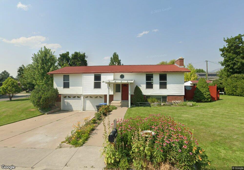
1015 E 2050 N North Logan, UT 84341
Estimated Value: $434,000 - $487,000
4
Beds
2
Baths
2,000
Sq Ft
$229/Sq Ft
Est. Value
About This Home
$2000 per month. HOUSE at 1015 E 2050 N., North Logan. NO ANIMALS/no smoking. Big rooms and nice landscaping. Family room AND living room! Close to the park. Central air conditioning, big deck, double car garage, 4 bed 2 bath. Available immediately. Please call American Real Estate ONLY Monday through Friday 9 am to 5 pm.
Ownership History
Date
Name
Owned For
Owner Type
Purchase Details
Closed on
Jan 4, 2011
Sold by
Speth Larry M and Speth Maxine B
Bought by
Speth Larry M and Speth Maxine B
Current Estimated Value
Purchase Details
Closed on
Mar 10, 2008
Sold by
Heier Raymond W and Heier Patricia
Bought by
Speth Larry M and Speth Maxine B
Home Financials for this Owner
Home Financials are based on the most recent Mortgage that was taken out on this home.
Original Mortgage
$61,000
Outstanding Balance
$37,150
Interest Rate
5.41%
Mortgage Type
New Conventional
Estimated Equity
$420,665
Create a Home Valuation Report for This Property
The Home Valuation Report is an in-depth analysis detailing your home's value as well as a comparison with similar homes in the area
Home Values in the Area
Average Home Value in this Area
Purchase History
| Date | Buyer | Sale Price | Title Company |
|---|---|---|---|
| Speth Larry M | -- | None Available | |
| Speth Larry M | -- | Northern Title Company |
Source: Public Records
Mortgage History
| Date | Status | Borrower | Loan Amount |
|---|---|---|---|
| Open | Speth Larry M | $61,000 |
Source: Public Records
Property History
| Date | Event | Price | List to Sale | Price per Sq Ft |
|---|---|---|---|---|
| 09/22/2025 09/22/25 | Off Market | $2,000 | -- | -- |
| 08/27/2025 08/27/25 | For Rent | $2,000 | -- | -- |
Tax History Compared to Growth
Tax History
| Year | Tax Paid | Tax Assessment Tax Assessment Total Assessment is a certain percentage of the fair market value that is determined by local assessors to be the total taxable value of land and additions on the property. | Land | Improvement |
|---|---|---|---|---|
| 2025 | $1,732 | $242,495 | $0 | $0 |
| 2024 | $1,915 | $249,405 | $0 | $0 |
| 2023 | $1,951 | $237,855 | $0 | $0 |
| 2022 | $1,752 | $204,035 | $0 | $0 |
| 2021 | $1,655 | $298,860 | $58,500 | $240,360 |
| 2020 | $1,528 | $258,800 | $58,500 | $200,300 |
| 2019 | $1,145 | $185,109 | $58,500 | $126,609 |
| 2018 | $1,057 | $165,796 | $58,500 | $107,296 |
| 2017 | $995 | $82,115 | $0 | $0 |
| 2016 | $1,011 | $82,115 | $0 | $0 |
| 2015 | $1,014 | $82,115 | $0 | $0 |
| 2014 | $970 | $80,400 | $0 | $0 |
| 2013 | -- | $80,400 | $0 | $0 |
Source: Public Records
Map
Nearby Homes
- 1963 N 1000 E
- 2143 N 950 E
- 1593 N 110 W Unit 201
- 611 E 2450 N Unit 1
- 1593 N 110 W Unit 202
- 1593 N 110 W Unit 204
- 1593 N 110 W Unit 203
- 1200 W 1400 N
- 2950 N Mahogony Valley Rd E Unit 7
- 1598 N Sharptail Cir
- 1000 W 2500 N
- 2284 N 740 E
- 1901 N 1380 E
- 1335 E 2300 N
- 3057 N 1200 E
- 3073 N 1200 E Unit 3
- 2361 N 740 E Unit 31
- 2361 N 740 E
- 2377 N 740 E
- 2377 N 740 E Unit 32