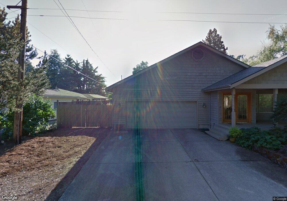
1015 Forrester Way Eugene, OR 97401
Cal Young NeighborhoodEstimated Value: $537,000 - $698,000
3
Beds
2
Baths
1,860
Sq Ft
$323/Sq Ft
Est. Value
About This Home
This home is located at 1015 Forrester Way, Eugene, OR 97401 and is currently estimated at $600,111, approximately $322 per square foot. 1015 Forrester Way is a home located in Lane County with nearby schools including Willagillespie Elementary School, Monroe Middle School, and Sheldon High School.
Ownership History
Date
Name
Owned For
Owner Type
Purchase Details
Closed on
Aug 8, 2014
Sold by
Brown Christopher B and Dean Erlene G
Bought by
Bennett Steven C and Bennett Joyce E
Current Estimated Value
Home Financials for this Owner
Home Financials are based on the most recent Mortgage that was taken out on this home.
Original Mortgage
$237,850
Outstanding Balance
$180,368
Interest Rate
4.12%
Mortgage Type
New Conventional
Estimated Equity
$419,743
Purchase Details
Closed on
Nov 1, 2002
Sold by
Frogner Roger A and Osborne Shirley R
Bought by
Dean Erlene Gail and Brown Christopher B
Home Financials for this Owner
Home Financials are based on the most recent Mortgage that was taken out on this home.
Original Mortgage
$125,000
Interest Rate
5.39%
Create a Home Valuation Report for This Property
The Home Valuation Report is an in-depth analysis detailing your home's value as well as a comparison with similar homes in the area
Home Values in the Area
Average Home Value in this Area
Purchase History
| Date | Buyer | Sale Price | Title Company |
|---|---|---|---|
| Bennett Steven C | $280,000 | Western Title | |
| Dean Erlene Gail | $250,000 | Western Pioneer Title Co |
Source: Public Records
Mortgage History
| Date | Status | Borrower | Loan Amount |
|---|---|---|---|
| Open | Bennett Steven C | $237,850 | |
| Previous Owner | Dean Erlene Gail | $125,000 |
Source: Public Records
Tax History Compared to Growth
Tax History
| Year | Tax Paid | Tax Assessment Tax Assessment Total Assessment is a certain percentage of the fair market value that is determined by local assessors to be the total taxable value of land and additions on the property. | Land | Improvement |
|---|---|---|---|---|
| 2025 | $5,920 | $303,864 | -- | -- |
| 2024 | $5,847 | $295,014 | -- | -- |
| 2023 | $5,847 | $286,422 | $0 | $0 |
| 2022 | $5,477 | $278,080 | $0 | $0 |
| 2021 | $5,145 | $269,981 | $0 | $0 |
| 2020 | $5,163 | $262,118 | $0 | $0 |
| 2019 | $4,986 | $254,484 | $0 | $0 |
| 2018 | $4,694 | $239,876 | $0 | $0 |
| 2017 | $4,452 | $239,876 | $0 | $0 |
| 2016 | $4,268 | $232,889 | $0 | $0 |
| 2015 | $4,105 | $226,106 | $0 | $0 |
| 2014 | $3,920 | $219,520 | $0 | $0 |
Source: Public Records
Map
Nearby Homes
- 2568 Sharon Way
- 805 Lariat Dr
- 950 Coburg Rd
- 2653 Sharon Way
- 820 Lariat Dr
- 2355 Pioneer Pike
- 2250 Turnberry Ct
- 529 Antelope Way
- 2849 Harlow Rd
- 2107 Bedford Way
- 347 Rustic Place Unit 1
- 2150 Greenview St
- 863 Fairway View Dr
- 2925 Van Ave
- 2055 Monterey Ln
- 3080 Harlow Rd
- 1097 Leigh St
- 488 Pinto Way
- 341 Ransom Ct
- 250 Regal Ct
- 1033 Forrester Way
- 2515 Tandy Turn
- 1010 Forrester Way
- 2500 Forrester Way
- 1040 Corydon St
- 2585 Tandy Turn
- 1050 Corydon St
- 1030 Forrester Way
- 2520 Forrester Way
- 1076 Forrester Way
- 2465 Tandy Turn
- 2516 Tandy Turn
- 1120 Buff Way
- 1090 Corydon St
- 2584 Tandy Turn
- 2490 Tandy Turn
- 2515 Forrester Way
- 2615 Tandy Turn
- 1023 Sharon Way
- 1033 Sharon Way