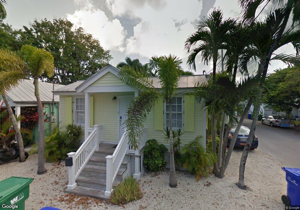
1015 Howe St Key West, FL 33040
Old Town NeighborhoodEstimated Value: $1,128,957 - $1,438,000
2
Beds
2
Baths
848
Sq Ft
$1,442/Sq Ft
Est. Value
About This Home
This home is located at 1015 Howe St, Key West, FL 33040 and is currently estimated at $1,222,739, approximately $1,441 per square foot. 1015 Howe St is a home located in Monroe County with nearby schools including Horace O'Bryant School, Key West High School, and May Sands Montessori School.
Ownership History
Date
Name
Owned For
Owner Type
Purchase Details
Closed on
Sep 15, 2022
Sold by
Stuart Tomlinson James and Ferguson Ruth
Bought by
Conklin-Penwell Kelly
Current Estimated Value
Purchase Details
Closed on
Feb 25, 2003
Sold by
Cave Holdings 1016 Howe Street Llc
Bought by
Ferguson Tomlinson James Stuart and Ferguson Tomlinson Ruth
Purchase Details
Closed on
Feb 2, 2001
Sold by
Anderson Willie L and Anderson Joanne
Bought by
Cave Holdings & 1016 Howe St
Purchase Details
Closed on
Jun 21, 2000
Sold by
Clerk Of The Court
Bought by
Northside Builders Inc
Create a Home Valuation Report for This Property
The Home Valuation Report is an in-depth analysis detailing your home's value as well as a comparison with similar homes in the area
Home Values in the Area
Average Home Value in this Area
Purchase History
| Date | Buyer | Sale Price | Title Company |
|---|---|---|---|
| Conklin-Penwell Kelly | $1,185,000 | First International Title | |
| Ferguson Tomlinson James Stuart | $370,000 | -- | |
| Cave Holdings & 1016 Howe St | $155,000 | -- | |
| Northside Builders Inc | $45,000 | -- |
Source: Public Records
Tax History
| Year | Tax Paid | Tax Assessment Tax Assessment Total Assessment is a certain percentage of the fair market value that is determined by local assessors to be the total taxable value of land and additions on the property. | Land | Improvement |
|---|---|---|---|---|
| 2025 | $8,368 | $970,989 | $600,631 | $370,358 |
| 2024 | $8,439 | $999,330 | $639,382 | $359,948 |
| 2023 | $8,439 | $994,759 | $656,604 | $338,155 |
| 2022 | $4,661 | $577,225 | $398,268 | $178,957 |
| 2021 | $4,197 | $430,395 | $322,920 | $107,475 |
| 2020 | $4,110 | $422,307 | $312,156 | $110,151 |
| 2019 | $4,078 | $424,473 | $327,226 | $97,247 |
| 2018 | $3,967 | $432,531 | $332,608 | $99,923 |
| 2017 | $3,839 | $435,206 | $0 | $0 |
| 2016 | $4,055 | $496,632 | $0 | $0 |
| 2015 | $3,624 | $396,353 | $0 | $0 |
| 2014 | $3,459 | $364,213 | $0 | $0 |
Source: Public Records
Map
Nearby Homes
- 209 Olivia St
- 927 Thomas St Unit 2
- 927 Thomas St Unit 4
- 919 Thomas St
- 813 Thomas St
- 1102 Whitehead St
- 817 Terry Ln
- 720 Emma St
- 1119 Whitehead St
- 1121 Whitehead St
- 414 Virginia St
- 418 Olivia St
- 709 Chapman Ln
- 1202 Whitehead St
- 705 Chapman Ln
- 120 Angela St Unit 102
- 422 Amelia St Unit 6
- 405 Petronia St
- 411 Louisa St
- 410 Louisa St
- 226 Julia St Unit 3
- 226 Julia St
- 227 Julia St
- 1011 Howe St Unit SI ID1385998P
- 1011 Howe St Unit ID1385998P
- 1027 Howe St
- 1018 Thomas St
- 1004 Thomas St
- 1014 Thomas St
- 1031 Howe St
- 1006 Howe St
- 285 Hutchinson Ln
- 1020 Thomas St
- 224 Truman Ave
- 213 Julia St
- 228 Truman Ave
- 219 Truman Ave
- 1016 Howe St Unit 8-11-14
- 1016 Howe St Unit 13
Your Personal Tour Guide
Ask me questions while you tour the home.