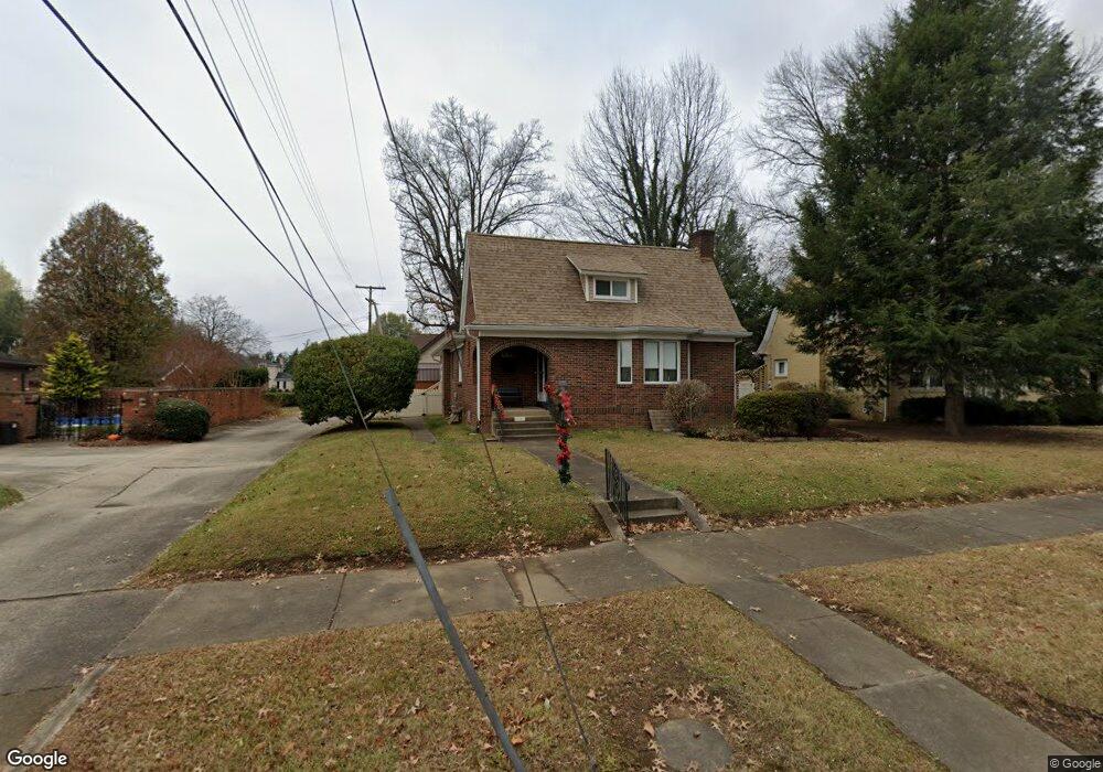
1015 Kemp Ave Ironton, OH 45638
Estimated Value: $174,672 - $200,000
3
Beds
2
Baths
2,692
Sq Ft
$69/Sq Ft
Est. Value
About This Home
This home is located at 1015 Kemp Ave, Ironton, OH 45638 and is currently estimated at $186,418, approximately $69 per square foot. 1015 Kemp Ave is a home located in Lawrence County with nearby schools including Ironton Elementary School, Ironton Middle School, and Ironton High School.
Ownership History
Date
Name
Owned For
Owner Type
Purchase Details
Closed on
Oct 19, 2020
Sold by
U S Bank Na
Bought by
Daniel Geraldine and Daniel Douglas R
Current Estimated Value
Purchase Details
Closed on
Jan 17, 2014
Sold by
Daniel Geraldine
Bought by
Us Bank Na and Daniel Family Trust
Purchase Details
Closed on
Oct 9, 2006
Sold by
Daniel Douglas R and Daniel Geraldine
Bought by
Geraldine Daniel Revocable Trust and Daniel Geraldine
Purchase Details
Closed on
Oct 24, 1990
Sold by
Morgan Craig and Morgan Kathy
Bought by
Daniel Douglas R and Daniel Gera
Create a Home Valuation Report for This Property
The Home Valuation Report is an in-depth analysis detailing your home's value as well as a comparison with similar homes in the area
Home Values in the Area
Average Home Value in this Area
Purchase History
| Date | Buyer | Sale Price | Title Company |
|---|---|---|---|
| Daniel Geraldine | -- | None Available | |
| Us Bank Na | -- | None Available | |
| Geraldine Daniel Revocable Trust | -- | None Available | |
| Daniel Douglas R | $85,000 | -- |
Source: Public Records
Tax History Compared to Growth
Tax History
| Year | Tax Paid | Tax Assessment Tax Assessment Total Assessment is a certain percentage of the fair market value that is determined by local assessors to be the total taxable value of land and additions on the property. | Land | Improvement |
|---|---|---|---|---|
| 2024 | -- | $46,360 | $6,780 | $39,580 |
| 2023 | $1,666 | $46,360 | $6,780 | $39,580 |
| 2022 | $1,664 | $46,360 | $6,780 | $39,580 |
| 2021 | $1,499 | $39,470 | $6,380 | $33,090 |
| 2020 | $1,499 | $39,470 | $6,380 | $33,090 |
| 2019 | $1,493 | $39,470 | $6,380 | $33,090 |
| 2018 | $1,510 | $39,470 | $6,380 | $33,090 |
| 2017 | $92 | $39,470 | $6,380 | $33,090 |
| 2016 | $1,414 | $39,470 | $6,380 | $33,090 |
| 2015 | $1,576 | $42,480 | $7,020 | $35,460 |
| 2014 | $1,520 | $42,480 | $7,020 | $35,460 |
| 2013 | $1,516 | $42,480 | $7,020 | $35,460 |
Source: Public Records
Map
Nearby Homes
- 2001 Liberty Ave
- 2008 S 9th St
- 2008 S 9th St Unit KO-2
- 707 Mastin Ave
- 1902 S 7th St
- 2121 S 6th St
- 1917 Woodland Dr
- 1819 S 6th St
- 2503 S 9th St
- 1619 S 6th St
- 1703 S 5th St
- 2322 S 5th St
- 1525 S 6th St
- 914 Pine St
- 914 Pine St
- 2436 S 5th St
- 1324 S 10th St
- 2520 S 6th St Unit BO-1
- 1222 Osage Ct
- 2616 S 13th St
- 2021 S 10th St
- 1001 Kemp Ave
- 1025 Kemp Ave
- 1014 Mastin Ave
- 1022 Kemp Ave
- 1004 Mastin Ave
- 1006 Kemp Ave
- 1102 Mastin Ave
- 2106 S 11th St
- 1101 Kemp Ave
- 1101 Kemp Ave Unit KO-10
- 2105 S 10th St
- 1105 Kemp Ave
- 2115 S 10th St
- 2022 S 10th St
- 2024 S 10th St
- 1108 Mastin Ave
- 2105 S 11th St
- 2110 S 11th St
- 2020 S 10th St