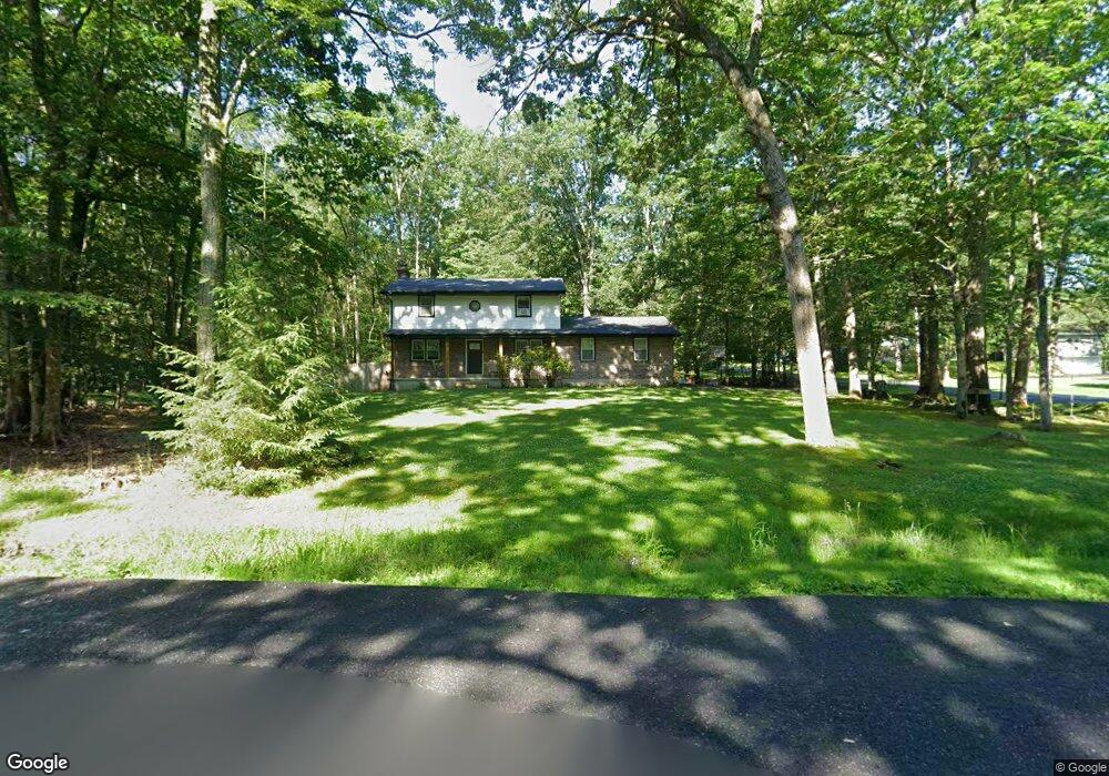
1015 Maple Ln Stroudsburg, PA 18360
Estimated Value: $342,365 - $440,000
4
Beds
2
Baths
2,400
Sq Ft
$163/Sq Ft
Est. Value
About This Home
This home is located at 1015 Maple Ln, Stroudsburg, PA 18360 and is currently estimated at $390,091, approximately $162 per square foot. 1015 Maple Ln is a home located in Monroe County with nearby schools including Stroudsburg Junior High School, Stroudsburg High School, and Stroudsburg Seventh-day Adventist School.
Ownership History
Date
Name
Owned For
Owner Type
Purchase Details
Closed on
Feb 10, 2025
Sold by
Dempsey Michael and Dempsey Filomena
Bought by
Dempsey Michael and Dempsey Filomena
Current Estimated Value
Purchase Details
Closed on
Apr 9, 2020
Sold by
Misiti Joseph and Misiti Christina M
Bought by
Dempsey Michael and Dempsey Filomena
Home Financials for this Owner
Home Financials are based on the most recent Mortgage that was taken out on this home.
Original Mortgage
$235,653
Interest Rate
3.3%
Mortgage Type
FHA
Purchase Details
Closed on
Oct 24, 2008
Sold by
Rovito Ronald M and Rovito Georgia Ann
Bought by
Misiti Joseph and Misiti Christina M
Home Financials for this Owner
Home Financials are based on the most recent Mortgage that was taken out on this home.
Original Mortgage
$239,506
Interest Rate
5.94%
Mortgage Type
FHA
Create a Home Valuation Report for This Property
The Home Valuation Report is an in-depth analysis detailing your home's value as well as a comparison with similar homes in the area
Home Values in the Area
Average Home Value in this Area
Purchase History
| Date | Buyer | Sale Price | Title Company |
|---|---|---|---|
| Dempsey Michael | -- | -- | |
| Dempsey Michael | $240,000 | Monroe Abstract Company | |
| Misiti Joseph | $242,000 | None Available |
Source: Public Records
Mortgage History
| Date | Status | Borrower | Loan Amount |
|---|---|---|---|
| Previous Owner | Dempsey Michael | $235,653 | |
| Previous Owner | Misiti Joseph | $239,506 |
Source: Public Records
Tax History Compared to Growth
Tax History
| Year | Tax Paid | Tax Assessment Tax Assessment Total Assessment is a certain percentage of the fair market value that is determined by local assessors to be the total taxable value of land and additions on the property. | Land | Improvement |
|---|---|---|---|---|
| 2025 | $1,193 | $144,730 | $38,200 | $106,530 |
| 2024 | $976 | $144,730 | $38,200 | $106,530 |
| 2023 | $4,831 | $144,730 | $38,200 | $106,530 |
| 2022 | $4,933 | $144,730 | $38,200 | $106,530 |
| 2021 | $4,781 | $144,730 | $38,200 | $106,530 |
| 2020 | $4,335 | $144,730 | $38,200 | $106,530 |
| 2019 | $4,312 | $22,870 | $5,250 | $17,620 |
| 2018 | $4,600 | $22,870 | $5,250 | $17,620 |
| 2017 | $4,600 | $22,870 | $5,250 | $17,620 |
| 2016 | $866 | $22,870 | $5,250 | $17,620 |
| 2015 | -- | $22,870 | $5,250 | $17,620 |
| 2014 | -- | $22,870 | $5,250 | $17,620 |
Source: Public Records
Map
Nearby Homes
- 2215 Sutton Dr
- LOT Edgemont Rd
- 00 Phillips St
- 412 N 8th St
- 830 Scott St
- 712 Scott St
- 818 Thomas St
- 712 Thomas St
- 810 Church St
- 1191 Appenzeller Ave
- 520 Scott St
- 607 Thomas St
- 1184 Appenzeller Ave
- 110 Kraemer Ave
- 507 Thomas St
- 108 Holmgren Dr
- 64 N 2nd St Unit A
- 25 N 2nd St
- 733 Ann St Unit 733-735
- 144 W Broad St
- 1957 Long Woods Dr
- 1024 Maple Ln
- 961 Longwoods Dr
- 1050 Longwoods Dr
- 956 Longwoods Dr
- 946 Longwoods Dr
- 960 Longwoods Dr
- 942 Long Woods Dr
- 942 Longwoods Dr
- 1011 Maple Ln
- 1011 Maple Ln
- 1011 Maple Ln
- 1939 Long Woods Dr
- 989 Longwoods Dr
- 1020 Longwoods Dr
- 901 Forest Dr
- 711 Horizon Dr
- 709 Horizon Dr
- 2020 Long Woods Dr
- 876 Forest Dr