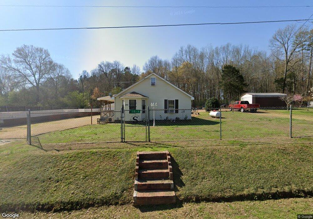
1015 Prior Station Rd Cedartown, GA 30125
Estimated Value: $178,000 - $259,000
2
Beds
1
Bath
1,654
Sq Ft
$129/Sq Ft
Est. Value
About This Home
This home is located at 1015 Prior Station Rd, Cedartown, GA 30125 and is currently estimated at $213,100, approximately $128 per square foot. 1015 Prior Station Rd is a home located in Polk County with nearby schools including Cedar Christian School.
Ownership History
Date
Name
Owned For
Owner Type
Purchase Details
Closed on
Jun 7, 1994
Sold by
Ayer Martha B
Bought by
Studdard Windell and Studdard Carmon G
Current Estimated Value
Purchase Details
Closed on
Aug 7, 1989
Sold by
Shelley Steve R
Bought by
Busby Martha S
Purchase Details
Closed on
Sep 9, 1988
Sold by
Noble Alice and Noble
Bought by
Shelley Steve R
Purchase Details
Closed on
Dec 16, 1985
Sold by
Whitlow Harry
Bought by
Morgan Tim L and Morgan
Purchase Details
Closed on
Aug 1, 1985
Sold by
Maddox C C
Bought by
Whitlow Harry
Purchase Details
Closed on
Dec 31, 1976
Sold by
Smith Ted and Smith Runette
Bought by
Stubblefield Jewell
Purchase Details
Closed on
Oct 19, 1976
Sold by
Stubblefield Jewell
Bought by
Smith Ted and Smith Runette
Purchase Details
Closed on
Mar 16, 1940
Sold by
Stubblefield Jewell
Bought by
Maddox C C
Create a Home Valuation Report for This Property
The Home Valuation Report is an in-depth analysis detailing your home's value as well as a comparison with similar homes in the area
Home Values in the Area
Average Home Value in this Area
Purchase History
| Date | Buyer | Sale Price | Title Company |
|---|---|---|---|
| Studdard Windell | $30,000 | -- | |
| Busby Martha S | -- | -- | |
| Shelley Steve R | $1,000 | -- | |
| Morgan Tim L | -- | -- | |
| Whitlow Harry | -- | -- | |
| Stubblefield Jewell | -- | -- | |
| Smith Ted | -- | -- | |
| Stubblefield Jewell | -- | -- | |
| Maddox C C | -- | -- |
Source: Public Records
Tax History Compared to Growth
Tax History
| Year | Tax Paid | Tax Assessment Tax Assessment Total Assessment is a certain percentage of the fair market value that is determined by local assessors to be the total taxable value of land and additions on the property. | Land | Improvement |
|---|---|---|---|---|
| 2024 | $724 | $66,620 | $1,330 | $65,290 |
| 2023 | $283 | $43,913 | $1,330 | $42,583 |
| 2022 | $41 | $33,734 | $886 | $32,848 |
| 2021 | $42 | $33,734 | $886 | $32,848 |
| 2020 | $490 | $33,734 | $886 | $32,848 |
| 2019 | $133 | $15,857 | $886 | $14,971 |
| 2018 | $131 | $15,406 | $886 | $14,520 |
| 2017 | $126 | $15,406 | $886 | $14,520 |
| 2016 | $133 | $16,013 | $1,493 | $14,520 |
| 2015 | $134 | $16,111 | $1,493 | $14,618 |
| 2014 | $135 | $16,111 | $1,493 | $14,618 |
Source: Public Records
Map
Nearby Homes
- 119 New Harmony Rd
- 0 Mountain Home Rd Unit 1020-C 10351948
- 0 Mountain Home Rd Unit 1020-B 10351940
- 0 Mountain Home Rd Unit 1020-A 10351930
- 151 Friendship Rd
- 255 Reynolds Rd
- 35 Harris Loop
- 1849 Prior Station Rd Unit 76 ACRES
- 1849 Prior Station Rd
- 382 5th St
- 293 4th St
- 516 Branch St
- 512 Branch St
- 508 Branch St
- 0 Cornelius Rd Unit 7646589
- 39 Summerwind Dr
- 28 Summerwind Dr
- 309 Walnut St
- 605 W Girard Ave
- 987 Prior Station Rd
- 1033 Prior Station Rd
- 1018 Prior Station Rd
- 1036 Prior Station Rd
- 1049 Prior Station Rd
- 250 New Harmony Rd
- 304 New Harmony Rd
- 224 New Harmony Rd
- 174 New Harmony Rd
- 972 Prior Station Rd
- 255 New Harmony Rd
- 1086 Prior Station Rd
- 944 Prior Station Rd
- 191 New Harmony Rd
- 285 New Harmony Rd
- 107 New Harmony Rd
- 93 New Harmony Rd
- 1102 Prior Station Rd
- 310 New Harmony Rd
- 81 New Harmony Rd