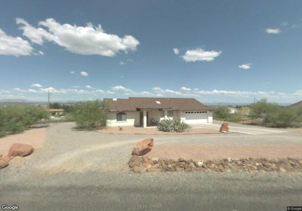
1015 S 8th St Cottonwood, AZ 86326
Cottonwood NeighborhoodEstimated Value: $511,153 - $610,000
--
Bed
--
Bath
1,868
Sq Ft
$308/Sq Ft
Est. Value
About This Home
This home is located at 1015 S 8th St, Cottonwood, AZ 86326 and is currently estimated at $575,038, approximately $307 per square foot. 1015 S 8th St is a home located in Yavapai County with nearby schools including Dr Daniel Bright Elementary School, Cottonwood Elementary School, and Cottonwood Community School.
Ownership History
Date
Name
Owned For
Owner Type
Purchase Details
Closed on
Jun 5, 2012
Sold by
Duncan Jessica V and Duncan Richard
Bought by
Duncan Jessica V and Dropps Daniel E
Current Estimated Value
Home Financials for this Owner
Home Financials are based on the most recent Mortgage that was taken out on this home.
Original Mortgage
$253,400
Outstanding Balance
$175,697
Interest Rate
3.84%
Mortgage Type
New Conventional
Estimated Equity
$399,341
Purchase Details
Closed on
Apr 21, 2005
Sold by
Osegueda Rupert F
Bought by
Duncan Jessica V and Duncan Richard
Home Financials for this Owner
Home Financials are based on the most recent Mortgage that was taken out on this home.
Original Mortgage
$283,000
Interest Rate
5.14%
Mortgage Type
New Conventional
Purchase Details
Closed on
Dec 15, 1995
Sold by
Rider Fae B
Bought by
Osegueda Rupert F
Create a Home Valuation Report for This Property
The Home Valuation Report is an in-depth analysis detailing your home's value as well as a comparison with similar homes in the area
Home Values in the Area
Average Home Value in this Area
Purchase History
| Date | Buyer | Sale Price | Title Company |
|---|---|---|---|
| Duncan Jessica V | -- | Security Title Agency | |
| Duncan Jessica V | $315,000 | Arizona Title Agency Inc | |
| Osegueda Rupert F | $34,000 | First American Title Ins |
Source: Public Records
Mortgage History
| Date | Status | Borrower | Loan Amount |
|---|---|---|---|
| Open | Duncan Jessica V | $253,400 | |
| Closed | Duncan Jessica V | $283,000 |
Source: Public Records
Tax History Compared to Growth
Tax History
| Year | Tax Paid | Tax Assessment Tax Assessment Total Assessment is a certain percentage of the fair market value that is determined by local assessors to be the total taxable value of land and additions on the property. | Land | Improvement |
|---|---|---|---|---|
| 2026 | $1,450 | $45,958 | -- | -- |
| 2024 | $1,417 | $46,079 | -- | -- |
| 2023 | $1,421 | $37,627 | $8,327 | $29,300 |
| 2022 | $1,417 | $31,228 | $6,964 | $24,264 |
| 2021 | $1,541 | $28,669 | $6,124 | $22,545 |
| 2020 | $1,530 | $0 | $0 | $0 |
| 2019 | $1,521 | $0 | $0 | $0 |
| 2018 | $1,462 | $0 | $0 | $0 |
| 2017 | $1,400 | $0 | $0 | $0 |
| 2016 | $1,376 | $0 | $0 | $0 |
| 2015 | $1,378 | $0 | $0 | $0 |
| 2014 | $1,221 | $0 | $0 | $0 |
Source: Public Records
Map
Nearby Homes
- 630 E Elm St
- 1295 E Ridgeview Dr
- 1798 E Fir St
- 912 S 6th St
- 1322 E Five Star Blvd
- 1860 Sunset Dr
- 1520 E Elm St
- 1041 S Vista Grande Dr
- 1203 S Settlers Cir
- 320 E Fir St
- 1615 E Crestview Cir
- 1161 S 10th St
- 1191 S Vista Grande Dr
- 421 Boulder Ln
- 1063 S Viejo Dr
- 1059 S 16th Place
- 910 S Tigres Trail
- 1476 S Verde Dr
- 1151 E State Route 89a --
- 1655 Oro Dr