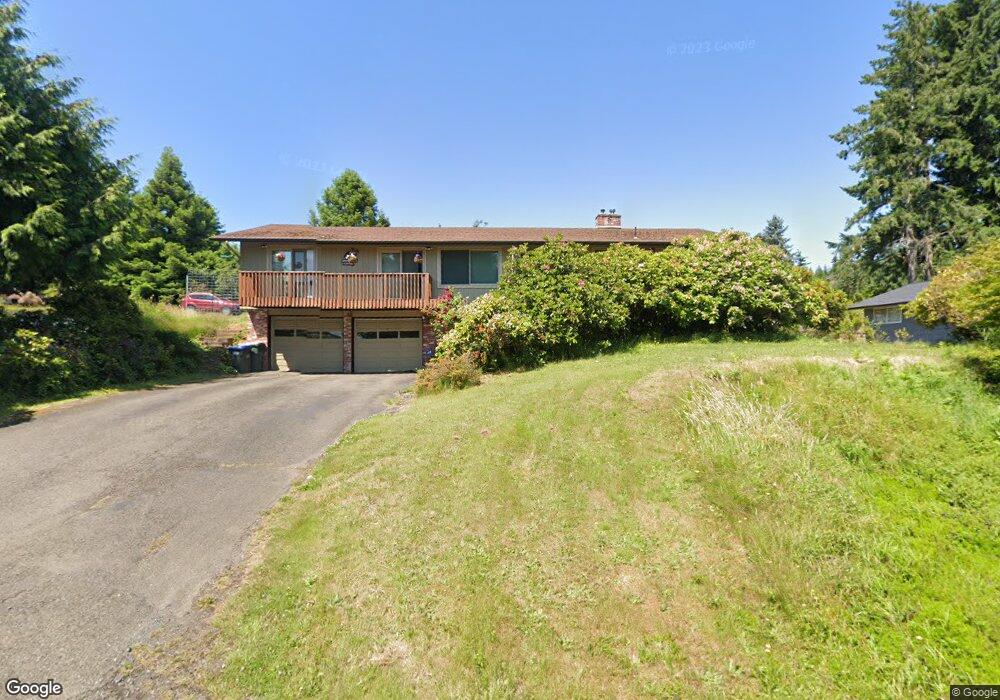
1015 Spring Ln Centralia, WA 98531
Estimated Value: $475,000 - $804,000
4
Beds
2
Baths
2,662
Sq Ft
$222/Sq Ft
Est. Value
About This Home
This home is located at 1015 Spring Ln, Centralia, WA 98531 and is currently estimated at $591,175, approximately $222 per square foot. 1015 Spring Ln is a home located in Lewis County with nearby schools including Centralia Middle School, Centralia High School, and Evergreen Academy of Arts & Sciences.
Ownership History
Date
Name
Owned For
Owner Type
Purchase Details
Closed on
Jun 9, 2010
Sold by
Brumsickle Bill T
Bought by
Mayes Justin and Mayes Franji
Current Estimated Value
Home Financials for this Owner
Home Financials are based on the most recent Mortgage that was taken out on this home.
Original Mortgage
$139,500
Outstanding Balance
$46,709
Interest Rate
5.03%
Mortgage Type
Purchase Money Mortgage
Estimated Equity
$544,466
Create a Home Valuation Report for This Property
The Home Valuation Report is an in-depth analysis detailing your home's value as well as a comparison with similar homes in the area
Home Values in the Area
Average Home Value in this Area
Purchase History
| Date | Buyer | Sale Price | Title Company |
|---|---|---|---|
| Mayes Justin | $239,500 | Title Guaranty |
Source: Public Records
Mortgage History
| Date | Status | Borrower | Loan Amount |
|---|---|---|---|
| Open | Mayes Justin | $139,500 |
Source: Public Records
Tax History Compared to Growth
Tax History
| Year | Tax Paid | Tax Assessment Tax Assessment Total Assessment is a certain percentage of the fair market value that is determined by local assessors to be the total taxable value of land and additions on the property. | Land | Improvement |
|---|---|---|---|---|
| 2025 | $3,339 | $509,300 | $110,000 | $399,300 |
| 2024 | $3,339 | $509,300 | $110,000 | $399,300 |
| 2023 | $4,044 | $492,200 | $110,000 | $382,200 |
| 2022 | $3,356 | $339,100 | $45,400 | $293,700 |
| 2021 | $2,682 | $339,100 | $45,400 | $293,700 |
| 2020 | $3,240 | $302,000 | $45,400 | $256,600 |
| 2019 | $2,761 | $288,000 | $43,200 | $244,800 |
| 2018 | $2,767 | $235,600 | $35,200 | $200,400 |
| 2017 | $2,204 | $207,300 | $35,200 | $172,100 |
| 2016 | $2,376 | $218,100 | $37,000 | $181,100 |
| 2015 | $2,376 | $196,100 | $38,300 | $157,800 |
| 2013 | $2,376 | $196,600 | $38,300 | $158,300 |
Source: Public Records
Map
Nearby Homes
- 2808 Colonial Dr
- 1000 Barbara Ln
- 920 Barbara Ln
- 312 Blanchard Rd
- 1218 Scammon Creek Rd
- 34 xx Graf Rd
- 2200 Cooks Hill Rd
- 823 Landing Way
- 2322 Rosewood Ln
- 0 Eloah Way
- 615 Oakland Ave
- 807 Wayne Dr
- 405 Bryden Ave
- 1746 Military Rd
- 119 River Heights Rd
- 3420 Prill Rd
- 0 Merry Glee Ln
- 3108 Borst Ave
- 3110 Borst Ave
- 1601 Cooks Hill Rd
- 1020 Swanson Dr
- 1016 Swanson Dr
- 1011 Spring Ln
- 1012 Swanson Dr
- 1100 Swanson Dr
- 1012 Spring Ln
- 1020 Spring Ln
- 1111 Swanson Dr
- 1008 Swanson Dr
- 1015 Swanson Dr
- 1019 Swanson Dr
- 1011 Swanson Dr
- 1004 Swanson Dr
- 1120 Spring Ln
- 1007 Swanson Dr
- 1004 Spring Ln
- 1121 Swanson Dr
- 916 Swanson Dr
- 1005 Swanson Dr
- 1001 Swanson Dr
