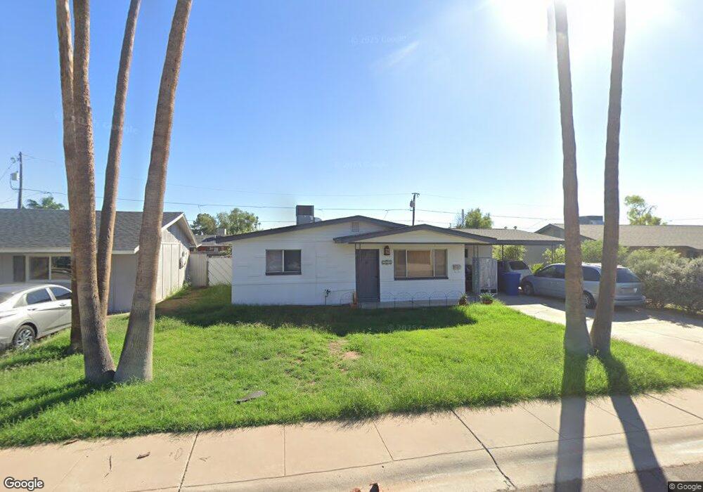
1015 W Howe St Tempe, AZ 85281
Gililland NeighborhoodEstimated Value: $365,105 - $449,000
Studio
2
Baths
1,264
Sq Ft
$333/Sq Ft
Est. Value
About This Home
This home is located at 1015 W Howe St, Tempe, AZ 85281 and is currently estimated at $421,526, approximately $333 per square foot. 1015 W Howe St is a home located in Maricopa County with nearby schools including Geneva Epps Mosley Middle School, Tempe High School, and Noor Academy of Arizona.
Ownership History
Date
Name
Owned For
Owner Type
Purchase Details
Closed on
Oct 11, 2018
Sold by
Burkhardt Dana and Burkhardt Neely
Bought by
1015 West Howe Llc
Current Estimated Value
Purchase Details
Closed on
Aug 16, 2018
Sold by
Burkhardt Dana
Bought by
Burkhardt Dana and Burkhardt Neely
Purchase Details
Closed on
Dec 8, 1999
Sold by
Shook Tom
Bought by
Burkhardt Dana
Purchase Details
Closed on
Dec 6, 1999
Sold by
Shook Frederick M
Bought by
Shook Tom
Purchase Details
Closed on
Nov 16, 1999
Sold by
Burkhardt Kimberly Dawn
Bought by
Burkhardt Dana
Purchase Details
Closed on
Jan 9, 1996
Sold by
Brownd Mary Maxine
Bought by
Shook Tom and Shook Frederick M
Home Financials for this Owner
Home Financials are based on the most recent Mortgage that was taken out on this home.
Original Mortgage
$76,789
Interest Rate
7.14%
Mortgage Type
FHA
Create a Home Valuation Report for This Property
The Home Valuation Report is an in-depth analysis detailing your home's value as well as a comparison with similar homes in the area
Home Values in the Area
Average Home Value in this Area
Purchase History
| Date | Buyer | Sale Price | Title Company |
|---|---|---|---|
| 1015 West Howe Llc | -- | None Available | |
| Burkhardt Dana | -- | None Available | |
| Burkhardt Dana | $112,500 | Chicago Title Insurance Co | |
| Shook Tom | -- | Chicago Title Insurance Co | |
| Burkhardt Dana | -- | Chicago Title Insurance Co | |
| Shook Tom | $76,900 | Chicago Title Insurance Co | |
| Brownd Mary Maxine | -- | Chicago Title Insurance Co |
Source: Public Records
Mortgage History
| Date | Status | Borrower | Loan Amount |
|---|---|---|---|
| Previous Owner | Shook Tom | $76,789 |
Source: Public Records
Tax History
| Year | Tax Paid | Tax Assessment Tax Assessment Total Assessment is a certain percentage of the fair market value that is determined by local assessors to be the total taxable value of land and additions on the property. | Land | Improvement |
|---|---|---|---|---|
| 2025 | $1,793 | $14,957 | -- | -- |
| 2024 | $1,655 | $14,245 | -- | -- |
| 2023 | $1,655 | $32,780 | $6,550 | $26,230 |
| 2022 | $1,588 | $25,160 | $5,030 | $20,130 |
| 2021 | $1,599 | $23,320 | $4,660 | $18,660 |
| 2020 | $1,550 | $20,700 | $4,140 | $16,560 |
| 2019 | $1,521 | $19,760 | $3,950 | $15,810 |
| 2018 | $1,483 | $17,650 | $3,530 | $14,120 |
| 2017 | $1,439 | $16,320 | $3,260 | $13,060 |
| 2016 | $1,429 | $15,450 | $3,090 | $12,360 |
| 2015 | $1,372 | $14,080 | $2,810 | $11,270 |
Source: Public Records
Map
Nearby Homes
- 826 W 12th St
- 1101 W 10th St
- 1321 S Mckemy St
- 1052 W Elna Rae St
- 1215 S Judd St
- 617 W 13th St
- 611 W 13th St
- 522 W Howe St
- 1111 W University Dr Unit 1028
- 1111 W University Dr Unit 3012
- 1111 W University Dr Unit 1016
- 1111 W University Dr Unit 3011
- 1018 W 16th St
- 1621 S Marilyn Ann Dr
- 1211 W 15th St
- 1321 W 14th St
- 1711 S Hardy Dr
- 700 W University Dr Unit 241
- 535 W 15th St
- 1351 W 10th St
- 1021 W Howe St
- 1009 W Howe St
- 1016 W 12th St
- 1010 W 12th St
- 1003 W Howe St
- 1043 S Parkside Dr
- 1022 W 12th St
- 1027 W Howe St
- 1040 S Hardy Dr
- 1004 W 12th St
- 1028 W 12th St
- 1037 S Parkside Dr
- 1048 S Parkside Dr
- 1034 S Hardy Dr
- 1042 S Parkside Dr
- 1034 W 12th St
- 1017 W 12th St
- 1031 S Parkside Dr
- 833 W Howe St
- 1011 W 12th St
Your Personal Tour Guide
Ask me questions while you tour the home.