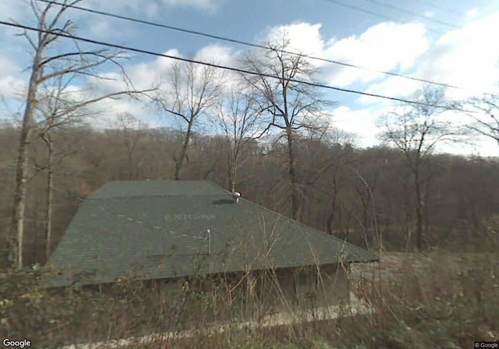
10150 Clairborne Rd Rogers, AR 72758
Estimated Value: $235,765 - $286,000
--
Bed
2
Baths
1,315
Sq Ft
$199/Sq Ft
Est. Value
About This Home
This home is located at 10150 Clairborne Rd, Rogers, AR 72758 and is currently estimated at $261,691, approximately $199 per square foot. 10150 Clairborne Rd is a home located in Benton County with nearby schools including Old Wire Elementary School, Kirksey Middle School, and Rogers High School.
Ownership History
Date
Name
Owned For
Owner Type
Purchase Details
Closed on
Sep 22, 2006
Sold by
Woodward Edward and Woodward Arlene
Bought by
Stewart Danny and Stewart Teresa
Current Estimated Value
Purchase Details
Closed on
Feb 25, 2002
Bought by
Stewart
Purchase Details
Closed on
Jun 8, 2001
Bought by
Ives
Purchase Details
Closed on
Oct 1, 1990
Bought by
Dye
Purchase Details
Closed on
Nov 15, 1985
Bought by
Gale
Create a Home Valuation Report for This Property
The Home Valuation Report is an in-depth analysis detailing your home's value as well as a comparison with similar homes in the area
Home Values in the Area
Average Home Value in this Area
Purchase History
| Date | Buyer | Sale Price | Title Company |
|---|---|---|---|
| Stewart Danny | -- | None Available | |
| Stewart | $10,000 | -- | |
| Dye | -- | -- | |
| Ives | -- | -- | |
| Dye | $8,000 | -- | |
| Gale | $7,300 | -- |
Source: Public Records
Tax History Compared to Growth
Tax History
| Year | Tax Paid | Tax Assessment Tax Assessment Total Assessment is a certain percentage of the fair market value that is determined by local assessors to be the total taxable value of land and additions on the property. | Land | Improvement |
|---|---|---|---|---|
| 2025 | $1,553 | $40,672 | $3,000 | $37,672 |
| 2024 | $1,343 | $40,672 | $3,000 | $37,672 |
| 2023 | $1,221 | $27,540 | $2,300 | $25,240 |
| 2022 | $1,261 | $27,540 | $2,300 | $25,240 |
| 2021 | $1,158 | $27,540 | $2,300 | $25,240 |
| 2020 | $1,058 | $19,530 | $1,220 | $18,310 |
| 2019 | $1,058 | $19,530 | $1,220 | $18,310 |
| 2018 | $1,058 | $19,530 | $1,220 | $18,310 |
| 2017 | $910 | $19,530 | $1,220 | $18,310 |
| 2016 | $910 | $19,530 | $1,220 | $18,310 |
| 2015 | $782 | $16,250 | $1,200 | $15,050 |
| 2014 | $832 | $16,250 | $1,200 | $15,050 |
Source: Public Records
Map
Nearby Homes
- 10177 Bonnabel Rd
- 0 La Harpe Rd Unit 1315983
- 10237 Bordeaux Rd
- 13734 Canal St
- 14044 Villera Dr
- 0 Lopez Dr
- 14076 Canal St
- 10729 Anzac Dr
- 14090 Canal St
- 2.46 Acres Monte Northeast Estates Dr
- 3300 Blue Hill Rd
- 14472 S Mountain Rd
- 14600 S Mountain Rd
- TRACT C 3210 S Blue Hill Rd
- TRACT A 3210 S Blue Hill Rd
- 12782 Stoney Point Rd
- 11246 Ervin McGarrah Rd
- 10010 Bobwhite Cir
- 11250 Ervin McGarrah Rd
- 0 Graham Ln
- 10157 Clairborne Rd
- 10190 Bonnabel Rd
- 10176 Bonnabel Rd
- 498 La Harpe Rd
- 490 La Harpe Rd
- 498 La Harpe Rd
- 0 La Harpe Rd Unit 664615
- 0 La Harpe Rd Unit 1161483
- 0 La Harpe Rd Unit 496 1193027
- 10204 Bonnabel Rd
- 10160 Bonnabel Rd
- 10182 Clairborne Rd
- Lot 426-431 Clairborne Rd
- Lot 373 Bonnabel Rd
- 10220 Bonnabel Rd
- 10177 Bonnabel Rd
- 490 La Harpe Rd
- 0 Bonnabel Rd
- 0 La Harpe St Unit 664619
- 10187 Bonnabel Rd