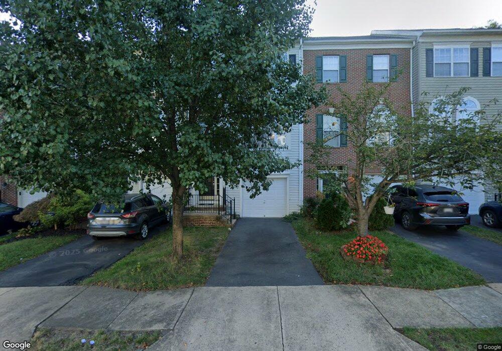
10157 Pale Rose Loop Bristow, VA 20136
Braemar NeighborhoodEstimated Value: $517,362 - $541,000
3
Beds
2
Baths
1,468
Sq Ft
$361/Sq Ft
Est. Value
About This Home
This home is located at 10157 Pale Rose Loop, Bristow, VA 20136 and is currently estimated at $530,341, approximately $361 per square foot. 10157 Pale Rose Loop is a home located in Prince William County with nearby schools including Patriot High School, Cedar Point Elementary School, and E.H. Marsteller Middle School.
Ownership History
Date
Name
Owned For
Owner Type
Purchase Details
Closed on
Mar 26, 2007
Sold by
Wood Christopher M
Bought by
Mccants Andrew P
Current Estimated Value
Home Financials for this Owner
Home Financials are based on the most recent Mortgage that was taken out on this home.
Original Mortgage
$271,950
Outstanding Balance
$166,050
Interest Rate
6.33%
Mortgage Type
New Conventional
Estimated Equity
$364,291
Purchase Details
Closed on
Jun 29, 2000
Sold by
Coscan Washington Inc
Bought by
Wood Christopher M
Home Financials for this Owner
Home Financials are based on the most recent Mortgage that was taken out on this home.
Original Mortgage
$163,100
Interest Rate
8.59%
Create a Home Valuation Report for This Property
The Home Valuation Report is an in-depth analysis detailing your home's value as well as a comparison with similar homes in the area
Home Values in the Area
Average Home Value in this Area
Purchase History
| Date | Buyer | Sale Price | Title Company |
|---|---|---|---|
| Mccants Andrew P | $339,999 | -- | |
| Wood Christopher M | $164,030 | -- |
Source: Public Records
Mortgage History
| Date | Status | Borrower | Loan Amount |
|---|---|---|---|
| Open | Mccants Andrew P | $271,950 | |
| Previous Owner | Wood Christopher M | $163,100 |
Source: Public Records
Tax History
| Year | Tax Paid | Tax Assessment Tax Assessment Total Assessment is a certain percentage of the fair market value that is determined by local assessors to be the total taxable value of land and additions on the property. | Land | Improvement |
|---|---|---|---|---|
| 2025 | $4,312 | $471,900 | $136,500 | $335,400 |
| 2024 | $4,312 | $433,600 | $130,000 | $303,600 |
| 2023 | $4,309 | $414,100 | $115,300 | $298,800 |
| 2022 | $4,324 | $390,400 | $115,300 | $275,100 |
| 2021 | $4,183 | $341,600 | $94,800 | $246,800 |
| 2020 | $4,917 | $317,200 | $85,400 | $231,800 |
| 2019 | $4,827 | $311,400 | $79,700 | $231,700 |
| 2018 | $3,517 | $291,300 | $79,700 | $211,600 |
| 2017 | $3,571 | $288,300 | $79,700 | $208,600 |
| 2016 | $3,353 | $272,800 | $75,000 | $197,800 |
| 2015 | $3,253 | $265,100 | $75,000 | $190,100 |
| 2014 | $3,253 | $258,900 | $72,100 | $186,800 |
Source: Public Records
Map
Nearby Homes
- 12458 Hadrians Ct
- 12511 Heykens Ln
- 12360 Corncrib Ct
- 9822 Maitland Loop
- 12217 Wheat Mill Loop
- 9778 Maitland Loop
- 9856 Maitland Loop
- 9884 Sounding Shore Ln
- 12203 Aster Rd
- 12151 Drum Salute Place
- 12149 Drum Salute Place
- 12172 Aster Rd
- 10410 Kettle Run Rd
- 10351 Spring Iris Dr
- 13624 Newtonmore Place
- 9653 Innerwick Place
- 12017 Youngtree Ct
- 13201 Daldownie Ct
- 12908 Ness Hollow Ct
- 10582 Poagues Battery Dr
- 10159 Pale Rose Loop
- 10161 Pale Rose Loop
- 10155 Pale Rose Loop
- 10153 Pale Rose Loop
- 10165 Pale Rose Loop
- 10151 Pale Rose Loop
- 10169 Pale Rose Loop
- 10160 Pale Rose Loop
- 10158 Pale Rose Loop
- 10162 Pale Rose Loop
- 10164 Pale Rose Loop
- 10173 Pale Rose Loop
- 10166 Pale Rose Loop
- 10138 Pale Rose Loop
- 10147 Pale Rose Loop
- 10168 Pale Rose Loop
- 10136 Pale Rose Loop
- 10145 Pale Rose Loop
- 10177 Pale Rose Loop
- 10134 Pale Rose Loop
Your Personal Tour Guide
Ask me questions while you tour the home.