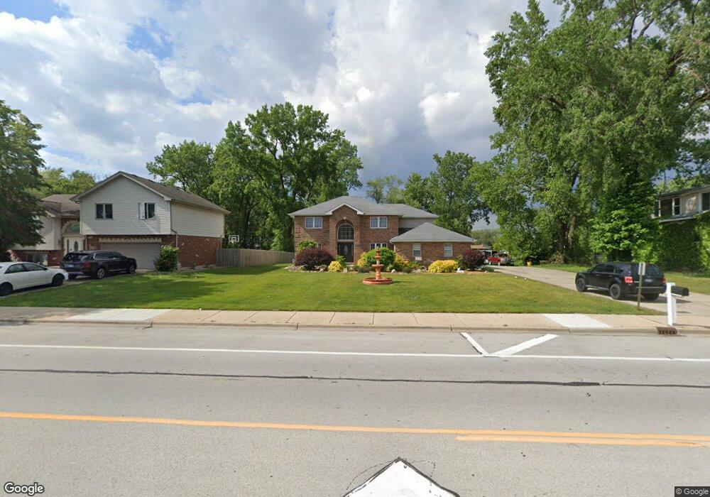
1016 175th St Hazel Crest, IL 60429
Estimated Value: $330,000 - $393,000
4
Beds
4
Baths
2,530
Sq Ft
$140/Sq Ft
Est. Value
About This Home
This home is located at 1016 175th St, Hazel Crest, IL 60429 and is currently estimated at $353,690, approximately $139 per square foot. 1016 175th St is a home located in Cook County with nearby schools including Thornwood High School and Glenwood Academy.
Ownership History
Date
Name
Owned For
Owner Type
Purchase Details
Closed on
Sep 29, 2017
Sold by
Carbajal Jose M and Carbajal Maria D
Bought by
Gallegos Salvador Nieves
Current Estimated Value
Home Financials for this Owner
Home Financials are based on the most recent Mortgage that was taken out on this home.
Original Mortgage
$230,743
Outstanding Balance
$191,772
Interest Rate
3.99%
Mortgage Type
FHA
Estimated Equity
$161,918
Purchase Details
Closed on
May 7, 1999
Sold by
Pastva Steven M and Pastva Julia A
Bought by
Carbajal Jose M and Carbajal Maria D
Create a Home Valuation Report for This Property
The Home Valuation Report is an in-depth analysis detailing your home's value as well as a comparison with similar homes in the area
Home Values in the Area
Average Home Value in this Area
Purchase History
We collect this data history from publicly available records. To have your information removed, we recommend requesting removal directly through your county’s website.
| Date | Buyer | Sale Price | Title Company |
|---|---|---|---|
| Gallegos Salvador Nieves | $237,500 | Fidelity National Title | |
| Carbajal Jose M | $18,500 | -- |
Source: Public Records
Mortgage History
We collect this data history from publicly available records. To have your information removed, we recommend requesting removal directly through your county’s website.
| Date | Status | Borrower | Loan Amount |
|---|---|---|---|
| Open | Gallegos Salvador Nieves | $230,743 |
Source: Public Records
Tax History
| Year | Tax Paid | Tax Assessment Tax Assessment Total Assessment is a certain percentage of the fair market value that is determined by local assessors to be the total taxable value of land and additions on the property. | Land | Improvement |
|---|---|---|---|---|
| 2025 | $13,869 | $28,554 | $7,859 | $20,695 |
| 2024 | $13,869 | $28,554 | $7,859 | $20,695 |
| 2023 | $9,554 | $30,000 | $7,859 | $22,141 |
| 2022 | $9,554 | $18,101 | $6,985 | $11,116 |
| 2021 | $9,435 | $18,101 | $6,985 | $11,116 |
| 2020 | $9,190 | $18,101 | $6,985 | $11,116 |
| 2019 | $10,443 | $17,463 | $6,112 | $11,351 |
| 2018 | $10,328 | $17,463 | $6,112 | $11,351 |
| 2017 | $10,380 | $17,463 | $6,112 | $11,351 |
| 2016 | $9,977 | $17,781 | $5,239 | $12,542 |
| 2015 | $8,226 | $17,781 | $5,239 | $12,542 |
| 2014 | $8,097 | $17,781 | $5,239 | $12,542 |
| 2013 | $8,212 | $19,347 | $5,239 | $14,108 |
Source: Public Records
Map
Nearby Homes
- 1016 174th St
- 904 Garden Ln Unit 904
- 1021 173rd St
- 1218 174th St
- 1307 173rd St
- 1401 174th St
- 1113 171st St
- 17208 Loomis Ave
- 1409 172nd St
- 1411 172nd St
- 17915 Hood Ave
- 17926 La Haigh Rd
- 1415 Burr Oak Rd
- 18205 Hart Dr Unit 2B
- 18205 Hart Dr Unit 3A
- 840 Elder Rd Unit A409
- 840 Elder Rd Unit A305
- 840 Elder Rd Unit A405
- 840 Elder Rd Unit A414
- 1525 Burr Oak Rd
Your Personal Tour Guide
Ask me questions while you tour the home.