Estimated Value: $61,000 - $97,000
3
Beds
1
Bath
1,500
Sq Ft
$49/Sq Ft
Est. Value
About This Home
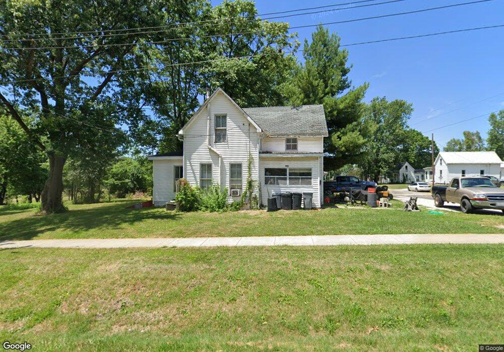
This home is located at 1016 Decatur St, Barry, IL 62312 and is currently estimated at $74,000, approximately $49 per square foot. 1016 Decatur St is a home with nearby schools including Western Junior High School, Western Barry Elementary School, and Western High School.
Ownership History
Date
Name
Owned For
Owner Type
Purchase Details
Closed on
Dec 27, 2024
Sold by
Marshall Philip K and Marshall Phil K
Bought by
Marshall Construction Llc
Current Estimated Value
Home Financials for this Owner
Home Financials are based on the most recent Mortgage that was taken out on this home.
Original Mortgage
$881,840
Outstanding Balance
$511,891
Interest Rate
6.78%
Mortgage Type
New Conventional
Estimated Equity
-$437,891
Create a Home Valuation Report for This Property
The Home Valuation Report is an in-depth analysis detailing your home's value as well as a comparison with similar homes in the area
Purchase History
We collect this data history from publicly available records. To have your information removed, we recommend requesting removal directly through your county’s website.
| Date | Buyer | Sale Price | Title Company |
|---|---|---|---|
| Marshall Construction Llc | -- | None Listed On Document | |
| Marshall Construction Llc | -- | None Listed On Document |
Source: Public Records
Mortgage History
We collect this data history from publicly available records. To have your information removed, we recommend requesting removal directly through your county’s website.
| Date | Status | Borrower | Loan Amount |
|---|---|---|---|
| Open | Marshall Construction Llc | $881,840 | |
| Closed | Marshall Construction Llc | $881,840 |
Source: Public Records
Tax History
| Year | Tax Paid | Tax Assessment Tax Assessment Total Assessment is a certain percentage of the fair market value that is determined by local assessors to be the total taxable value of land and additions on the property. | Land | Improvement |
|---|---|---|---|---|
| 2024 | $923 | $12,590 | $2,440 | $10,150 |
| 2023 | $904 | $11,460 | $2,220 | $9,240 |
| 2022 | $862 | $10,470 | $2,030 | $8,440 |
| 2021 | $834 | $9,970 | $1,930 | $8,040 |
| 2020 | $853 | $9,970 | $1,930 | $8,040 |
| 2019 | $854 | $9,753 | $1,883 | $7,870 |
| 2018 | $857 | $9,753 | $1,883 | $7,870 |
| 2015 | $725 | $9,300 | $1,800 | $7,500 |
| 2013 | $725 | $9,350 | $1,810 | $7,540 |
| 2010 | $725 | $8,810 | $1,700 | $7,110 |
Source: Public Records
Map
Nearby Homes
- 1085 Davis St
- 400 Mortimer St
- 390 Mortimer St
- 355 Bainbridge St
- 1328 Mortimer St
- 4 Orchard Dr
- 1409 Pratt St
- 2 Cieten Plaza
- 24080 287th Ave
- 28383 290th St
- 23475 295th Ave
- 26261 State Highway 96
- 115 Quincy St
- 165 S Harper St
- 0 County Highway 13
- BLOCK 3 Lots 5-6
- 0 N 250th Ave Unit Lot WP001 22517988
- 2729 N 250th Ave
- 77 E 3053rd Ln
- 190 S East St
- 980 Decatur St
- 1019 Decatur St
- 1060 Decatur St
- 645 Davis St
- 1039 Decatur St
- 610 Davis St
- 615 Davis St
- 590 Davis St
- 920 Decatur St
- 1010 Bainbridge St
- 720 Mason St
- 1054 Bainbridge St
- 587 Davis St
- 646 Mason St
- 984 Bainbridge St
- 746 Mason St
- 1084 Bainbridge St
- 901 Lawrence St
- 942 Lawrence St
- 1115 Decatur St
Your Personal Tour Guide
Ask me questions while you tour the home.