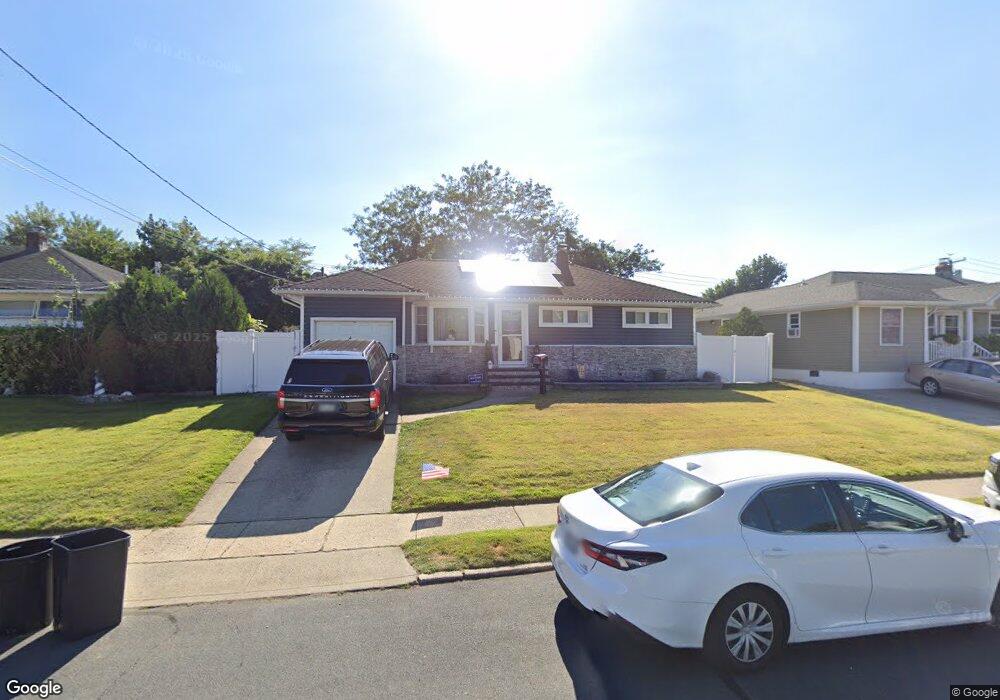
1016 N Broome Ave Lindenhurst, NY 11757
Estimated Value: $581,000 - $655,000
3
Beds
1
Bath
852
Sq Ft
$729/Sq Ft
Est. Value
About This Home
This home is located at 1016 N Broome Ave, Lindenhurst, NY 11757 and is currently estimated at $621,483, approximately $729 per square foot. 1016 N Broome Ave is a home located in Suffolk County with nearby schools including William Rall School, Lindenhurst Middle School, and Lindenhurst Senior High School.
Ownership History
Date
Name
Owned For
Owner Type
Purchase Details
Closed on
May 23, 2016
Sold by
Hofmann Diane and Stein Linda
Bought by
Dante Joshua and Dante Danielle
Current Estimated Value
Home Financials for this Owner
Home Financials are based on the most recent Mortgage that was taken out on this home.
Original Mortgage
$265,821
Outstanding Balance
$211,612
Interest Rate
3.66%
Mortgage Type
New Conventional
Estimated Equity
$409,871
Purchase Details
Closed on
Aug 18, 2010
Sold by
Neve Dorothy C and Neve L
Bought by
Hofmann Diane and Durmaz Laura
Create a Home Valuation Report for This Property
The Home Valuation Report is an in-depth analysis detailing your home's value as well as a comparison with similar homes in the area
Home Values in the Area
Average Home Value in this Area
Purchase History
| Date | Buyer | Sale Price | Title Company |
|---|---|---|---|
| Dante Joshua | $275,000 | Advantage Title | |
| Hofmann Diane | -- | -- |
Source: Public Records
Mortgage History
| Date | Status | Borrower | Loan Amount |
|---|---|---|---|
| Open | Dante Joshua | $265,821 |
Source: Public Records
Tax History Compared to Growth
Tax History
| Year | Tax Paid | Tax Assessment Tax Assessment Total Assessment is a certain percentage of the fair market value that is determined by local assessors to be the total taxable value of land and additions on the property. | Land | Improvement |
|---|---|---|---|---|
| 2024 | $9,975 | $2,580 | $290 | $2,290 |
| 2023 | $9,975 | $2,580 | $290 | $2,290 |
| 2022 | $5,569 | $2,580 | $290 | $2,290 |
| 2021 | $5,569 | $2,580 | $290 | $2,290 |
| 2020 | $9,180 | $2,580 | $290 | $2,290 |
| 2019 | $9,180 | $0 | $0 | $0 |
| 2018 | $8,827 | $2,580 | $290 | $2,290 |
| 2017 | $8,827 | $2,580 | $290 | $2,290 |
| 2016 | $5,529 | $2,580 | $290 | $2,290 |
| 2015 | -- | $2,580 | $290 | $2,290 |
| 2014 | -- | $2,580 | $290 | $2,290 |
Source: Public Records
Map
Nearby Homes
- 48 Farmers Ave
- 940 N Erie Ave
- 957 N Fulton Ave
- 126 Farmers Ave
- 280 Sherbrooke Rd
- 336 51st St
- 165 Tremont Rd
- 681 N Clinton Ave
- 413 51st St
- 10 Winchester Dr
- 656 N Greene Ave
- 456 Heathcote Rd
- 65 Heathcote Rd
- 37 Newark St
- 459 Albany Ave
- 445 48th St
- 303 42nd St
- 0 Tenety Ave Unit 3461459
- 429 47th St
- 22 Lenox St
- 1020 N Broome Ave
- 1012 N Broome Ave
- 1024 N Broome Ave
- 1008 N Broome Ave
- 1017 N Broome Ave
- 1013 N Broome Ave
- 1021 N Broome Ave
- 1028 N Broome Ave
- 1009 N Broome Ave
- 1004 N Broome Ave
- 1025 N Broome Ave
- 1016 N Clinton Ave
- 1005 N Broome Ave
- 1014 N Clinton Ave
- 1032 N Broome Ave
- 1020 N Clinton Ave
- 1029 N Broome Ave
- 646 Wellwood Ave
- 1008 N Clinton Ave
- 1028 N Clinton Ave