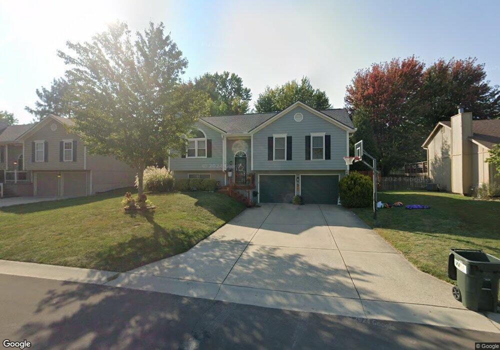
1016 NE Jason Ave Lees Summit, MO 64086
Estimated Value: $285,000 - $318,000
About This Home
This home is located at 1016 NE Jason Ave, Lees Summit, MO 64086 and is currently estimated at $301,458, approximately $260 per square foot. 1016 NE Jason Ave is a home located in Jackson County with nearby schools including Richardson Elementary School, Bernard C. Campbell Middle School, and Lee's Summit North High School.
Ownership History
We collect this data history from publicly available records. To have your information removed, we recommend requesting removal directly through your county’s website.
Purchase Details
Home Financials for this Owner
Home Financials are based on the most recent Mortgage that was taken out on this home.Purchase Details
Purchase Details
Home Financials for this Owner
Home Financials are based on the most recent Mortgage that was taken out on this home.Purchase Details
Home Financials for this Owner
Home Financials are based on the most recent Mortgage that was taken out on this home.Purchase Details
Home Financials for this Owner
Home Financials are based on the most recent Mortgage that was taken out on this home.Home Values in the Area
Average Home Value in this Area
Purchase History
We collect this data history from publicly available records. To have your information removed, we recommend requesting removal directly through your county’s website.
| Date | Buyer | Sale Price | Title Company |
|---|---|---|---|
| -- | Missouri Secured Title Lees | ||
| -- | Commonwealth Land Title Insu | ||
| -- | Kansas City Title | ||
| -- | -- | ||
| -- | Security Land Title Company |
Mortgage History
We collect this data history from publicly available records. To have your information removed, we recommend requesting removal directly through your county’s website.
| Date | Status | Borrower | Loan Amount |
|---|---|---|---|
| Open | $117,826 | ||
| Previous Owner | $139,750 | ||
| Previous Owner | $104,395 | ||
| Previous Owner | $87,986 |
Tax History
We collect this data history from publicly available records. To have your information removed, we recommend requesting removal directly through your county’s website.
| Year | Tax Paid | Tax Assessment Tax Assessment Total Assessment is a certain percentage of the fair market value that is determined by local assessors to be the total taxable value of land and additions on the property. | Land | Improvement |
|---|---|---|---|---|
| 2025 | $3,205 | $37,189 | $7,163 | $30,026 |
| 2024 | $3,205 | $44,384 | $5,263 | $39,121 |
| 2023 | $3,182 | $44,384 | $6,131 | $38,253 |
| 2022 | $2,270 | $28,120 | $4,788 | $23,332 |
| 2021 | $2,317 | $28,120 | $4,788 | $23,332 |
| 2020 | $2,223 | $26,715 | $4,788 | $21,927 |
| 2019 | $2,162 | $26,715 | $4,788 | $21,927 |
| 2018 | $2,184 | $25,042 | $3,662 | $21,380 |
| 2017 | $2,184 | $25,042 | $3,662 | $21,380 |
| 2016 | $2,151 | $24,415 | $3,629 | $20,786 |
| 2014 | $1,958 | $21,783 | $3,661 | $18,122 |
Map
- 1032 NE Bristol Dr
- 2405 NE Carousel Cir
- 2204 NE Chipman Rd
- 12406 S Acacia Dr
- 12408 S Acacia Dr
- 12404 S Acacia Dr
- 12424 S Redwood St
- 12426 S Redwood St
- 709 NE Twin Brook Dr
- 2437 NE Angel Fish Cir
- 2421 NE Lake Breeze Dr
- 516 NE Topaz Dr
- 1829 NE Riley Dr
- 416 NE Bitter Creek Rd
- 1348 NE Timbercreek Dr
- 1637 NE Woodland Shores Dr
- 400 NE Bitter Creek Rd
- 1029 NE Brookfield Dr
- 1676 NE Ozark Dr
- 1713 NE Ravenwood Dr
- 1044 NE Carousel Ln
- 1040 NE Carousel Ln
- 1017 NE Jason Ave
- 1045 NE Carousel Ln
- 1041 NE Carousel Ln
- 1036 NE Carousel Ln
- 1020 NE Jason Ave
- 1024 NE Jason Ave
- 1016 NE Carousel Ln
- 1013 NE Jason Ave
- 1028 NE Jason Ave
- 1037 NE Carousel Ln
- 1012 NE Jason Ave
- 1012 NE Carousel Ln
- 1032 NE Jason Ave
- 1009 NE Jason Ave
- 1033 NE Carousel Ln
- 1025 NE Carousel Ln
- 1021 NE Carousel Ln
- 1008 NE Jason Ave
Ask me questions while you tour the home.