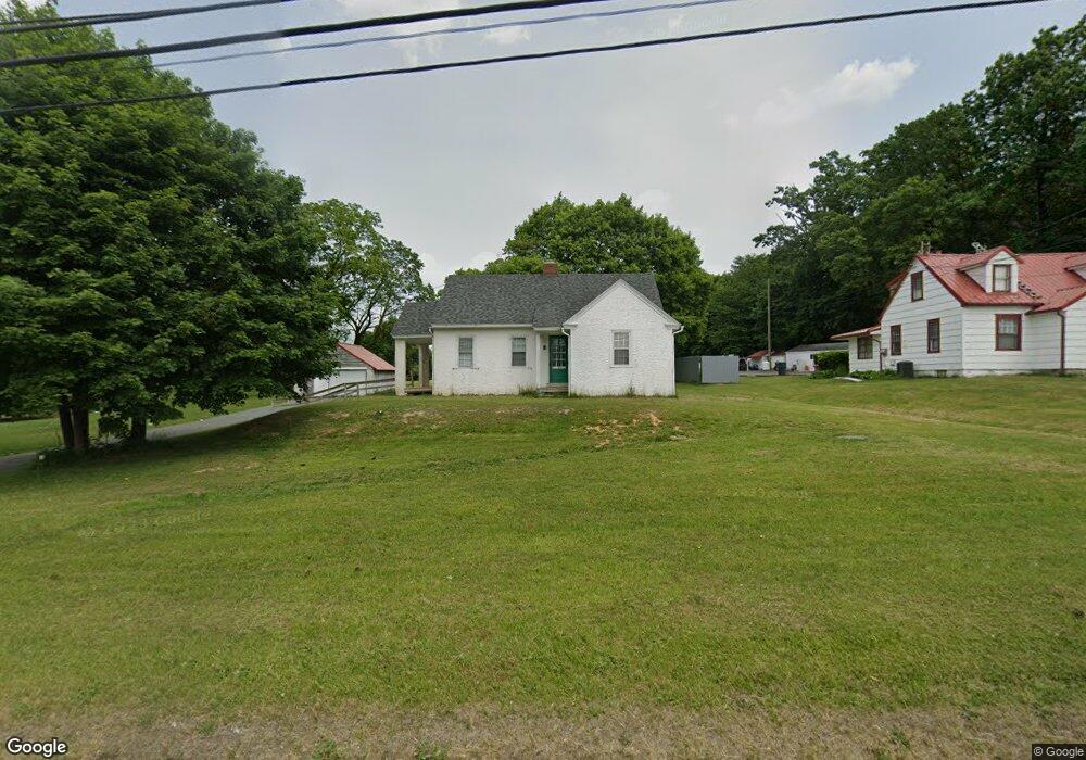
1016 Pottstown Pike Chester Springs, PA 19425
West Vincent Township NeighborhoodEstimated Value: $294,000 - $412,000
3
Beds
1
Bath
1,051
Sq Ft
$319/Sq Ft
Est. Value
About This Home
This home is located at 1016 Pottstown Pike, Chester Springs, PA 19425 and is currently estimated at $335,706, approximately $319 per square foot. 1016 Pottstown Pike is a home located in Chester County with nearby schools including West Vincent Elementary School, Owen J Roberts Middle School, and Owen J Roberts High School.
Ownership History
Date
Name
Owned For
Owner Type
Purchase Details
Closed on
Oct 1, 2021
Sold by
Lke Enterprise Llc
Bought by
Dilibero Barry B and Dilibero Theresa C
Current Estimated Value
Purchase Details
Closed on
Apr 25, 2003
Sold by
Hershey Nancy K and Estate Of Marian M Bright
Bought by
Lke Enterprise Llc
Home Financials for this Owner
Home Financials are based on the most recent Mortgage that was taken out on this home.
Original Mortgage
$204,000
Interest Rate
5.84%
Mortgage Type
Purchase Money Mortgage
Create a Home Valuation Report for This Property
The Home Valuation Report is an in-depth analysis detailing your home's value as well as a comparison with similar homes in the area
Home Values in the Area
Average Home Value in this Area
Purchase History
| Date | Buyer | Sale Price | Title Company |
|---|---|---|---|
| Dilibero Barry B | $220,000 | Devon Abstract Llc | |
| Lke Enterprise Llc | $255,000 | -- |
Source: Public Records
Mortgage History
| Date | Status | Borrower | Loan Amount |
|---|---|---|---|
| Previous Owner | Lke Enterprise Llc | $204,000 |
Source: Public Records
Tax History Compared to Growth
Tax History
| Year | Tax Paid | Tax Assessment Tax Assessment Total Assessment is a certain percentage of the fair market value that is determined by local assessors to be the total taxable value of land and additions on the property. | Land | Improvement |
|---|---|---|---|---|
| 2025 | $4,344 | $105,520 | $44,640 | $60,880 |
| 2024 | $4,344 | $105,520 | $44,640 | $60,880 |
| 2023 | $4,281 | $105,520 | $44,640 | $60,880 |
| 2022 | $4,212 | $105,520 | $44,640 | $60,880 |
| 2021 | $4,160 | $105,520 | $44,640 | $60,880 |
| 2020 | $4,053 | $105,520 | $44,640 | $60,880 |
| 2019 | $3,978 | $105,520 | $44,640 | $60,880 |
| 2018 | $3,900 | $105,520 | $44,640 | $60,880 |
| 2017 | $3,808 | $105,520 | $44,640 | $60,880 |
| 2016 | $3,248 | $105,520 | $44,640 | $60,880 |
| 2015 | $3,248 | $105,520 | $44,640 | $60,880 |
| 2014 | $3,248 | $105,520 | $44,640 | $60,880 |
Source: Public Records
Map
Nearby Homes
- 214 Windgate Dr
- 741 Sun Valley Ct
- 475 Fairmont Dr Unit 237
- 480 Fairmont Dr
- 726 Sun Valley Ct
- 1816 Pottstown Pike
- 618 Kent Ct
- 955 Pinehurst Dr
- 439 Fairmont Dr
- 1010 Linden Ave
- 411 Fairmont Dr
- 200 Black Horse Rd
- 550 Font Rd
- 1910 Cavalier Ln
- 21 Ludwigs Crossing Ln
- 35 Yarmouth Ln
- 38 Yarmouth Ln
- 307 Prescott Dr
- 1550 Pottstown Pike
- 1324 Fairview Rd
- 1020 Pottstown Pike
- 1012 Pottstown Pike
- 1024 Pottstown Pike
- 990 Pottstown Pike
- 1017 Pottstown Pike
- 2806 Conestoga Rd
- 2904 Conestoga Rd
- 980 Pottstown Pike Unit 1
- 980 Pottstown Pike Unit 2
- L98 Pottstown Pike
- 2934 Conestoga Rd
- 240 Windgate Dr
- 240 Windgate Dr Unit 302
- 240 Windgate Dr Unit 113
- 240 Windgate Dr
- 2912 Conestoga Rd
- 15 Saint Andrews Ln
- 222 Windgate Dr
- 220 Windgate Dr
- 2964 Conestoga Rd