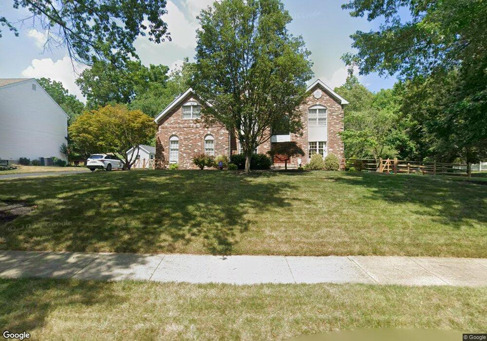
1016 Redtail Rd Norristown, PA 19403
Estimated Value: $811,000 - $897,000
4
Beds
3
Baths
3,412
Sq Ft
$248/Sq Ft
Est. Value
About This Home
This home is located at 1016 Redtail Rd, Norristown, PA 19403 and is currently estimated at $845,576, approximately $247 per square foot. 1016 Redtail Rd is a home located in Montgomery County with nearby schools including Skyview Upper Elementary School, Arrowhead Elementary School, and Arcola Intermediate School.
Ownership History
Date
Name
Owned For
Owner Type
Purchase Details
Closed on
May 16, 2024
Sold by
Mccarthy Euguene F and Mccarthy Eugene F
Bought by
Spak Jamie K and Spak Mark D
Current Estimated Value
Home Financials for this Owner
Home Financials are based on the most recent Mortgage that was taken out on this home.
Original Mortgage
$477,000
Outstanding Balance
$470,235
Interest Rate
6.82%
Mortgage Type
New Conventional
Estimated Equity
$375,341
Purchase Details
Closed on
Jul 15, 2021
Sold by
Sheahan Margaret M and Mccarthy Eugene F
Bought by
Mccarthy Euguene F
Purchase Details
Closed on
Jan 4, 2011
Sold by
Sheahan Margaret M and Mccarthy Eugene F
Bought by
Sheahan Margaret M
Purchase Details
Closed on
Aug 18, 1995
Sold by
Audubon Ridge Lp
Bought by
Mccarthy Eugene F and Sheahan Margaret M
Create a Home Valuation Report for This Property
The Home Valuation Report is an in-depth analysis detailing your home's value as well as a comparison with similar homes in the area
Home Values in the Area
Average Home Value in this Area
Purchase History
| Date | Buyer | Sale Price | Title Company |
|---|---|---|---|
| Spak Jamie K | $795,000 | Germantown Title | |
| Mccarthy Euguene F | -- | None Available | |
| Sheahan Margaret M | -- | None Available | |
| Mccarthy Eugene F | $365,569 | -- |
Source: Public Records
Mortgage History
| Date | Status | Borrower | Loan Amount |
|---|---|---|---|
| Open | Spak Jamie K | $477,000 |
Source: Public Records
Tax History
| Year | Tax Paid | Tax Assessment Tax Assessment Total Assessment is a certain percentage of the fair market value that is determined by local assessors to be the total taxable value of land and additions on the property. | Land | Improvement |
|---|---|---|---|---|
| 2025 | $13,016 | $319,160 | $111,770 | $207,390 |
| 2024 | $13,016 | $319,160 | $111,770 | $207,390 |
| 2023 | $12,522 | $319,160 | $111,770 | $207,390 |
| 2022 | $12,181 | $319,160 | $111,770 | $207,390 |
| 2021 | $11,867 | $319,160 | $111,770 | $207,390 |
| 2020 | $11,590 | $319,160 | $111,770 | $207,390 |
| 2019 | $11,483 | $319,160 | $111,770 | $207,390 |
Source: Public Records
Map
Nearby Homes
- 3104 W Mount Kirk Ave
- 617 Meadowlark Rd
- 123 Glenwood Ave
- 600 Linnet Rd
- 13 Glenwood Ave
- 11 Pershing Ave
- 12 Wilson Blvd
- 38 S Grange Ave
- 324 Rogers Rd
- 2817 Egypt Rd
- 2825 Egypt Rd
- 520 Deerfield Dr
- Laney Craftsman
- 536 Lexington Ln
- 18 Pheasant Rd
- 43 Casselberry Dr
- 0 Roosevelt Blvd
- 706 Kennedy Ct Unit 706
- 92 Wheatsheaf Ln Unit 92
- 57 Essex Ct
- 1018 Redtail Rd
- 1014 Redtail Rd
- 1020 Redtail Rd
- 1015 Redtail Rd Unit 113
- 1013 Redtail Rd
- 1012 Redtail Rd
- 1017 Redtail Rd
- 1011 Redtail Rd
- 1022 Redtail Rd
- 1010 Redtail Rd
- 5012 Blue Bird Cir
- 4025 Redwing Ln
- 1019 Redtail Rd
- 5010 Blue Bird Cir
- 1024 Redtail Rd
- 3036 Appledale Rd
- 5014 Blue Bird Cir
- 3034 Appledale Rd
- 4023 Redwing Ln
- 3038 Appledale Rd
Your Personal Tour Guide
Ask me questions while you tour the home.