Estimated Value: $297,000 - $314,000
3
Beds
2
Baths
1,443
Sq Ft
$214/Sq Ft
Est. Value
About This Home
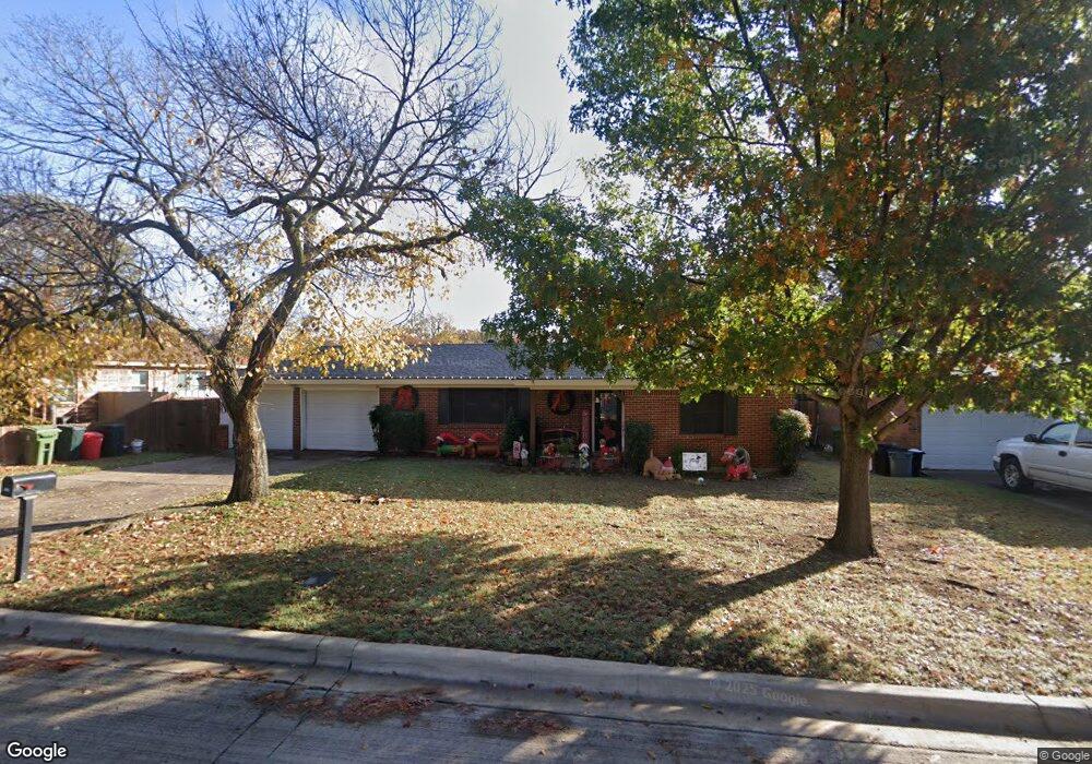
This home is located at 1016 Valentine St, Hurst, TX 76053 and is currently estimated at $308,417, approximately $213 per square foot. 1016 Valentine St is a home located in Tarrant County with nearby schools including Harrison Lane Elementary School, Hurst J High School, and L.D. Bell High School.
Ownership History
Date
Name
Owned For
Owner Type
Purchase Details
Closed on
Feb 27, 2009
Sold by
Basil Teri L
Bought by
Dougan Curtiss D and Dougan Christy M
Current Estimated Value
Home Financials for this Owner
Home Financials are based on the most recent Mortgage that was taken out on this home.
Original Mortgage
$115,077
Outstanding Balance
$73,173
Interest Rate
5.13%
Mortgage Type
FHA
Estimated Equity
$235,244
Purchase Details
Closed on
Jul 30, 2003
Sold by
Fisher Michael A and Fisher Robin G
Bought by
Basil Teri L
Home Financials for this Owner
Home Financials are based on the most recent Mortgage that was taken out on this home.
Original Mortgage
$94,395
Interest Rate
5.19%
Mortgage Type
FHA
Purchase Details
Closed on
Sep 6, 1995
Sold by
Stockey Marc and Stockey Carie
Bought by
Fisher Michael A and Fisher Robin G
Home Financials for this Owner
Home Financials are based on the most recent Mortgage that was taken out on this home.
Original Mortgage
$67,400
Interest Rate
7.77%
Create a Home Valuation Report for This Property
The Home Valuation Report is an in-depth analysis detailing your home's value as well as a comparison with similar homes in the area
Home Values in the Area
Average Home Value in this Area
Purchase History
| Date | Buyer | Sale Price | Title Company |
|---|---|---|---|
| Dougan Curtiss D | -- | Republic Title Of Texas Inc | |
| Basil Teri L | -- | Commonwealth Land Title | |
| Fisher Michael A | -- | First American Title Co |
Source: Public Records
Mortgage History
| Date | Status | Borrower | Loan Amount |
|---|---|---|---|
| Open | Dougan Curtiss D | $115,077 | |
| Previous Owner | Basil Teri L | $94,395 | |
| Previous Owner | Fisher Michael A | $67,400 |
Source: Public Records
Tax History Compared to Growth
Tax History
| Year | Tax Paid | Tax Assessment Tax Assessment Total Assessment is a certain percentage of the fair market value that is determined by local assessors to be the total taxable value of land and additions on the property. | Land | Improvement |
|---|---|---|---|---|
| 2025 | $3,410 | $284,965 | $65,000 | $219,965 |
| 2024 | $3,410 | $284,965 | $65,000 | $219,965 |
| 2023 | $4,363 | $258,000 | $40,000 | $218,000 |
| 2022 | $4,559 | $239,860 | $40,000 | $199,860 |
| 2021 | $4,341 | $180,000 | $40,000 | $140,000 |
| 2020 | $4,340 | $189,918 | $40,000 | $149,918 |
| 2019 | $4,013 | $191,191 | $40,000 | $151,191 |
| 2018 | $3,094 | $149,072 | $19,000 | $130,072 |
| 2017 | $3,429 | $156,236 | $19,000 | $137,236 |
| 2016 | $3,118 | $132,871 | $19,000 | $113,871 |
| 2015 | $2,526 | $112,000 | $15,000 | $97,000 |
| 2014 | $2,526 | $112,000 | $15,000 | $97,000 |
Source: Public Records
Map
Nearby Homes
- 1016 Keith Dr
- 400 Joanna Dr
- 420 Bedford Ct W
- 127 W Cedar St
- 1136 Simpson Dr
- 409 Vicki Place
- 1208 Karla Dr
- 624 Harrison Ln
- 231 Elm St
- 644 Caduceus Ln
- 905 Brown Trail
- 632 Forest Ln
- 708 Hurstview Dr
- 1220 Norwood Dr
- 552 Norwood Dr
- 1208 Birch St
- 802 Brown Trail
- 803 Glenda Dr
- 1145 Terrace Trail
- 612 Elm St
- 1020 Valentine St
- 1012 Valentine St
- 1017 Reed St
- 1021 Reed St
- 1013 Reed St
- 1024 Valentine St
- 1008 Valentine St
- 1017 Valentine St
- 1021 Valentine St
- 1013 Valentine St
- 1025 Reed St
- 1009 Reed St
- 1028 Valentine St
- 1004 Valentine St
- 1025 Valentine St
- 1009 Valentine St
- 1029 Reed St
- 1005 Reed St
- 1029 Valentine St
- 1005 Valentine St