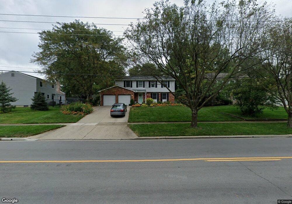
1016 W Main St Westerville, OH 43081
Estimated Value: $402,000 - $444,000
4
Beds
3
Baths
1,952
Sq Ft
$217/Sq Ft
Est. Value
About This Home
This home is located at 1016 W Main St, Westerville, OH 43081 and is currently estimated at $423,144, approximately $216 per square foot. 1016 W Main St is a home located in Franklin County with nearby schools including Annehurst Elementary School, Heritage Middle School, and Westerville South High School.
Ownership History
Date
Name
Owned For
Owner Type
Purchase Details
Closed on
Dec 15, 2004
Sold by
Smith William R and Smith Pamela A
Bought by
Moore Keith E and Moore Leslie M
Current Estimated Value
Home Financials for this Owner
Home Financials are based on the most recent Mortgage that was taken out on this home.
Original Mortgage
$135,000
Outstanding Balance
$68,013
Interest Rate
5.82%
Mortgage Type
Purchase Money Mortgage
Estimated Equity
$355,131
Purchase Details
Closed on
Apr 8, 1992
Bought by
Smith William R
Purchase Details
Closed on
May 1, 1987
Purchase Details
Closed on
Oct 1, 1978
Create a Home Valuation Report for This Property
The Home Valuation Report is an in-depth analysis detailing your home's value as well as a comparison with similar homes in the area
Home Values in the Area
Average Home Value in this Area
Purchase History
| Date | Buyer | Sale Price | Title Company |
|---|---|---|---|
| Moore Keith E | $183,000 | Chicago Tit | |
| Smith William R | $101,000 | -- | |
| -- | $92,500 | -- | |
| -- | $64,000 | -- |
Source: Public Records
Mortgage History
| Date | Status | Borrower | Loan Amount |
|---|---|---|---|
| Open | Moore Keith E | $135,000 |
Source: Public Records
Tax History Compared to Growth
Tax History
| Year | Tax Paid | Tax Assessment Tax Assessment Total Assessment is a certain percentage of the fair market value that is determined by local assessors to be the total taxable value of land and additions on the property. | Land | Improvement |
|---|---|---|---|---|
| 2024 | $7,213 | $126,910 | $29,750 | $97,160 |
| 2023 | $7,149 | $126,910 | $29,750 | $97,160 |
| 2022 | $6,326 | $85,610 | $21,210 | $64,400 |
| 2021 | $6,379 | $85,610 | $21,210 | $64,400 |
| 2020 | $6,361 | $85,610 | $21,210 | $64,400 |
| 2019 | $5,828 | $73,960 | $21,210 | $52,750 |
| 2018 | $5,239 | $73,960 | $21,210 | $52,750 |
| 2017 | $5,327 | $73,960 | $21,210 | $52,750 |
| 2016 | $5,009 | $59,750 | $19,530 | $40,220 |
| 2015 | $4,852 | $59,750 | $19,530 | $40,220 |
| 2014 | $4,855 | $59,750 | $19,530 | $40,220 |
| 2013 | $2,424 | $59,745 | $19,530 | $40,215 |
Source: Public Records
Map
Nearby Homes
- 258 Bellefield Ave
- 1095 Belle Meade Place
- 106 Ormsbee Ave
- 774 W Main St
- 7691 Key Deer Dr
- 7685 Key Deer Dr Unit 7685
- 828 Memories Ln
- 1585 Fawn Ct
- 671 College Crest Rd
- 953 Arcadia Blvd
- 1024 Arcadia Blvd
- 658 River Trace
- 640 Glacier Pass
- 101 W Ticonderoga Dr Unit B
- 134 W Ticonderoga Dr Unit D
- 106 E Ticonderoga Dr
- 106 E Ticonderoga Dr Unit A
- 8278 Mira St Unit 154
- 8282 Mira St Unit 153
- 7852 Heathcock Ct
- 1008 W Main St
- 8 Ormsbee Ave
- 255 Bellefield Ave
- 247 Bellefield Ave
- 1000 W Main St
- 263 Bellefield Ave
- 241 Bellefield Ave
- 992 W Main St
- 7 Ormsbee Ave
- 979 Cogswell St
- 15 Ormsbee Ave
- 984 W Main St
- 266 Bellefield Ave
- 250 Bellefield Ave
- 973 Cogswell St
- 21 Ormsbee Ave
- 242 Bellefield Ave
- 976 W Main St
- 967 Cogswell St
- 892 Danvers Ave