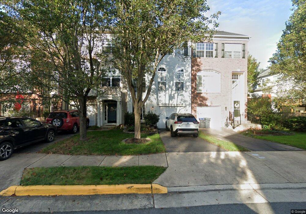
10160 Pale Rose Loop Bristow, VA 20136
Braemar NeighborhoodEstimated Value: $480,681 - $547,000
3
Beds
2
Baths
1,468
Sq Ft
$353/Sq Ft
Est. Value
About This Home
This home is located at 10160 Pale Rose Loop, Bristow, VA 20136 and is currently estimated at $518,670, approximately $353 per square foot. 10160 Pale Rose Loop is a home located in Prince William County with nearby schools including Patriot High School, Cedar Point Elementary School, and E.H. Marsteller Middle School.
Ownership History
Date
Name
Owned For
Owner Type
Purchase Details
Closed on
Aug 31, 2000
Sold by
Washington Coscan
Bought by
Bowles Tommy
Current Estimated Value
Home Financials for this Owner
Home Financials are based on the most recent Mortgage that was taken out on this home.
Original Mortgage
$173,450
Outstanding Balance
$63,485
Interest Rate
8.16%
Estimated Equity
$455,185
Create a Home Valuation Report for This Property
The Home Valuation Report is an in-depth analysis detailing your home's value as well as a comparison with similar homes in the area
Home Values in the Area
Average Home Value in this Area
Purchase History
| Date | Buyer | Sale Price | Title Company |
|---|---|---|---|
| Bowles Tommy | $170,065 | -- |
Source: Public Records
Mortgage History
| Date | Status | Borrower | Loan Amount |
|---|---|---|---|
| Open | Bowles Tommy | $173,450 |
Source: Public Records
Tax History Compared to Growth
Tax History
| Year | Tax Paid | Tax Assessment Tax Assessment Total Assessment is a certain percentage of the fair market value that is determined by local assessors to be the total taxable value of land and additions on the property. | Land | Improvement |
|---|---|---|---|---|
| 2025 | -- | $479,000 | $136,500 | $342,500 |
| 2024 | -- | $440,500 | $130,000 | $310,500 |
| 2023 | $4,379 | $420,900 | $115,300 | $305,600 |
| 2022 | $4,425 | $396,600 | $115,300 | $281,300 |
| 2021 | $4,242 | $346,500 | $94,800 | $251,700 |
| 2020 | $4,991 | $322,000 | $85,400 | $236,600 |
| 2019 | $4,896 | $315,900 | $79,700 | $236,200 |
| 2018 | $3,580 | $296,500 | $79,700 | $216,800 |
| 2017 | $3,633 | $293,400 | $79,700 | $213,700 |
| 2016 | $3,413 | $277,900 | $75,000 | $202,900 |
| 2015 | $3,311 | $269,900 | $75,000 | $194,900 |
| 2014 | $3,311 | $263,600 | $72,100 | $191,500 |
Source: Public Records
Map
Nearby Homes
- 12590 Garry Glen Dr
- 12217 Wheat Mill Loop
- 9846 Maitland Loop
- Hampton II Plan at Parkgate Estates
- 12151 Hayfield Ct
- 10410 Kettle Run Rd
- 9927 Broadsword Dr
- 12021 Spring Beauty Rd
- 11998 Youngtree Ct
- 12142 Millbill Ct
- 9819 Pear Tree Ct
- 9656 Bedder Stone Place
- 9475 Sarah Mill Terrace
- 10554 Andrew Humphreys Ct
- 10154 Broadsword Dr
- 10423 Rifle Rd
- 9505 Grady Pond Way
- 9204 Crestview Ridge Dr
- 11979 Benton Lake Rd
- 9084 Acadia Park Dr
- 10162 Pale Rose Loop
- 10158 Pale Rose Loop
- 10164 Pale Rose Loop
- 10166 Pale Rose Loop
- 10168 Pale Rose Loop
- 10138 Pale Rose Loop
- 10136 Pale Rose Loop
- 10134 Pale Rose Loop
- 10132 Pale Rose Loop
- 10159 Pale Rose Loop
- 10161 Pale Rose Loop
- 10157 Pale Rose Loop
- 10155 Pale Rose Loop
- 10165 Pale Rose Loop
- 10108 Pale Rose Loop
- 10153 Pale Rose Loop
- 10106 Pale Rose Loop
- 10114 Pale Rose Loop
- 10104 Pale Rose Loop
- 10102 Pale Rose Loop