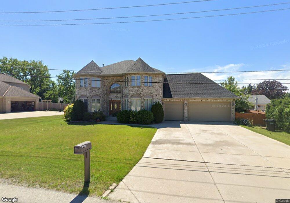
10164 Potter Rd Des Plaines, IL 60016
Estimated Value: $682,000 - $910,000
4
Beds
3
Baths
3,469
Sq Ft
$230/Sq Ft
Est. Value
About This Home
This home is located at 10164 Potter Rd, Des Plaines, IL 60016 and is currently estimated at $796,773, approximately $229 per square foot. 10164 Potter Rd is a home located in Cook County with nearby schools including Apollo Elementary School, Gemini Middle School, and Maine East High School.
Ownership History
Date
Name
Owned For
Owner Type
Purchase Details
Closed on
Sep 20, 2004
Sold by
Dziedzic Wladyslaw and Dziedzic Barbara
Bought by
Suja Adimuriel Jose and Suja Jose
Current Estimated Value
Home Financials for this Owner
Home Financials are based on the most recent Mortgage that was taken out on this home.
Original Mortgage
$333,700
Outstanding Balance
$162,578
Interest Rate
5.95%
Mortgage Type
Unknown
Estimated Equity
$634,195
Purchase Details
Closed on
Mar 20, 2002
Sold by
Chrisos Constantino Gus and Romano Betty
Bought by
Dziedzic Wladyslaw and Dziedzic Barbara
Create a Home Valuation Report for This Property
The Home Valuation Report is an in-depth analysis detailing your home's value as well as a comparison with similar homes in the area
Home Values in the Area
Average Home Value in this Area
Purchase History
We collect this data history from publicly available records. To have your information removed, we recommend requesting removal directly through your county’s website.
| Date | Buyer | Sale Price | Title Company |
|---|---|---|---|
| Suja Adimuriel Jose | $590,000 | Heritage Title Company | |
| Dziedzic Wladyslaw | $125,000 | -- |
Source: Public Records
Mortgage History
We collect this data history from publicly available records. To have your information removed, we recommend requesting removal directly through your county’s website.
| Date | Status | Borrower | Loan Amount |
|---|---|---|---|
| Open | Suja Adimuriel Jose | $333,700 |
Source: Public Records
Tax History
| Year | Tax Paid | Tax Assessment Tax Assessment Total Assessment is a certain percentage of the fair market value that is determined by local assessors to be the total taxable value of land and additions on the property. | Land | Improvement |
|---|---|---|---|---|
| 2025 | $15,237 | $77,000 | $3,600 | $73,400 |
| 2024 | $15,237 | $62,000 | $2,700 | $59,300 |
| 2023 | $14,459 | $62,000 | $2,700 | $59,300 |
| 2022 | $14,459 | $62,000 | $2,700 | $59,300 |
| 2021 | $13,008 | $46,612 | $2,475 | $44,137 |
| 2020 | $12,782 | $46,612 | $2,475 | $44,137 |
| 2019 | $12,639 | $52,373 | $2,475 | $49,898 |
| 2018 | $11,906 | $44,086 | $2,250 | $41,836 |
| 2017 | $11,726 | $44,086 | $2,250 | $41,836 |
| 2016 | $11,187 | $44,086 | $2,250 | $41,836 |
| 2015 | $13,065 | $47,087 | $2,025 | $45,062 |
| 2014 | $12,636 | $47,087 | $2,025 | $45,062 |
| 2013 | $12,403 | $47,087 | $2,025 | $45,062 |
Source: Public Records
Map
Nearby Homes
- 684 Quincy Bridge Ln Unit 202
- 9517 W Central Rd
- 718 Cobblestone Cir Unit C
- 10357 Dearlove Rd Unit 1J
- 702 Cobblestone Cir Unit D
- 10369 Dearlove Rd Unit 1F
- 10385 Dearlove Rd Unit 1K
- 10373 Dearlove Rd Unit 304
- 10353 Dearlove Rd Unit 3A
- 701 Forum Square Unit 607
- 9355 Harrison St Unit 671493
- 3925 Triumvera Dr Unit 10B
- 601 Country Ln Unit 601
- 638 Naples Ct Unit T23C
- 3700 Capri Ct Unit 206
- 9600 S Lyman Ave
- 9701 N Dee Rd Unit 6M
- 9701 N Dee Rd Unit 6N
- 9118 W Elmwood Dr Unit 3K
- 9128 W Terrace Dr Unit 4F
- 10166 Potter Rd
- 10160 Potter Rd
- 9409 W Central Rd
- 10165 Potter Rd
- 9415 W Central Rd
- 10158 Potter Rd
- 10163 Potter Rd
- 10161 Potter Rd
- 9329 W Central Rd
- 10159 Potter Rd
- 4272 Central Rd Unit 301
- 4272 Central Rd Unit 4272
- 4272 Central Rd Unit 302
- 4272 Central Rd Unit 202
- 4272 Central Rd Unit 201
- 4272 Central Rd Unit 101
- 4272 Central Rd Unit 102
- 4272 Central Rd
- 4270 Central Rd Unit 4270
- 4270 Central Rd
Your Personal Tour Guide
Ask me questions while you tour the home.