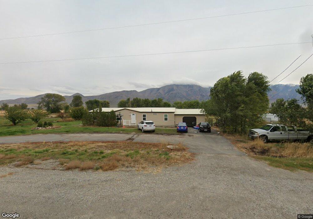
10165 N 5200 W Tremonton, UT 84337
Estimated Value: $424,000 - $499,000
--
Bed
--
Bath
1,620
Sq Ft
$278/Sq Ft
Est. Value
About This Home
This home is located at 10165 N 5200 W, Tremonton, UT 84337 and is currently estimated at $449,832, approximately $277 per square foot. 10165 N 5200 W is a home located in Box Elder County with nearby schools including McKinley School, Bear River Middle School, and Alice C. Harris Intermediate School.
Ownership History
Date
Name
Owned For
Owner Type
Purchase Details
Closed on
Jun 27, 2017
Sold by
Kadnkyl Llc
Bought by
Peavler Mark and Peavler Janet L
Current Estimated Value
Purchase Details
Closed on
Sep 16, 2016
Sold by
Bronson Christina Lynn
Bought by
Kadnkyl Llc
Purchase Details
Closed on
May 26, 2016
Sold by
Bronson Christina Lynn
Bought by
Bronson Christina Lynn
Create a Home Valuation Report for This Property
The Home Valuation Report is an in-depth analysis detailing your home's value as well as a comparison with similar homes in the area
Home Values in the Area
Average Home Value in this Area
Purchase History
| Date | Buyer | Sale Price | Title Company |
|---|---|---|---|
| Peavler Mark | -- | American Secure Title Tremon | |
| Kadnkyl Llc | -- | American Secure Title Tremon | |
| Bronson Christina Lynn | -- | None Available |
Source: Public Records
Tax History Compared to Growth
Tax History
| Year | Tax Paid | Tax Assessment Tax Assessment Total Assessment is a certain percentage of the fair market value that is determined by local assessors to be the total taxable value of land and additions on the property. | Land | Improvement |
|---|---|---|---|---|
| 2025 | $1,596 | $335,181 | $136,000 | $199,181 |
| 2024 | $1,596 | $335,945 | $134,000 | $201,945 |
| 2023 | $1,540 | $333,597 | $137,400 | $196,197 |
| 2022 | $1,316 | $264,154 | $50,900 | $213,254 |
| 2021 | $1,188 | $181,742 | $50,900 | $130,842 |
| 2020 | $1,061 | $181,742 | $50,900 | $130,842 |
| 2019 | $859 | $4,800 | $2,400 | $2,400 |
| 2018 | $907 | $76,724 | $28,275 | $48,449 |
| 2017 | $940 | $138,189 | $28,275 | $88,089 |
| 2016 | $937 | $74,417 | $28,275 | $46,142 |
| 2015 | $876 | $70,222 | $28,275 | $41,947 |
| 2014 | $876 | $68,225 | $28,275 | $39,950 |
| 2013 | -- | $68,225 | $26,675 | $41,550 |
Source: Public Records
Map
Nearby Homes
- 9449 N Powerline Rd Unit 2
- 9480 N 5600 W
- 9428 N 5600 W
- Emerson 1797 Plan at The Estates At Riverview - The Estates
- Ridge Plan at The Estates At Riverview - The Estates
- 9290 N 5600 W Unit 5
- 1215 S 100 E
- 9270 N 5600 W Unit 7
- 50 E 1225 S
- Harvest Village Plan at Harvest Village Townhome Community - Harvest Village
- 4693 W 9120 N
- 181 W 1300 S Unit 31
- 208 W 1300 S
- 9190 N 6000 W
- 795 S 150 W
- 200 W 1200 S Unit 72
- 200 W 1200 S Unit 152
- 200 W 1200 S Unit 153
- 200 W 1200 S Unit 151
- 200 W 1200 S Unit 156