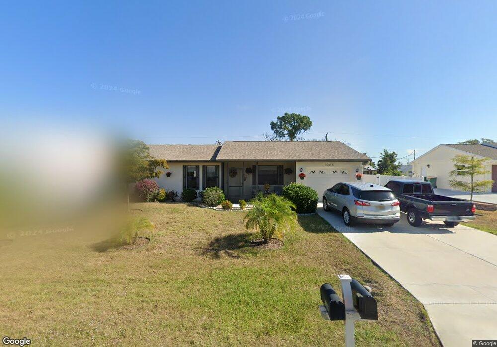
10166 Seabrook Ave Englewood, FL 34224
Englewood East NeighborhoodEstimated Value: $234,908 - $307,000
2
Beds
2
Baths
978
Sq Ft
$270/Sq Ft
Est. Value
About This Home
This home is located at 10166 Seabrook Ave, Englewood, FL 34224 and is currently estimated at $264,227, approximately $270 per square foot. 10166 Seabrook Ave is a home located in Charlotte County with nearby schools including Vineland Elementary School, L.A. Ainger Middle School, and Lemon Bay High School.
Ownership History
Date
Name
Owned For
Owner Type
Purchase Details
Closed on
Jul 29, 2005
Sold by
Mages Thomas E
Bought by
Aldridge Michael E and Aldridge Leanna J
Current Estimated Value
Home Financials for this Owner
Home Financials are based on the most recent Mortgage that was taken out on this home.
Original Mortgage
$112,000
Interest Rate
5.77%
Mortgage Type
Fannie Mae Freddie Mac
Purchase Details
Closed on
Apr 25, 1997
Sold by
Fuson Karolyn Z and Muxlow Karolyn Z
Bought by
Mages Henry E
Home Financials for this Owner
Home Financials are based on the most recent Mortgage that was taken out on this home.
Original Mortgage
$55,971
Interest Rate
7.95%
Mortgage Type
FHA
Create a Home Valuation Report for This Property
The Home Valuation Report is an in-depth analysis detailing your home's value as well as a comparison with similar homes in the area
Home Values in the Area
Average Home Value in this Area
Purchase History
| Date | Buyer | Sale Price | Title Company |
|---|---|---|---|
| Aldridge Michael E | $140,000 | -- | |
| Mages Henry E | $56,000 | -- |
Source: Public Records
Mortgage History
| Date | Status | Borrower | Loan Amount |
|---|---|---|---|
| Previous Owner | Aldridge Michael E | $112,000 | |
| Previous Owner | Mages Henry E | $55,971 |
Source: Public Records
Tax History Compared to Growth
Tax History
| Year | Tax Paid | Tax Assessment Tax Assessment Total Assessment is a certain percentage of the fair market value that is determined by local assessors to be the total taxable value of land and additions on the property. | Land | Improvement |
|---|---|---|---|---|
| 2023 | $1,296 | $73,004 | $0 | $0 |
| 2022 | $1,249 | $70,878 | $0 | $0 |
| 2021 | $1,233 | $68,814 | $0 | $0 |
| 2020 | $1,130 | $67,864 | $0 | $0 |
| 2019 | $1,062 | $66,338 | $0 | $0 |
| 2018 | $918 | $65,101 | $0 | $0 |
| 2017 | $913 | $63,762 | $0 | $0 |
| 2016 | $907 | $61,916 | $0 | $0 |
| 2015 | $884 | $61,486 | $0 | $0 |
| 2014 | $879 | $60,998 | $0 | $0 |
Source: Public Records
Map
Nearby Homes
- 10152 Willowood Ave
- 10168 Willowood Ave
- 10127 Peach Ave
- 7424 Snow Dr
- 10141 Asbury Ave
- 10235 Stonecrop Ave
- 7409 Teaberry St
- 7368 Quarry St
- 7483 Snow Dr
- 10309 Rachel Ave
- 7296 Skycrest St
- 10341 Greenway Ave
- 11030 Oceanspray Blvd
- 11148 Oceanspray Blvd
- 7378 Mamouth St
- 8100 Memory Ln Unit 207
- 7268 Beardsley St
- 10043 Topsail Ave
- 10051 Topsail Ave
- 8050 Memory Ln Unit 101
- 10174 Seabrook Ave
- 10158 Seabrook Ave
- 10158 Avenue
- 10159 Rafferty Ave
- 10175 Rafferty Ave
- 10150 Seabrook Ave
- 10165 Seabrook Ave
- 10173 Seabrook Ave
- 10151 Rafferty Ave
- 10181 Seabrook Ave
- 10190 Seabrook Ave
- 10142 Seabrook Ave
- 10149 Seabrook Ave
- 10143 Rafferty Ave
- 10167 Rafferty Ave
- 10189 Seabrook Ave
- 10166 Gulfstream Blvd
- 11926 Seabrook Ave
- 10158 Gulfstream Blvd