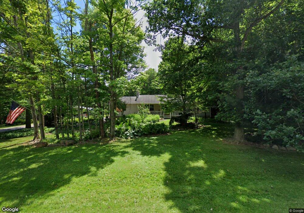
10166 Whippoorwill Rd Newton Falls, OH 44444
Estimated Value: $266,000 - $314,051
3
Beds
2
Baths
1,688
Sq Ft
$174/Sq Ft
Est. Value
About This Home
This home is located at 10166 Whippoorwill Rd, Newton Falls, OH 44444 and is currently estimated at $294,263, approximately $174 per square foot. 10166 Whippoorwill Rd is a home located in Portage County with nearby schools including Southeast High School.
Ownership History
Date
Name
Owned For
Owner Type
Purchase Details
Closed on
Aug 6, 2003
Sold by
Cendant Mobility Financial Corp
Bought by
Burt Donald R and Burt Mary M
Current Estimated Value
Home Financials for this Owner
Home Financials are based on the most recent Mortgage that was taken out on this home.
Original Mortgage
$138,800
Interest Rate
5.47%
Mortgage Type
Purchase Money Mortgage
Purchase Details
Closed on
Jul 30, 2003
Sold by
Bresette Ronald E and Jacobs Linda A
Bought by
Cendant Mobility Financial Corp
Home Financials for this Owner
Home Financials are based on the most recent Mortgage that was taken out on this home.
Original Mortgage
$138,800
Interest Rate
5.47%
Mortgage Type
Purchase Money Mortgage
Create a Home Valuation Report for This Property
The Home Valuation Report is an in-depth analysis detailing your home's value as well as a comparison with similar homes in the area
Home Values in the Area
Average Home Value in this Area
Purchase History
| Date | Buyer | Sale Price | Title Company |
|---|---|---|---|
| Burt Donald R | $231,333 | Midland Title Security Inc | |
| Cendant Mobility Financial Corp | $231,333 | Midland Title Security Inc |
Source: Public Records
Mortgage History
| Date | Status | Borrower | Loan Amount |
|---|---|---|---|
| Previous Owner | Burt Donald R | $138,800 |
Source: Public Records
Tax History Compared to Growth
Tax History
| Year | Tax Paid | Tax Assessment Tax Assessment Total Assessment is a certain percentage of the fair market value that is determined by local assessors to be the total taxable value of land and additions on the property. | Land | Improvement |
|---|---|---|---|---|
| 2024 | $3,146 | $88,940 | $10,470 | $78,470 |
| 2023 | $2,692 | $68,850 | $7,670 | $61,180 |
| 2022 | $2,795 | $68,850 | $7,670 | $61,180 |
| 2021 | $2,819 | $68,850 | $7,670 | $61,180 |
| 2020 | $2,384 | $55,830 | $7,670 | $48,160 |
| 2019 | $2,390 | $55,830 | $7,670 | $48,160 |
| 2018 | $2,241 | $49,320 | $7,670 | $41,650 |
| 2017 | $2,241 | $49,320 | $7,670 | $41,650 |
| 2016 | $2,233 | $49,320 | $7,670 | $41,650 |
| 2015 | $2,140 | $49,320 | $7,670 | $41,650 |
| 2014 | $2,181 | $49,320 | $7,670 | $41,650 |
| 2013 | $2,159 | $49,320 | $7,670 | $41,650 |
Source: Public Records
Map
Nearby Homes
- 9865 Tallmadge Rd
- 18066 Hillcrest Dr
- 17964 Glendale Ave
- 4094 Ohio 225
- 0 Maplewood Ave
- 4133 State Route 225
- 0 Manchester St Unit 5172420
- 0 Lawnview Ave
- 0 Ohio 225 Unit 5174573
- 9408 Tallmadge Rd
- 0 Redwood Rd Unit 5170261
- 1135 Mahoning Portage County Line Rd
- 0 Vl Glenwood Ave Unit 5175896
- 17632 Laurel Ave
- 0 Normandy Rd
- 0 Mahoning Ave Unit 16434374
- 0 Mahoning Ave Unit 5168095
- 0 Mahoning Ave Unit 5168074
- 0 Mahoning Ave Unit 11482663
- 0 Mahoning Ave Unit 5168085
- 00 Whippoorwill Rd
- 10118 Whippoorwill Rd
- 10131 Whippoorwill Rd
- 10216 Whippoorwill Rd
- 10151 Whippoorwill Rd
- 10088 Whippoorwill Rd
- 10240 Whippoorwill Rd
- 10073 Whippoorwill Rd
- 10272 Whippoorwill Rd
- 10113 Whippoorwill Rd
- 10093 Whippoorwill Rd
- 10045 Whippoorwill Rd
- 10058 Whippoorwill Rd
- 10028 Whippoorwill Rd
- 10014 Whippoorwill Rd
- 10011 Whippoorwill Rd
- 10225 Whippoorwill Rd
- 10330 Whippoorwill Rd
- 4580 McClintocksburg Rd
- 4548 McClintocksburg Rd