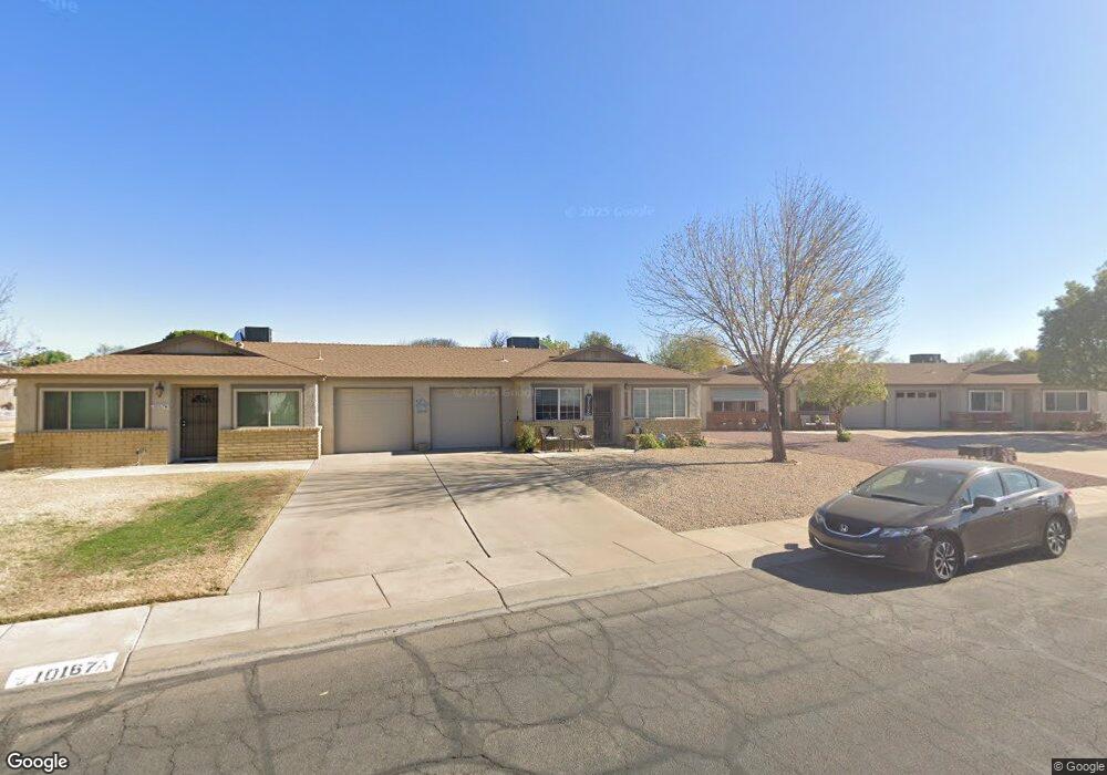
10167 N 97th Ave Unit B Peoria, AZ 85345
Estimated Value: $181,009 - $237,000
--
Bed
2
Baths
1,025
Sq Ft
$208/Sq Ft
Est. Value
About This Home
This home is located at 10167 N 97th Ave Unit B, Peoria, AZ 85345 and is currently estimated at $213,002, approximately $207 per square foot. 10167 N 97th Ave Unit B is a home located in Maricopa County with nearby schools including Sun Valley Elementary School, Raymond S. Kellis, and Ombudsman - Northwest Charter.
Ownership History
Date
Name
Owned For
Owner Type
Purchase Details
Closed on
May 15, 2012
Sold by
Moore Mallory
Bought by
Moore Randall E
Current Estimated Value
Home Financials for this Owner
Home Financials are based on the most recent Mortgage that was taken out on this home.
Original Mortgage
$31,500
Outstanding Balance
$4,464
Interest Rate
3.86%
Mortgage Type
New Conventional
Estimated Equity
$208,538
Purchase Details
Closed on
May 8, 2010
Sold by
Moore Hilda S
Bought by
Sargent Cheryl J and Moore Randall E
Purchase Details
Closed on
Jun 23, 1994
Sold by
Besaw Gene A
Bought by
Moore Hilda S
Create a Home Valuation Report for This Property
The Home Valuation Report is an in-depth analysis detailing your home's value as well as a comparison with similar homes in the area
Home Values in the Area
Average Home Value in this Area
Purchase History
| Date | Buyer | Sale Price | Title Company |
|---|---|---|---|
| Moore Randall E | -- | Driggs Title Agency Inc | |
| Fleury Zandr L | -- | Driggs Title Agency Inc | |
| Sargent Cheryl J | -- | Driggs Title Agency Inc | |
| Sargent Cheryl J | -- | None Available | |
| Moore Hilda S | $42,500 | Transamerica Title Ins Co |
Source: Public Records
Mortgage History
| Date | Status | Borrower | Loan Amount |
|---|---|---|---|
| Open | Sargent Cheryl J | $31,500 | |
| Closed | Fleury Zandr L | $31,500 |
Source: Public Records
Tax History Compared to Growth
Tax History
| Year | Tax Paid | Tax Assessment Tax Assessment Total Assessment is a certain percentage of the fair market value that is determined by local assessors to be the total taxable value of land and additions on the property. | Land | Improvement |
|---|---|---|---|---|
| 2025 | $439 | $5,644 | -- | -- |
| 2024 | $433 | $5,375 | -- | -- |
| 2023 | $433 | $16,130 | $3,220 | $12,910 |
| 2022 | $424 | $12,360 | $2,470 | $9,890 |
| 2021 | $454 | $10,750 | $2,150 | $8,600 |
| 2020 | $458 | $9,930 | $1,980 | $7,950 |
| 2019 | $443 | $8,780 | $1,750 | $7,030 |
| 2018 | $428 | $6,970 | $1,390 | $5,580 |
| 2017 | $429 | $5,770 | $1,150 | $4,620 |
| 2016 | $424 | $5,170 | $1,030 | $4,140 |
| 2015 | $396 | $5,180 | $1,030 | $4,150 |
Source: Public Records
Map
Nearby Homes
- 10134 N 97th Ave Unit B
- 10127 N 95th Dr Unit A
- 9627 W North Ln Unit B
- 10018 N 97th Dr Unit A
- 10226 N 93rd Dr
- 9616 W Mountain View Rd Unit A
- 10245 N 93rd Dr
- 9564 W Purdue Ave
- 10201 N 99th Ave Unit 32A
- 10201 N 99th Ave Unit 46
- 10201 N 99th Ave Unit 44
- 10201 N 99th Ave Unit 97
- 10201 N 99th Ave Unit 34
- 10201 N 99th Ave Unit 28A
- 10201 N 99th Ave Unit 49
- 10201 N 99th Ave Unit 129E
- 10201 N 99th Ave Unit 135F
- 10201 N 99th Ave Unit 3
- 10201 N 99th Ave Unit 160
- 10201 N 99th Ave Unit 149
- 10167 N 97th Ave Unit A
- 10167 N 97th Ave
- 10201 N 97th Ave Unit A
- 10159 N 97th Ave
- 10159 N 97th Ave Unit A
- 10159 N 97th Ave Unit B
- 10204 N 96th Ave Unit B
- 10204 N 96th Ave
- 10204 N 96th Ave Unit A
- 10130 N 96th Ave Unit B
- 10130 N 96th Ave Unit A
- 10130 N 96th Ave Unit B
- 10130 N 96th Ave
- 10210 N 96th Ave Unit A
- 10210 N 96th Ave Unit B
- 10210 N 96th Ave Unit A
- 10210 N 96th Ave Unit B
- 10210 N 96th Ave
- 10200 N 96th Ave Unit B
- 10200 N 96th Ave Unit A