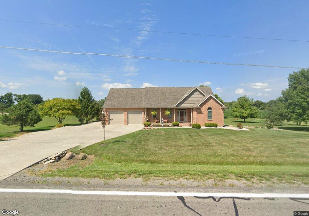
10167 State Route 638 Belle Center, OH 43310
Estimated Value: $241,000 - $374,374
3
Beds
2
Baths
1,836
Sq Ft
$176/Sq Ft
Est. Value
About This Home
This home is located at 10167 State Route 638, Belle Center, OH 43310 and is currently estimated at $323,844, approximately $176 per square foot. 10167 State Route 638 is a home with nearby schools including Benjamin Logan Elementary School, Benjamin Logan Middle School, and Benjamin Logan High School.
Ownership History
Date
Name
Owned For
Owner Type
Purchase Details
Closed on
Aug 27, 2020
Sold by
Weir Roger E and Weir Deborah M
Bought by
Neider Dana and Neider Karen
Current Estimated Value
Purchase Details
Closed on
Sep 1, 2017
Sold by
Walton Melvin E and Walton Jaclin L
Bought by
Weir Roger E and Weir Deborah M
Purchase Details
Closed on
Nov 26, 2001
Bought by
Walton Melvin E
Create a Home Valuation Report for This Property
The Home Valuation Report is an in-depth analysis detailing your home's value as well as a comparison with similar homes in the area
Home Values in the Area
Average Home Value in this Area
Purchase History
| Date | Buyer | Sale Price | Title Company |
|---|---|---|---|
| Neider Dana | $138,250 | Elite Land Title | |
| Weir Roger E | $237,000 | None Available | |
| Walton Melvin E | $140,000 | -- |
Source: Public Records
Tax History Compared to Growth
Tax History
| Year | Tax Paid | Tax Assessment Tax Assessment Total Assessment is a certain percentage of the fair market value that is determined by local assessors to be the total taxable value of land and additions on the property. | Land | Improvement |
|---|---|---|---|---|
| 2024 | $3,243 | $94,570 | $6,790 | $87,780 |
| 2023 | $3,243 | $94,570 | $6,790 | $87,780 |
| 2022 | $3,307 | $75,660 | $5,430 | $70,230 |
| 2021 | $2,837 | $75,660 | $5,430 | $70,230 |
| 2020 | $2,308 | $68,580 | $5,230 | $63,350 |
| 2019 | $2,318 | $68,580 | $5,230 | $63,350 |
| 2018 | $2,335 | $68,580 | $5,230 | $63,350 |
| 2016 | $2,302 | $62,340 | $4,750 | $57,590 |
| 2014 | $1,777 | $62,340 | $4,750 | $57,590 |
| 2013 | $1,584 | $62,340 | $4,750 | $57,590 |
| 2012 | $1,943 | $67,390 | $4,280 | $63,110 |
Source: Public Records
Map
Nearby Homes
- 307 E Main St
- 0 Ohio 273
- 402 N Elizabeth St
- 0 County Road 103
- 301 Kendall St
- 9712 Heron Way
- 9792 Heron Way Unit Lot 52
- 9792 Heron Way Unit Lot 35
- 9722 Heron Way
- 9819 Heron Way
- 9820 Heron Way Unit Lot 32
- . County Road 49
- 0 C R 103 Unit 22337969
- 0 C R 103 Unit 225000597
- 6836 County Road 101
- 8556
- 8556 State Route 117
- 0 County Road 37
- 212 S Sandusky St
- 17334 Township Road 95
- 10167 Ohio 638
- 10235 State Route 638
- 10109 Ohio 638
- 10109 State Route 638
- 2406 Township Road 242
- 10049 State Route 638
- 2599 W Buckeye (Sr 273)
- 0 Ohio 638
- 500 Buckeye St E
- 417 Buckeye St E
- 2598 Ohio 273
- 2598 State Route 273 W
- 412 Buckeye St E
- 415 Buckeye St E
- 2365 State Route 273 W
- 410 Buckeye St E
- 601 Charles St
- 414 E Torrence St
- 411 Buckeye St E
- 402 E Main St