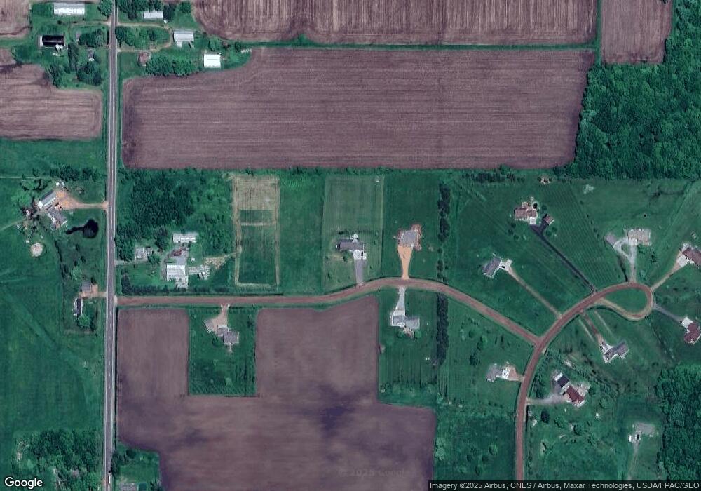
101680 Purdy Ln Marshfield, WI 54449
Estimated Value: $363,492 - $491,000
4
Beds
--
Bath
2,336
Sq Ft
$180/Sq Ft
Est. Value
About This Home
This home is located at 101680 Purdy Ln, Marshfield, WI 54449 and is currently estimated at $419,873, approximately $179 per square foot. 101680 Purdy Ln is a home located in Marathon County with nearby schools including Spencer Elementary School and Spencer Middle/High School.
Ownership History
Date
Name
Owned For
Owner Type
Purchase Details
Closed on
Jun 7, 2011
Sold by
Dunlap Wade W and Dunlap Jill
Bought by
Zaleski Patrick K and Zaleski Katherine E
Current Estimated Value
Home Financials for this Owner
Home Financials are based on the most recent Mortgage that was taken out on this home.
Original Mortgage
$172,800
Outstanding Balance
$119,348
Interest Rate
4.67%
Mortgage Type
New Conventional
Estimated Equity
$300,525
Purchase Details
Closed on
Aug 18, 2006
Sold by
Miller Philip
Bought by
Dunlap Wade W and Dunlap Jill
Home Financials for this Owner
Home Financials are based on the most recent Mortgage that was taken out on this home.
Original Mortgage
$186,500
Interest Rate
6.5%
Mortgage Type
Construction
Create a Home Valuation Report for This Property
The Home Valuation Report is an in-depth analysis detailing your home's value as well as a comparison with similar homes in the area
Home Values in the Area
Average Home Value in this Area
Purchase History
| Date | Buyer | Sale Price | Title Company |
|---|---|---|---|
| Zaleski Patrick K | $216,000 | Integrity Title | |
| Dunlap Wade W | $20,000 | Integrity Title |
Source: Public Records
Mortgage History
| Date | Status | Borrower | Loan Amount |
|---|---|---|---|
| Open | Zaleski Patrick K | $172,800 | |
| Previous Owner | Dunlap Wade W | $186,500 |
Source: Public Records
Tax History Compared to Growth
Tax History
| Year | Tax Paid | Tax Assessment Tax Assessment Total Assessment is a certain percentage of the fair market value that is determined by local assessors to be the total taxable value of land and additions on the property. | Land | Improvement |
|---|---|---|---|---|
| 2024 | $4,436 | $345,400 | $24,100 | $321,300 |
| 2023 | $4,263 | $345,400 | $24,100 | $321,300 |
| 2022 | $3,977 | $207,500 | $15,200 | $192,300 |
| 2021 | $3,583 | $207,500 | $15,200 | $192,300 |
| 2020 | $4,074 | $207,500 | $15,200 | $192,300 |
| 2019 | $3,739 | $207,500 | $15,200 | $192,300 |
| 2018 | $3,775 | $207,500 | $15,200 | $192,300 |
| 2017 | $3,928 | $207,500 | $15,200 | $192,300 |
| 2016 | $3,855 | $207,500 | $15,200 | $192,300 |
| 2015 | $3,464 | $207,500 | $15,200 | $192,300 |
| 2014 | $3,717 | $207,500 | $15,200 | $192,300 |
Source: Public Records
Map
Nearby Homes
- 203536 Sun Ridge Dr
- 200890 Robin Rd
- Lot 4 and 5 Fairhaven Ave
- 104134 Back Country Rd
- W839 W Rosewood Dr Unit Lot 4
- 107 Lincoln St
- 803 E Birch St
- 201 Kobs St
- 203 Kobs St
- 701 E Hemlock St
- 704 E Hemlock St
- 407 W Louisa St
- 815 W Roberts St
- 802 W Roberts St
- 821 W Roberts St
- Lot 10 Woodsview Rd
- 309 E Clark St
- 605 E Clark St
- 607 E Clark St
- 203 W Mill St
- 101732 Purdy Ln
- 101731 Purdy Ln
- 1053 Purdy Ln
- 201926 Oak Brook Dr
- 101525 Purdy Ln
- 201960 Oak Brook Dr
- 201949 County Road V
- 201949 County Road V
- S2715 Oakbrook Ct
- 202215 County Road V
- 201910 County Road V
- S2710 Oakbrook Ct
- 201974 Oak Brook Dr
- 202018 County Road V
- 202018 County Road V
- S2720 Oakbrook Ct
- S2730 Oakbrook Ct
- 202216 County Road V
- 201676 Oak Brook Dr
- 201988 Oak Brook Dr
