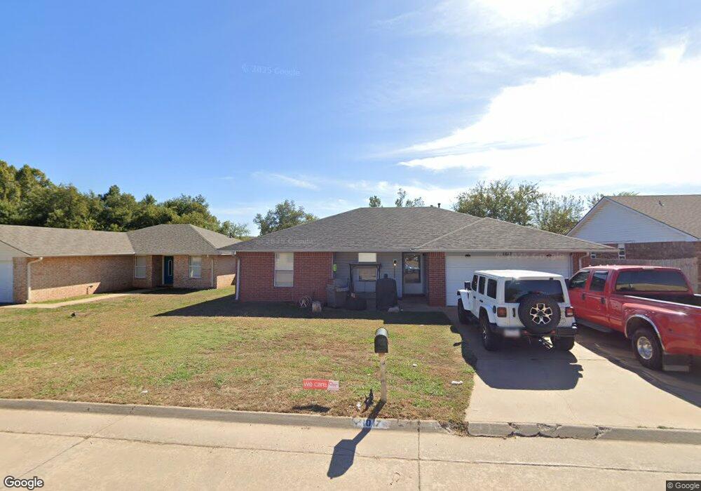
1017 Aspen Dr Shawnee, OK 74804
Estimated Value: $99,000 - $184,000
3
Beds
2
Baths
1,220
Sq Ft
$117/Sq Ft
Est. Value
About This Home
This home is located at 1017 Aspen Dr, Shawnee, OK 74804 and is currently estimated at $142,449, approximately $116 per square foot. 1017 Aspen Dr is a home with nearby schools including Will Rogers Elementary School, Shawnee Middle School, and Shawnee High School.
Ownership History
Date
Name
Owned For
Owner Type
Purchase Details
Closed on
Jul 8, 2022
Sold by
Conrad Snow Josephine and Conrad Brian
Bought by
Conrad Courtney and Conrad Austin
Current Estimated Value
Home Financials for this Owner
Home Financials are based on the most recent Mortgage that was taken out on this home.
Original Mortgage
$56,000
Outstanding Balance
$46,985
Interest Rate
4.31%
Mortgage Type
New Conventional
Estimated Equity
$95,464
Purchase Details
Closed on
Dec 9, 2019
Sold by
Housing Authority Of Absentee Shawnee Tr
Bought by
Conrad Josephine
Purchase Details
Closed on
Dec 3, 1998
Sold by
Westchester Dev Co
Bought by
Housing Auth Of Absentee
Purchase Details
Closed on
Jul 27, 1998
Sold by
Jones Wayne and Jones Donna
Bought by
Zukosky Phyllis and Lynn St
Create a Home Valuation Report for This Property
The Home Valuation Report is an in-depth analysis detailing your home's value as well as a comparison with similar homes in the area
Home Values in the Area
Average Home Value in this Area
Purchase History
| Date | Buyer | Sale Price | Title Company |
|---|---|---|---|
| Conrad Courtney | $70,000 | First American Title | |
| Conrad Josephine | -- | None Available | |
| Housing Auth Of Absentee | $72,000 | -- | |
| Zukosky Phyllis | $325,000 | -- |
Source: Public Records
Mortgage History
| Date | Status | Borrower | Loan Amount |
|---|---|---|---|
| Open | Conrad Courtney | $56,000 |
Source: Public Records
Tax History Compared to Growth
Tax History
| Year | Tax Paid | Tax Assessment Tax Assessment Total Assessment is a certain percentage of the fair market value that is determined by local assessors to be the total taxable value of land and additions on the property. | Land | Improvement |
|---|---|---|---|---|
| 2024 | $1,148 | $10,988 | $1,320 | $9,668 |
| 2023 | $1,148 | $10,988 | $1,320 | $9,668 |
| 2022 | $1,025 | $10,988 | $1,320 | $9,668 |
| 2021 | $1,006 | $10,988 | $1,320 | $9,668 |
| 2020 | $1,022 | $11,118 | $1,320 | $9,798 |
| 2019 | $0 | $0 | $0 | $0 |
| 2018 | $0 | $0 | $0 | $0 |
| 2017 | $0 | $0 | $0 | $0 |
| 2016 | -- | $0 | $0 | $0 |
| 2015 | -- | $0 | $0 | $0 |
| 2014 | -- | $0 | $0 | $0 |
Source: Public Records
Map
Nearby Homes
- 13 Robby Rd
- 7 N Tawana Dr
- 3 Rock Hollow Rd
- 4103 Pine Ridge Rd
- 1000 W 45th St
- 29 Timber Creek Way
- 4206 N Aydelotte Ave
- 312 Traditional Way Ct
- 000 45th and Union Lot 2
- 000 45th and Union Lot 3
- 000 45th and Union Lot 1
- 000 45th and Union Lot 6
- 000 45th and Union Lot 4
- 000 45th and Union Lot 5
- 000 45th and Union Lot 7
- 1821 W Wiley St
- 2418 Ellis Dr
- 4601 Pigeon Run
- 507 Blue Bird Ln
- 1933 Rain Tree Dr
- 4411 Smoking Tree
- 1017 Burning Wood Dr
- 4405 Smoking Tree
- 1019 Burning Wood Dr
- 1015 Burning Wood Dr
- 1013 Burning Wood Dr
- 1021 Aspen Dr
- 1015 Aspen Dr
- 4410 Smoking Tree
- 4412 Smoking Tree
- 4414 Smoking Tree
- 1011 Burning Wood Dr
- 1011 Aspen Dr
- 4406 Smoking Tree
- 4416 Smoking Tree
- 1013 Aspen Dr
- 1014 Burning Wood Dr
- 1012 Burning Wood Dr
- 4404 Smoking Tree
- 1010 Burning Wood Dr