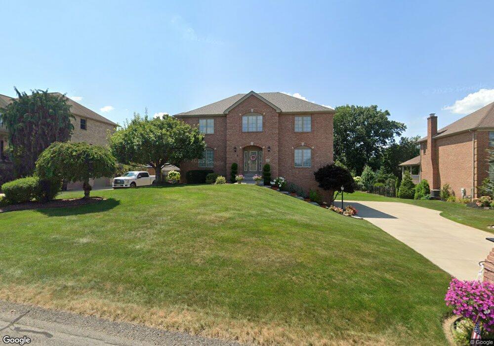
1017 Buck Run Rd Canonsburg, PA 15317
Estimated Value: $583,057 - $689,000
4
Beds
3
Baths
2,606
Sq Ft
$248/Sq Ft
Est. Value
About This Home
This home is located at 1017 Buck Run Rd, Canonsburg, PA 15317 and is currently estimated at $646,514, approximately $248 per square foot. 1017 Buck Run Rd is a home located in Washington County with nearby schools including Canon-Mcmillan Senior High School.
Ownership History
Date
Name
Owned For
Owner Type
Purchase Details
Closed on
Jul 23, 2001
Sold by
Graziani William
Bought by
Spataro Thomas
Current Estimated Value
Home Financials for this Owner
Home Financials are based on the most recent Mortgage that was taken out on this home.
Original Mortgage
$195,000
Outstanding Balance
$75,366
Interest Rate
7.18%
Estimated Equity
$571,148
Create a Home Valuation Report for This Property
The Home Valuation Report is an in-depth analysis detailing your home's value as well as a comparison with similar homes in the area
Home Values in the Area
Average Home Value in this Area
Purchase History
| Date | Buyer | Sale Price | Title Company |
|---|---|---|---|
| Spataro Thomas | $54,000 | -- |
Source: Public Records
Mortgage History
| Date | Status | Borrower | Loan Amount |
|---|---|---|---|
| Open | Spataro Thomas | $195,000 |
Source: Public Records
Tax History Compared to Growth
Tax History
| Year | Tax Paid | Tax Assessment Tax Assessment Total Assessment is a certain percentage of the fair market value that is determined by local assessors to be the total taxable value of land and additions on the property. | Land | Improvement |
|---|---|---|---|---|
| 2025 | $6,113 | $363,000 | $106,400 | $256,600 |
| 2024 | $5,783 | $363,000 | $106,400 | $256,600 |
| 2023 | $5,783 | $363,000 | $106,400 | $256,600 |
| 2022 | $5,783 | $363,000 | $106,400 | $256,600 |
| 2021 | $5,765 | $363,000 | $106,400 | $256,600 |
| 2020 | $5,656 | $363,000 | $106,400 | $256,600 |
| 2019 | $5,565 | $363,000 | $106,400 | $256,600 |
| 2018 | $5,452 | $363,000 | $106,400 | $256,600 |
| 2017 | $929 | $363,000 | $106,400 | $256,600 |
| 2016 | $929 | $37,329 | $7,182 | $30,147 |
| 2015 | $611 | $37,329 | $7,182 | $30,147 |
| 2014 | $929 | $37,329 | $7,182 | $30,147 |
| 2013 | $929 | $37,329 | $7,182 | $30,147 |
Source: Public Records
Map
Nearby Homes
- 1037 Skyline Dr
- 1033 Skyline Dr
- 1041 Skyline Dr
- 1065 Skyline Dr
- 1272 Mcewen Rd
- 1582 Network Dr
- 29 Virginia Ln
- 1382 Lucia Dr
- 214 Hooks Ln
- 1163 Mcewen Ave
- 510 Panorama Dr
- 9 Puskar Ln
- 520 Panorama Dr
- 209 Joseph Dr
- 4084 Overview Dr
- 3016 Brookstone Dr
- 1021 Coldstream Dr
- 3029 Brookstone Dr
- 1116 Martin Dr
- 718 Gladden Rd
- 1013 Buck Run Rd
- 1013 Buck Run Rd
- 1021 Buck Run Rd
- 1009 Buck Run Rd
- 1025 Buck Run Rd
- 1020 Buck Run Rd
- 1016 Buck Run Rd
- 1012 Buck Run Rd
- 1028 Buck Run Rd
- 1005 Buck Run Rd
- 1024 Buck Run Rd
- 1008 Buck Run Rd
- 1505 Network Dr
- 1001 Buck Run Rd
- 1521 Network Dr
- 1501 Network Dr
- 1525 Network Dr
- 1021 Oak Ridge Rd
- 1529 Network Dr
- 1025 Oak Ridge Rd