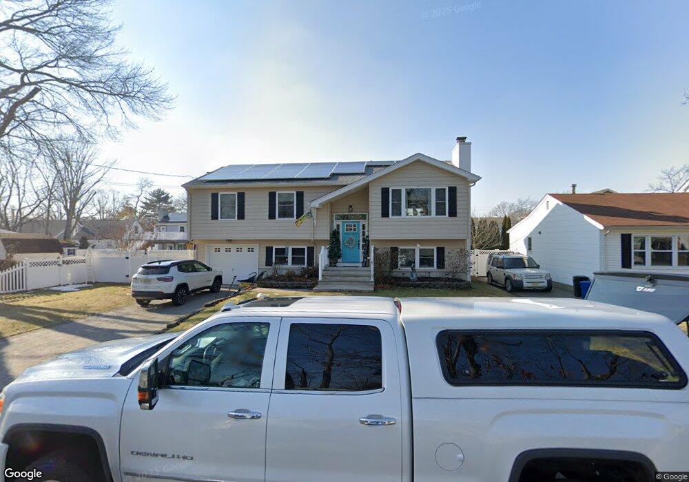
1017 Curtis Ave Point Pleasant Beach, NJ 08742
Estimated Value: $692,000 - $766,000
4
Beds
2
Baths
1,832
Sq Ft
$404/Sq Ft
Est. Value
About This Home
This home is located at 1017 Curtis Ave, Point Pleasant Beach, NJ 08742 and is currently estimated at $739,579, approximately $403 per square foot. 1017 Curtis Ave is a home located in Ocean County with nearby schools including Point Pleasant High School and St Dominic School.
Ownership History
Date
Name
Owned For
Owner Type
Purchase Details
Closed on
Sep 8, 2005
Sold by
Reilly Michael
Bought by
Carter Lisa
Current Estimated Value
Home Financials for this Owner
Home Financials are based on the most recent Mortgage that was taken out on this home.
Original Mortgage
$175,000
Outstanding Balance
$93,567
Interest Rate
5.84%
Mortgage Type
Stand Alone First
Estimated Equity
$646,012
Create a Home Valuation Report for This Property
The Home Valuation Report is an in-depth analysis detailing your home's value as well as a comparison with similar homes in the area
Home Values in the Area
Average Home Value in this Area
Purchase History
| Date | Buyer | Sale Price | Title Company |
|---|---|---|---|
| Carter Lisa | $380,000 | -- |
Source: Public Records
Mortgage History
| Date | Status | Borrower | Loan Amount |
|---|---|---|---|
| Open | Carter Lisa | $175,000 |
Source: Public Records
Tax History Compared to Growth
Tax History
| Year | Tax Paid | Tax Assessment Tax Assessment Total Assessment is a certain percentage of the fair market value that is determined by local assessors to be the total taxable value of land and additions on the property. | Land | Improvement |
|---|---|---|---|---|
| 2025 | $7,908 | $345,800 | $172,500 | $173,300 |
| 2024 | $7,559 | $345,800 | $172,500 | $173,300 |
| 2023 | $7,040 | $328,800 | $172,500 | $156,300 |
| 2022 | $7,040 | $328,800 | $172,500 | $156,300 |
| 2021 | $6,931 | $328,800 | $172,500 | $156,300 |
| 2020 | $6,859 | $328,800 | $172,500 | $156,300 |
| 2019 | $6,767 | $328,800 | $172,500 | $156,300 |
| 2018 | $6,566 | $328,800 | $172,500 | $156,300 |
| 2017 | $6,421 | $328,800 | $172,500 | $156,300 |
| 2016 | $6,372 | $328,800 | $172,500 | $156,300 |
| 2015 | $6,297 | $328,800 | $172,500 | $156,300 |
| 2014 | $6,152 | $328,800 | $172,500 | $156,300 |
Source: Public Records
Map
Nearby Homes
- 1111 River Ave
- 3105 Pocahontas Ave
- 2607 Spruce St
- 2704 Route 88
- 3118 Pocahontas Ave
- 2406 Chestnut St
- 2400 Beech St
- 1315 Sunset Ave
- 602 Boulton Ave
- 519 Curtis Ave
- 1328 Sleepy Hollow Rd
- 505 Curtis Ave
- 619 Mistletoe Ave
- 530 Riverwood Ave
- 2410 Mark Place
- 1115 Beaver Dam Rd
- 837 Beaver Dam Rd
- 3006 Herbertsville Rd
- 1504 Ivy Rd
- 403 Matt Robinson Ln
- 1015 Curtis Ave
- 1101 Curtis Ave
- 1016 Sunset Ave
- 1013 Curtis Ave
- 1100 Sunset Ave
- 1103 Curtis Ave
- 1012 Sunset Ave
- 2612 Willow St
- 1011 Curtis Ave
- 1102 Sunset Ave
- 1014 Curtis Ave
- 1105 Curtis Ave
- 1012 Curtis Ave
- 1010 Sunset Ave
- 1102 Curtis Ave
- 1104 Sunset Ave
- 1009 Curtis Ave
- 1010 Curtis Ave
- 2610 Willow St
- 1107 Curtis Ave