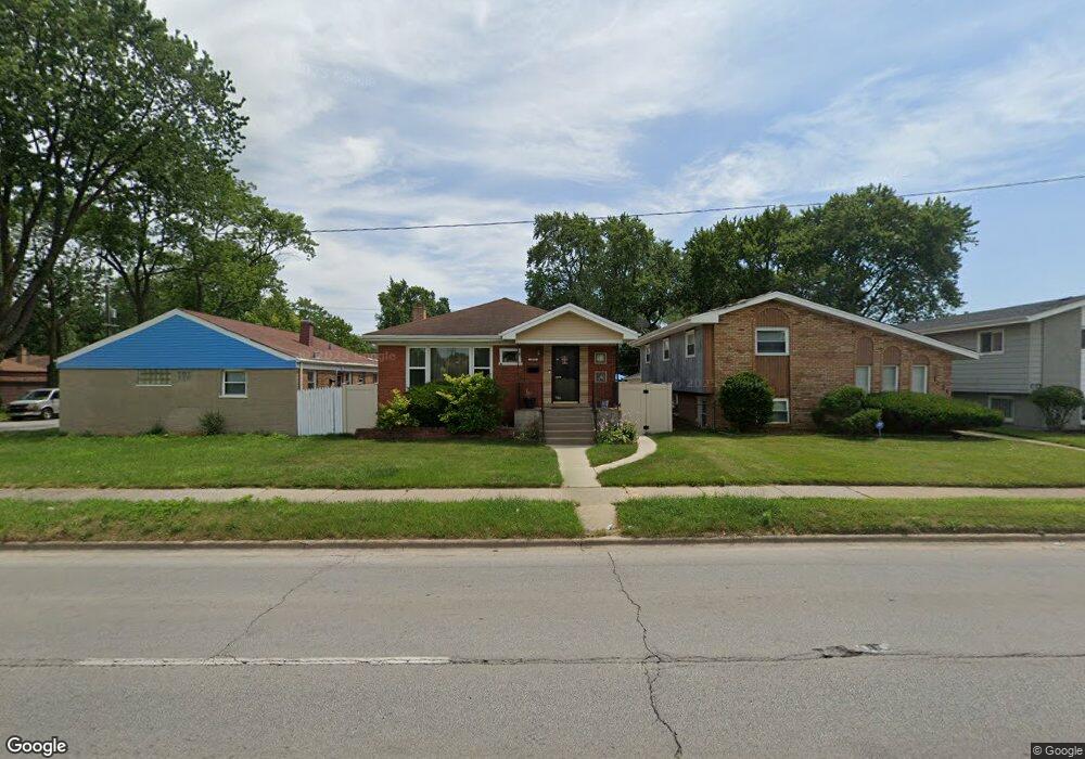
1017 E 142nd St Dolton, IL 60419
Estimated Value: $144,000 - $184,000
3
Beds
1
Bath
1,120
Sq Ft
$152/Sq Ft
Est. Value
About This Home
This home is located at 1017 E 142nd St, Dolton, IL 60419 and is currently estimated at $169,897, approximately $151 per square foot. 1017 E 142nd St is a home located in Cook County with nearby schools including Lincoln Elementary School, Lincoln Junior High School, and Thornridge High School.
Ownership History
Date
Name
Owned For
Owner Type
Purchase Details
Closed on
May 31, 2022
Sold by
Smith Ltonia W and Smith Theodore
Bought by
Smith Jim R
Current Estimated Value
Home Financials for this Owner
Home Financials are based on the most recent Mortgage that was taken out on this home.
Original Mortgage
$175,000
Outstanding Balance
$164,701
Interest Rate
4.75%
Mortgage Type
Balloon
Estimated Equity
$5,196
Create a Home Valuation Report for This Property
The Home Valuation Report is an in-depth analysis detailing your home's value as well as a comparison with similar homes in the area
Home Values in the Area
Average Home Value in this Area
Purchase History
| Date | Buyer | Sale Price | Title Company |
|---|---|---|---|
| Smith Jim R | $175,000 | Old Republic Title |
Source: Public Records
Mortgage History
| Date | Status | Borrower | Loan Amount |
|---|---|---|---|
| Open | Smith Jim R | $175,000 |
Source: Public Records
Tax History
| Year | Tax Paid | Tax Assessment Tax Assessment Total Assessment is a certain percentage of the fair market value that is determined by local assessors to be the total taxable value of land and additions on the property. | Land | Improvement |
|---|---|---|---|---|
| 2025 | $144 | $13,000 | $2,072 | $10,928 |
| 2024 | $144 | $13,000 | $2,072 | $10,928 |
| 2023 | $144 | $13,000 | $2,072 | $10,928 |
| 2022 | $144 | $8,611 | $1,828 | $6,783 |
| 2021 | $4,425 | $8,610 | $1,828 | $6,782 |
| 2020 | $4,363 | $8,610 | $1,828 | $6,782 |
| 2019 | $2,986 | $6,836 | $1,706 | $5,130 |
| 2018 | $2,891 | $6,836 | $1,706 | $5,130 |
| 2017 | $2,770 | $6,836 | $1,706 | $5,130 |
| 2016 | $3,623 | $7,439 | $1,584 | $5,855 |
| 2015 | $3,423 | $7,439 | $1,584 | $5,855 |
| 2014 | $3,435 | $7,439 | $1,584 | $5,855 |
| 2013 | $2,801 | $6,949 | $1,584 | $5,365 |
Source: Public Records
Map
Nearby Homes
- 14214 Minerva Ave
- 14234 Minerva Ave
- 14208 Ingleside Ave
- 14234 Ingleside Ave
- 14315 Dobson Ave
- 14314 Minerva Ave
- 14223 University Ave
- 14200 Drexel Ave
- 14325 Ingleside Ave
- 14201 Maryland Ave
- 14227 Woodlawn Ave
- 14341 Drexel Ave
- 14341 University Ave
- 14418 Drexel Ave
- 14405 Woodlawn Ave
- 1107 E 145th St
- 14308 Kenwood Ave
- 14525 Dobson Ave
- 14408 Lincoln Ave
- 14263 Lincoln Ave
- 1019 E 142nd St
- 1011 E 142nd St
- 1009 E 142nd St
- 14210 Dobson Ave
- 1005 E 142nd St
- 1005 E 142nd St
- 14214 Dobson Ave
- 1027 E 142nd St
- 14211 Ellis Ave
- 14220 Dobson Ave
- 1031 E 142nd St
- 1001 E 142nd St
- 1001 E 142nd St
- 14215 Ellis Ave
- 14211 Dobson Ave
- 14224 Dobson Ave
- 14219 Ellis Ave
- 1031 E 142nd St
- 14215 Dobson Ave
- 1037 E 142nd St
Your Personal Tour Guide
Ask me questions while you tour the home.