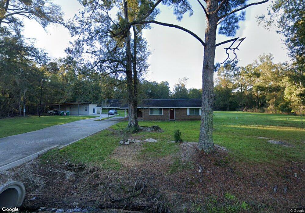
1017 Esterbrook Rd Ponchatoula, LA 70454
Estimated Value: $184,906 - $286,000
--
Bed
--
Bath
2,287
Sq Ft
$102/Sq Ft
Est. Value
About This Home
This home is located at 1017 Esterbrook Rd, Ponchatoula, LA 70454 and is currently estimated at $232,727, approximately $101 per square foot. 1017 Esterbrook Rd is a home located in Tangipahoa Parish with nearby schools including Tucker Memorial Elementary School, D.C. Reeves Elementary School, and Ponchatoula Junior High School.
Ownership History
Date
Name
Owned For
Owner Type
Purchase Details
Closed on
Nov 1, 2007
Sold by
Cook Myton Lucian
Bought by
Cotton Cassandra Ann and Warren Walter
Current Estimated Value
Home Financials for this Owner
Home Financials are based on the most recent Mortgage that was taken out on this home.
Original Mortgage
$145,000
Outstanding Balance
$91,743
Interest Rate
6.38%
Mortgage Type
Future Advance Clause Open End Mortgage
Estimated Equity
$140,984
Create a Home Valuation Report for This Property
The Home Valuation Report is an in-depth analysis detailing your home's value as well as a comparison with similar homes in the area
Home Values in the Area
Average Home Value in this Area
Purchase History
| Date | Buyer | Sale Price | Title Company |
|---|---|---|---|
| Cotton Cassandra Ann | $145,000 | None Available |
Source: Public Records
Mortgage History
| Date | Status | Borrower | Loan Amount |
|---|---|---|---|
| Open | Cotton Cassandra Ann | $145,000 |
Source: Public Records
Tax History Compared to Growth
Tax History
| Year | Tax Paid | Tax Assessment Tax Assessment Total Assessment is a certain percentage of the fair market value that is determined by local assessors to be the total taxable value of land and additions on the property. | Land | Improvement |
|---|---|---|---|---|
| 2024 | $691 | $10,135 | $3,538 | $6,597 |
| 2023 | $687 | $9,872 | $3,276 | $6,596 |
| 2022 | $687 | $9,872 | $3,276 | $6,596 |
| 2021 | $334 | $9,872 | $3,276 | $6,596 |
| 2020 | $849 | $9,872 | $3,276 | $6,596 |
| 2019 | $847 | $9,872 | $3,276 | $6,596 |
| 2018 | $850 | $9,872 | $3,276 | $6,596 |
| 2017 | $850 | $9,872 | $3,276 | $6,596 |
| 2016 | $850 | $9,872 | $3,276 | $6,596 |
| 2015 | $166 | $9,872 | $3,276 | $6,596 |
| 2014 | $151 | $9,872 | $3,276 | $6,596 |
Source: Public Records
Map
Nearby Homes
- 313 Silverstone Cir
- 515 1/2 S 2nd St
- 18226 Esterbrook Rd
- 530 E Cypress St
- 350 E Pecan St
- 551 Daybreak Dr
- 135 Shirleen Dr
- 125 McGary Ln
- 208 E Pecan St
- 18270 Highway 22 Unit LOT 17
- 180 N 2nd St
- 508 Saint Louis Ct
- 200 N 2nd St
- 669 Lake Iberville Ct
- 451 Lake Orleans Blvd
- 18369 Louisiana 22
- 18369 Hwy 22 None
- 443 Lake Orleans Blvd
- 13.91 AC Louisiana 22
- 1014 Esterbrook Rd
- 158 Colver Dr
- 1018 Esterbrook Rd
- 154 Colver Dr
- 520 S First St
- 520 S 1st St
- 151 Colver Dr
- 510 S 1st St
- 328 Silverstone Cir
- 150 Colver Dr
- 1020 Esterbrook Rd
- 324 Silverstone Cir
- 540 S 1st St Unit D
- 540 S 1st St Unit B
- 540 S 1st St Unit A
- 540 S 1st St Unit B
- 540 S 1st St Unit C
- 143 Colver Dr
- 1011 Esterbrook Rd
- 336 Silverstone Cir