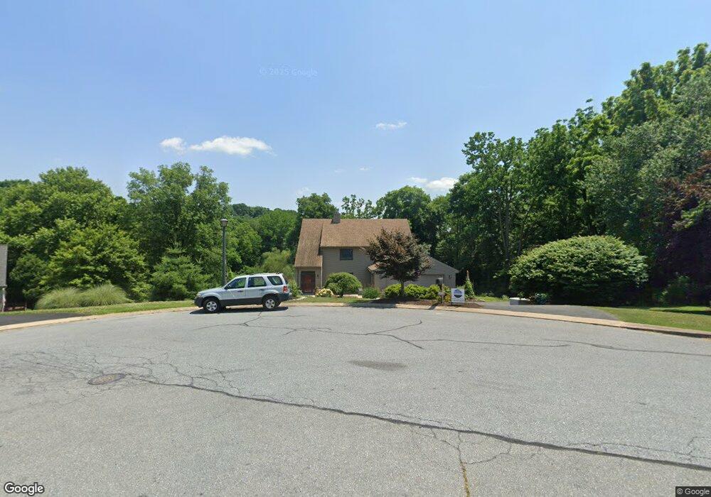
1017 Fieldstone Ct Lancaster, PA 17603
Blue Rock NeighborhoodEstimated Value: $630,696 - $716,000
3
Beds
4
Baths
3,034
Sq Ft
$221/Sq Ft
Est. Value
About This Home
This home is located at 1017 Fieldstone Ct, Lancaster, PA 17603 and is currently estimated at $670,174, approximately $220 per square foot. 1017 Fieldstone Ct is a home located in Lancaster County with nearby schools including Central Manor Elementary School, Manor Middle School, and Penn Manor High School.
Ownership History
Date
Name
Owned For
Owner Type
Purchase Details
Closed on
May 27, 2003
Sold by
Frey Pauline M
Bought by
Bennawit James R and Bennawit Debbie L
Current Estimated Value
Home Financials for this Owner
Home Financials are based on the most recent Mortgage that was taken out on this home.
Original Mortgage
$228,000
Outstanding Balance
$137,071
Interest Rate
5.86%
Mortgage Type
Purchase Money Mortgage
Estimated Equity
$533,103
Create a Home Valuation Report for This Property
The Home Valuation Report is an in-depth analysis detailing your home's value as well as a comparison with similar homes in the area
Home Values in the Area
Average Home Value in this Area
Purchase History
| Date | Buyer | Sale Price | Title Company |
|---|---|---|---|
| Bennawit James R | $285,000 | -- |
Source: Public Records
Mortgage History
| Date | Status | Borrower | Loan Amount |
|---|---|---|---|
| Open | Bennawit James R | $228,000 | |
| Closed | Bennawit James R | $42,750 |
Source: Public Records
Tax History
| Year | Tax Paid | Tax Assessment Tax Assessment Total Assessment is a certain percentage of the fair market value that is determined by local assessors to be the total taxable value of land and additions on the property. | Land | Improvement |
|---|---|---|---|---|
| 2025 | $6,981 | $334,800 | $84,100 | $250,700 |
| 2024 | $6,981 | $319,700 | $84,100 | $235,600 |
| 2023 | $6,981 | $319,700 | $84,100 | $235,600 |
| 2022 | $6,849 | $319,700 | $84,100 | $235,600 |
| 2021 | $6,676 | $319,700 | $84,100 | $235,600 |
| 2020 | $6,676 | $319,700 | $84,100 | $235,600 |
| 2019 | $6,490 | $319,700 | $84,100 | $235,600 |
| 2018 | $5,123 | $319,700 | $84,100 | $235,600 |
| 2017 | $6,605 | $272,200 | $57,200 | $215,000 |
| 2016 | $6,605 | $272,200 | $57,200 | $215,000 |
| 2015 | $1,360 | $272,200 | $57,200 | $215,000 |
| 2014 | $4,675 | $272,200 | $57,200 | $215,000 |
Source: Public Records
Map
Nearby Homes
- 1014 Shadowstone Dr
- 32 Knollwood Rd
- 1098 Monticello Ln
- 1038 Monticello Ln
- 1105 Williamsburg Rd
- 1113 Williamsburg Rd
- 140 Village Dr
- 1522 Manor Blvd
- 109 Village Dr
- 116 Village Dr
- 102 Village Dr
- 31 S Duke St
- 32 S Duke St
- 39 N Prince St
- 455 N George St
- 33 N Prince St
- 31 Manor Ave
- 168 Elizabeth St
- 46 W Frederick St
- 2210 Berkshire Rd
- 1015 Fieldstone Ct
- 1018 Fieldstone Ct
- 1013 Fieldstone Ct
- 1014 Fieldstone Ct
- 130 Bridle Cir
- 1011 Fieldstone Ct
- 1012 Fieldstone Ct
- 1016 Fieldstone Ct
- 1010 Fieldstone Ct
- 1009 Fieldstone Ct
- 1008 Fieldstone Ct
- 135 Bridle Cir
- 1007 Fieldstone Ct
- 1006 Fieldstone Ct
- 1005 Fieldstone Ct
- 127 Bridle Cir
- 115 Bridle Cir
- 1004 Fieldstone Ct
- 1041 Hearthstone Rd
- 133 Swedesford Ln
Your Personal Tour Guide
Ask me questions while you tour the home.