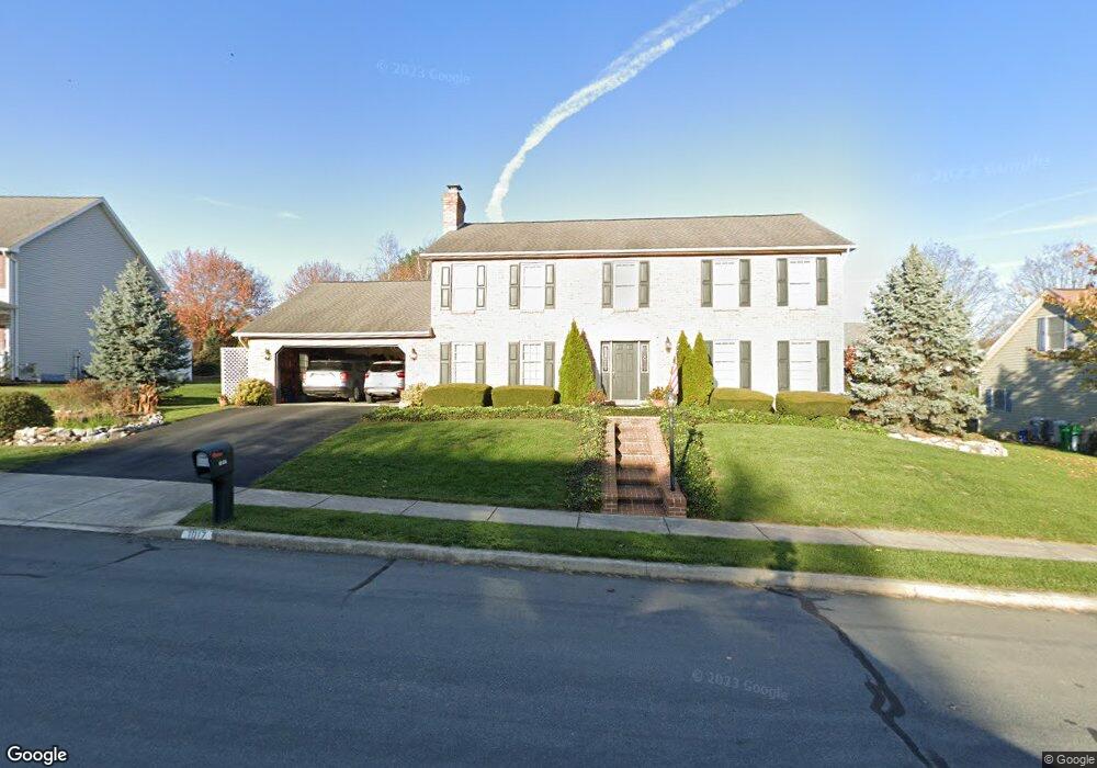
1017 Forbes Rd Carlisle, PA 17013
Estimated Value: $435,000 - $531,957
4
Beds
3
Baths
2,976
Sq Ft
$166/Sq Ft
Est. Value
About This Home
This home is located at 1017 Forbes Rd, Carlisle, PA 17013 and is currently estimated at $494,739, approximately $166 per square foot. 1017 Forbes Rd is a home located in Cumberland County with nearby schools including Bellaire Elementary School, Wilson Middle School, and Carlisle Area High School.
Ownership History
Date
Name
Owned For
Owner Type
Purchase Details
Closed on
Feb 29, 2000
Sold by
Frey Robert G
Bought by
Roe Carl G
Current Estimated Value
Home Financials for this Owner
Home Financials are based on the most recent Mortgage that was taken out on this home.
Original Mortgage
$172,000
Outstanding Balance
$57,957
Interest Rate
8.21%
Estimated Equity
$436,782
Create a Home Valuation Report for This Property
The Home Valuation Report is an in-depth analysis detailing your home's value as well as a comparison with similar homes in the area
Home Values in the Area
Average Home Value in this Area
Purchase History
| Date | Buyer | Sale Price | Title Company |
|---|---|---|---|
| Roe Carl G | $215,000 | -- |
Source: Public Records
Mortgage History
| Date | Status | Borrower | Loan Amount |
|---|---|---|---|
| Open | Roe Carl G | $172,000 |
Source: Public Records
Tax History Compared to Growth
Tax History
| Year | Tax Paid | Tax Assessment Tax Assessment Total Assessment is a certain percentage of the fair market value that is determined by local assessors to be the total taxable value of land and additions on the property. | Land | Improvement |
|---|---|---|---|---|
| 2025 | $7,154 | $303,800 | $71,400 | $232,400 |
| 2024 | $6,949 | $303,800 | $71,400 | $232,400 |
| 2023 | $6,632 | $303,800 | $71,400 | $232,400 |
| 2022 | $6,537 | $303,800 | $71,400 | $232,400 |
| 2021 | $6,443 | $303,800 | $71,400 | $232,400 |
| 2020 | $6,307 | $303,800 | $71,400 | $232,400 |
| 2019 | $6,176 | $303,800 | $71,400 | $232,400 |
| 2018 | $6,043 | $303,800 | $71,400 | $232,400 |
| 2017 | $5,923 | $303,800 | $71,400 | $232,400 |
| 2016 | -- | $303,800 | $71,400 | $232,400 |
| 2015 | -- | $303,800 | $71,400 | $232,400 |
| 2014 | -- | $303,800 | $71,400 | $232,400 |
Source: Public Records
Map
Nearby Homes
- 34 Donegal Dr
- 944 W North St
- 61 Bennington Way
- Charlotte Plan at Chesterfield
- Chamberlain Plan at Chesterfield
- Bayberry Plan at Chesterfield
- Fairmont Plan at Chesterfield
- Greenwood Plan at Chesterfield
- Ashwood Plan at Chesterfield
- Wynwood Plan at Chesterfield
- Aspen Plan at Chesterfield
- Dartmouth Plan at Chesterfield
- Newport Plan at Chesterfield
- Gatewood Plan at Chesterfield
- Rosewood Plan at Chesterfield
- Norwood Plan at Chesterfield
- Crestmont Plan at Chesterfield
- 13 Shillington Ln
- 12 Cheltenham Ln
- 10 Cheltenham Ln
- 1021 Forbes Rd
- 1013 Forbes Rd
- 1014 Armstrong Rd
- 1010 Armstrong Rd
- 1018 Armstrong Rd
- 1 Stewart Dr
- 1020 Forbes Rd
- 1009 Forbes Rd
- 1022 Armstrong Rd
- 1006 Armstrong Rd
- 1026 Armstrong Rd
- 1007 Armstrong Rd
- 13 Donegal Dr
- 1005 Forbes Rd
- 5 Stewart Dr
- 17 Donegal Dr
- 1011 Armstrong Rd
- 9 Donegal Dr
- 1002 Armstrong Rd
- 1003 Armstrong Rd