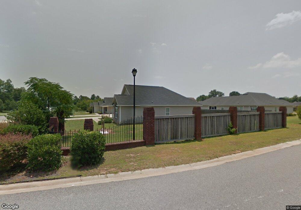
1017 N Houston Lake Blvd Warner Robins, GA 31093
Estimated Value: $230,000 - $249,000
3
Beds
2
Baths
1,545
Sq Ft
$156/Sq Ft
Est. Value
About This Home
This home is located at 1017 N Houston Lake Blvd, Warner Robins, GA 31093 and is currently estimated at $240,365, approximately $155 per square foot. 1017 N Houston Lake Blvd is a home located in Houston County with nearby schools including Centerville Elementary School, Thomson Middle School, and Northside High School.
Ownership History
Date
Name
Owned For
Owner Type
Purchase Details
Closed on
Apr 16, 2020
Sold by
Mosley Nicole Rice and Westbrook Nicole
Bought by
Mosley Nicole Rice and Westbrook Willie
Current Estimated Value
Purchase Details
Closed on
Aug 30, 2010
Sold by
Eugene Coulange and Eugene Anjanie
Bought by
Mosley Nicole Rice
Home Financials for this Owner
Home Financials are based on the most recent Mortgage that was taken out on this home.
Original Mortgage
$103,000
Interest Rate
4.59%
Mortgage Type
Purchase Money Mortgage
Purchase Details
Closed on
Aug 31, 2006
Sold by
J B Home Construction Llc
Bought by
Eugene Coulange
Home Financials for this Owner
Home Financials are based on the most recent Mortgage that was taken out on this home.
Original Mortgage
$113,050
Interest Rate
10.38%
Mortgage Type
Adjustable Rate Mortgage/ARM
Purchase Details
Closed on
Apr 13, 2004
Sold by
Cottonwood Land Corp
Bought by
J B Home Construction Llc
Create a Home Valuation Report for This Property
The Home Valuation Report is an in-depth analysis detailing your home's value as well as a comparison with similar homes in the area
Home Values in the Area
Average Home Value in this Area
Purchase History
| Date | Buyer | Sale Price | Title Company |
|---|---|---|---|
| Mosley Nicole Rice | -- | None Available | |
| Mosley Nicole Rice | $103,000 | None Available | |
| Eugene Coulange | $119,000 | None Available | |
| J B Home Construction Llc | $21,300 | -- |
Source: Public Records
Mortgage History
| Date | Status | Borrower | Loan Amount |
|---|---|---|---|
| Closed | Mosley Nicole Rice | $103,000 | |
| Previous Owner | Eugene Coulange | $113,050 |
Source: Public Records
Tax History Compared to Growth
Tax History
| Year | Tax Paid | Tax Assessment Tax Assessment Total Assessment is a certain percentage of the fair market value that is determined by local assessors to be the total taxable value of land and additions on the property. | Land | Improvement |
|---|---|---|---|---|
| 2024 | $2,594 | $76,080 | $12,000 | $64,080 |
| 2023 | $2,029 | $59,400 | $10,000 | $49,400 |
| 2022 | $1,174 | $53,080 | $7,280 | $45,800 |
| 2021 | $1,070 | $48,280 | $7,280 | $41,000 |
| 2020 | $1,058 | $47,520 | $7,280 | $40,240 |
| 2019 | $1,058 | $47,520 | $7,280 | $40,240 |
| 2018 | $1,058 | $47,520 | $7,280 | $40,240 |
| 2017 | $1,059 | $47,520 | $7,280 | $40,240 |
| 2016 | $1,060 | $47,520 | $7,280 | $40,240 |
| 2015 | $1,062 | $47,520 | $7,280 | $40,240 |
| 2014 | -- | $47,520 | $7,280 | $40,240 |
| 2013 | -- | $50,560 | $8,600 | $41,960 |
Source: Public Records
Map
Nearby Homes
- 208 Sunnymeade Dr
- 116 Red Birch Ln
- 104 Sourwood Ln
- 113 Sourwood Ln
- 113 Sourwood Ln
- 101 Kent Dr
- 205 Cambridge Dr
- 141 Back Cedar Ln
- 110 Pilgrim Mill Trail
- 106 Arbor Creek
- 175 Arbor Creek
- 184 Giles Rd
- 118 Ridgewood Dr
- 918 Collins Ave Unit 36
- 305 Brantley Rd Unit 6
- 111 Shamrock Dr
- 1089 Dunbar Rd
- 708 N Houston Lake Blvd
- 1015 N Houston Lake Blvd
- 230 Sunnymeade Dr
- 228 Sunnymeade Dr
- 1019 N Houston Lake Blvd
- 1013 N Houston Lake Blvd
- 226 Sunnymeade Dr
- 219 Sunnymeade Dr
- 221 Sunnymeade Dr
- 102 Sunnymeade Dr
- 223 Sunnymeade Dr
- 101 Sunnymeade Dr
- 224 Sunnymeade Dr
- 103 Sunnymeade Dr
- 217 Sunnymeade Dr
- 104 Sunnymeade Dr
- 215 Sunnymeade Dr
- 222 Sunnymeade Dr
- 213 Sunnymeade Dr
- 106 Sunnymeade Dr
- 105 Sunnymeade Dr